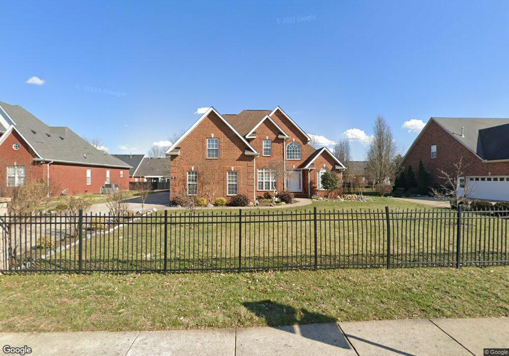
2349 Saint Andrews Dr Murfreesboro, TN 37128
Estimated Value: $472,000 - $509,000
--
Bed
4
Baths
2,546
Sq Ft
$191/Sq Ft
Est. Value
About This Home
This home is located at 2349 Saint Andrews Dr, Murfreesboro, TN 37128 and is currently estimated at $485,527, approximately $190 per square foot. 2349 Saint Andrews Dr is a home located in Rutherford County with nearby schools including Scales Elementary School, Rockvale Middle School, and Rockvale High School.
Ownership History
Date
Name
Owned For
Owner Type
Purchase Details
Closed on
Dec 17, 2004
Sold by
Tennessee Homes Llc
Bought by
Phalichanh Malaythong T and Phalichanh Lams
Current Estimated Value
Home Financials for this Owner
Home Financials are based on the most recent Mortgage that was taken out on this home.
Original Mortgage
$47,980
Outstanding Balance
$23,916
Interest Rate
5.66%
Estimated Equity
$461,611
Create a Home Valuation Report for This Property
The Home Valuation Report is an in-depth analysis detailing your home's value as well as a comparison with similar homes in the area
Home Values in the Area
Average Home Value in this Area
Purchase History
| Date | Buyer | Sale Price | Title Company |
|---|---|---|---|
| Phalichanh Malaythong T | $239,900 | -- |
Source: Public Records
Mortgage History
| Date | Status | Borrower | Loan Amount |
|---|---|---|---|
| Open | Phalichanh Malaythong T | $47,980 |
Source: Public Records
Tax History Compared to Growth
Tax History
| Year | Tax Paid | Tax Assessment Tax Assessment Total Assessment is a certain percentage of the fair market value that is determined by local assessors to be the total taxable value of land and additions on the property. | Land | Improvement |
|---|---|---|---|---|
| 2025 | $2,810 | $99,325 | $13,750 | $85,575 |
| 2024 | $2,810 | $99,325 | $13,750 | $85,575 |
| 2023 | $1,866 | $99,475 | $13,750 | $85,725 |
| 2022 | $503 | $99,475 | $13,750 | $85,725 |
| 2021 | $1,594 | $71,800 | $13,750 | $58,050 |
| 2020 | $1,594 | $71,800 | $13,750 | $58,050 |
| 2019 | $1,594 | $71,800 | $13,750 | $58,050 |
| 2018 | $2,189 | $71,800 | $0 | $0 |
| 2017 | $2,241 | $57,650 | $0 | $0 |
| 2016 | $2,241 | $57,650 | $0 | $0 |
| 2015 | $2,241 | $57,650 | $0 | $0 |
| 2014 | $1,434 | $57,650 | $0 | $0 |
| 2013 | -- | $59,200 | $0 | $0 |
Source: Public Records
Map
Nearby Homes
- 3429 Deerview Dr
- 2339 Shafer Dr
- 3409 Nightshade Dr
- 1315 Elevation ABC Plan at Evergreen Farms
- 3217 Mapleside Ln
- 3525 Nightshade Dr
- 3116 Mapleside Ln
- 2003 Tabasco Way
- 3508 Donerail Cir
- 2044 Alysheba Run
- 1944 Colyn Ave
- 2040 Alysheba Run
- 2017 Victory Gallop Ln
- 2018 Debonair Ln
- 1943 Odessa Ave
- 1919 Debonair Ln
- 2012 Victory Gallop Ln
- 3216 Terrapin Ct
- 1428 Ovaldale Dr
- 1819 Allwood Ave
- 2353 Saint Andrews Dr
- 2345 Saint Andrews Dr
- 2344 Will Drew Dr
- 2346 Will Drew Dr
- 2340 Will Drew Dr
- 2350 Will Drew Dr
- 2352 Will Drew Dr
- 2338 Will Drew Dr
- 2356 Will Drew Dr
- 2356 Saint Andrews Dr
- 2358 Will Drew Dr
- 2411 Saint Andrews Dr
- 2362 Will Drew Dr
- 2337 Saint Andrews Dr
- 3372 Berryside Dr
- 2345 Will Drew Dr
- 2347 Will Drew Dr
- 2341 Will Drew Dr
- 3370 Berryside Dr
- 2351 Will Drew Dr