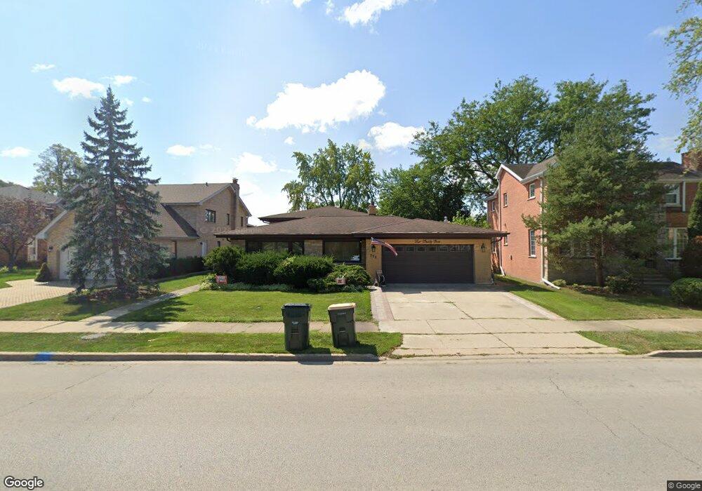
235 Devon Ave Park Ridge, IL 60068
O'Hare NeighborhoodEstimated Value: $647,000 - $747,337
3
Beds
3
Baths
1,819
Sq Ft
$394/Sq Ft
Est. Value
About This Home
This home is located at 235 Devon Ave, Park Ridge, IL 60068 and is currently estimated at $716,584, approximately $393 per square foot. 235 Devon Ave is a home located in Cook County with nearby schools including Theodore Roosevelt Elementary School, Lincoln Middle School, and Maine South High School.
Ownership History
Date
Name
Owned For
Owner Type
Purchase Details
Closed on
May 26, 2010
Sold by
Leyva Margarita X and Leyva Sandra M
Bought by
Smee Jason and Pytlarz Courtney
Current Estimated Value
Home Financials for this Owner
Home Financials are based on the most recent Mortgage that was taken out on this home.
Original Mortgage
$356,000
Outstanding Balance
$236,905
Interest Rate
5.14%
Mortgage Type
New Conventional
Estimated Equity
$479,679
Purchase Details
Closed on
Jul 20, 2006
Sold by
Leyva Margarita X
Bought by
Leyva Margarita X and Leyva Sandra M
Create a Home Valuation Report for This Property
The Home Valuation Report is an in-depth analysis detailing your home's value as well as a comparison with similar homes in the area
Home Values in the Area
Average Home Value in this Area
Purchase History
| Date | Buyer | Sale Price | Title Company |
|---|---|---|---|
| Smee Jason | $445,000 | Republic Title Company | |
| Leyva Margarita X | -- | None Available |
Source: Public Records
Mortgage History
| Date | Status | Borrower | Loan Amount |
|---|---|---|---|
| Open | Smee Jason | $356,000 |
Source: Public Records
Tax History
| Year | Tax Paid | Tax Assessment Tax Assessment Total Assessment is a certain percentage of the fair market value that is determined by local assessors to be the total taxable value of land and additions on the property. | Land | Improvement |
|---|---|---|---|---|
| 2025 | $13,911 | $60,000 | $20,889 | $39,111 |
| 2024 | $13,911 | $55,000 | $17,724 | $37,276 |
| 2023 | $13,307 | $55,000 | $17,724 | $37,276 |
| 2022 | $13,307 | $55,000 | $17,724 | $37,276 |
| 2021 | $12,068 | $43,345 | $13,293 | $30,052 |
| 2020 | $11,729 | $43,345 | $13,293 | $30,052 |
| 2019 | $11,633 | $48,215 | $13,293 | $34,922 |
| 2018 | $11,342 | $43,403 | $11,077 | $32,326 |
| 2017 | $11,271 | $43,403 | $11,077 | $32,326 |
| 2016 | $11,086 | $43,403 | $11,077 | $32,326 |
| 2015 | $11,209 | $39,405 | $9,495 | $29,910 |
| 2014 | $11,004 | $39,405 | $9,495 | $29,910 |
| 2013 | $10,405 | $39,405 | $9,495 | $29,910 |
Source: Public Records
Map
Nearby Homes
- 1220 Courtland Ave
- 902 S Crescent Ave
- 7725 W Myrtle Ave
- 1233 S Prospect Ave
- 1607 S Ashland Ave
- 7660 W Talcott Ave
- 6100 N Overhill Ave
- 7740 W Norwood St
- 820 W Talcott Rd
- 6046 N Oriole Ave
- 7425 W Devon Ave
- 6681 N Northwest Hwy
- 400 S Northwest Hwy Unit 301B
- 6839 N Northwest Hwy Unit 1A
- 5871 N Overhill Ave
- 1929 S Ashland Ave
- 2003 Newton Ave
- 1820 S Prospect Ave
- 311 S Vine Ave Unit E
- 7802 W Victoria St
- 217 Devon Ave
- 241 Devon Ave
- 1212 Linden Ave
- 1209 S Washington Ave
- 243 Devon Ave
- 211 Devon Ave
- 1216 Linden Ave
- 1213 S Washington Ave
- 1217 S Washington Ave
- 245 Devon Ave
- 1220 Linden Ave
- 224 Devon Ave
- 1221 S Washington Ave
- 1129 S Washington Ave
- 1224 Linden Ave
- 1126 Peale Ave
- 1225 S Washington Ave
- 1129 Peale Ave
- 1125 S Washington Ave
- 1211 S Washington Ave
Your Personal Tour Guide
Ask me questions while you tour the home.