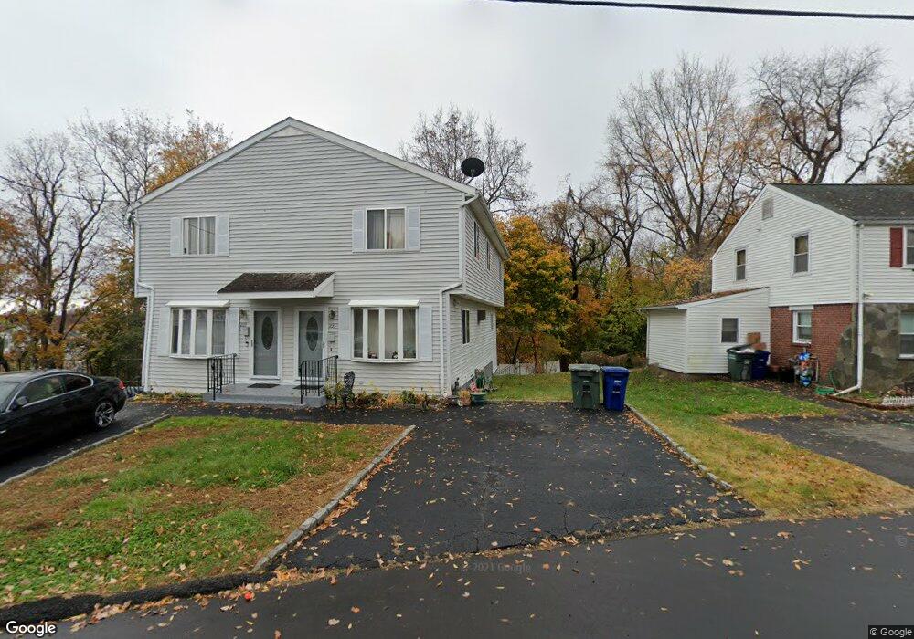
235 High Ridge Dr Bridgeport, CT 06606
Brooklawn-Saint Vincent NeighborhoodEstimated Value: $352,000 - $452,000
3
Beds
3
Baths
1,333
Sq Ft
$290/Sq Ft
Est. Value
About This Home
This home is located at 235 High Ridge Dr, Bridgeport, CT 06606 and is currently estimated at $386,662, approximately $290 per square foot. 235 High Ridge Dr is a home located in Fairfield County with nearby schools including Blackham School, Central High School, and Assumption Catholic School.
Ownership History
Date
Name
Owned For
Owner Type
Purchase Details
Closed on
Mar 2, 2021
Sold by
Young Maricka
Bought by
Young Calede
Current Estimated Value
Purchase Details
Closed on
Dec 5, 1991
Sold by
Gonclaves Joseph and Freitas Manuel
Bought by
Young David and Young Maricka
Home Financials for this Owner
Home Financials are based on the most recent Mortgage that was taken out on this home.
Original Mortgage
$67,000
Interest Rate
8.82%
Mortgage Type
Unknown
Create a Home Valuation Report for This Property
The Home Valuation Report is an in-depth analysis detailing your home's value as well as a comparison with similar homes in the area
Home Values in the Area
Average Home Value in this Area
Purchase History
| Date | Buyer | Sale Price | Title Company |
|---|---|---|---|
| Young Calede | -- | None Available | |
| Young Calede | -- | None Available | |
| Young David | $97,000 | -- | |
| Young David | $97,000 | -- |
Source: Public Records
Mortgage History
| Date | Status | Borrower | Loan Amount |
|---|---|---|---|
| Previous Owner | Young David | $67,000 | |
| Previous Owner | Young David | $67,000 |
Source: Public Records
Tax History Compared to Growth
Tax History
| Year | Tax Paid | Tax Assessment Tax Assessment Total Assessment is a certain percentage of the fair market value that is determined by local assessors to be the total taxable value of land and additions on the property. | Land | Improvement |
|---|---|---|---|---|
| 2025 | $6,631 | $152,610 | $32,860 | $119,750 |
| 2024 | $6,631 | $152,610 | $32,860 | $119,750 |
| 2023 | $6,631 | $152,610 | $32,860 | $119,750 |
| 2022 | $6,631 | $152,610 | $32,860 | $119,750 |
| 2021 | $6,631 | $152,610 | $32,860 | $119,750 |
| 2020 | $5,246 | $97,160 | $17,190 | $79,970 |
| 2019 | $5,246 | $97,160 | $17,190 | $79,970 |
| 2018 | $5,283 | $97,160 | $17,190 | $79,970 |
| 2017 | $5,283 | $97,160 | $17,190 | $79,970 |
| 2016 | $5,283 | $97,160 | $17,190 | $79,970 |
| 2015 | $5,645 | $133,770 | $31,190 | $102,580 |
| 2014 | $5,645 | $133,770 | $31,190 | $102,580 |
Source: Public Records
Map
Nearby Homes
- 201 High Ridge Dr
- 125 Alexander Dr
- 150 Alexander Dr
- 11 Myron Ave
- 241 Sampson St
- 1275 Capitol Ave
- 76 Suburban Ave
- 2625 Park Ave Unit 12L
- 2625 Park Ave Unit 5N
- 2445 Park Ave Unit 23
- 2345 Park Ave
- 2675 Park Ave Unit 3
- 2675 Park Ave Unit 22
- 1480 Capitol Ave Unit 811
- 356 Taft Ave
- 119 Madison Terrace
- 1473 Wood Ave
- 31 Taft Ave
- 203 Wayne St
- 724 Capitol Ave Unit 726
- 233 High Ridge Dr
- 243 High Ridge Dr
- 221 High Ridge Dr
- 243 High Ridge Dr Unit 245
- 218 High Ridge Dr Unit 220
- 234 High Ridge Dr Unit 238
- 255 High Ridge Dr
- 203 High Ridge Dr
- 257 High Ridge Dr
- 261 High Ridge Dr Unit 263
- 256 High Ridge Dr Unit 258
- 258 High Ridge Dr
- 258 High Ridge (Rear) Dr
- 258 High Ridge (Rear) Dr
- 200 High Ridge Dr
- 267 High Ridge Dr Unit 269
- 658 Lincoln Ave
- 636 Lincoln Ave
- 193 High Ridge Dr
- 182 High Ridge Dr Unit 184