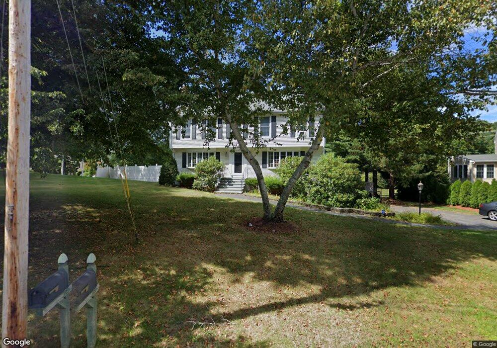
235 Lancaster Dr Tewksbury, MA 01876
Estimated Value: $738,000 - $981,000
4
Beds
3
Baths
2,628
Sq Ft
$332/Sq Ft
Est. Value
About This Home
This home is located at 235 Lancaster Dr, Tewksbury, MA 01876 and is currently estimated at $871,829, approximately $331 per square foot. 235 Lancaster Dr is a home located in Middlesex County with nearby schools including John F. Ryan Elementary School, John W. Wynn Middle School, and Tewksbury Memorial High School.
Ownership History
Date
Name
Owned For
Owner Type
Purchase Details
Closed on
Oct 2, 2025
Sold by
Gruning Brian and Gruning Maria
Bought by
Gruning Joint Ret and Gruning
Current Estimated Value
Purchase Details
Closed on
Jan 2, 2009
Sold by
Gangemi Allyson and Gangemi Brian
Bought by
Gruning Brian E and Gruning Maria Whyte
Home Financials for this Owner
Home Financials are based on the most recent Mortgage that was taken out on this home.
Original Mortgage
$59,300
Interest Rate
6.08%
Mortgage Type
Small Business Administration
Purchase Details
Closed on
Aug 28, 2003
Sold by
Ferro John A and Ferro Madeleine A
Bought by
Gangemi Allyson and Gangemi Brian
Home Financials for this Owner
Home Financials are based on the most recent Mortgage that was taken out on this home.
Original Mortgage
$322,700
Interest Rate
5.69%
Mortgage Type
Purchase Money Mortgage
Create a Home Valuation Report for This Property
The Home Valuation Report is an in-depth analysis detailing your home's value as well as a comparison with similar homes in the area
Home Values in the Area
Average Home Value in this Area
Purchase History
| Date | Buyer | Sale Price | Title Company |
|---|---|---|---|
| Gruning Joint Ret | -- | -- | |
| Gruning Brian E | $438,450 | -- | |
| Gruning Brian E | $438,450 | -- | |
| Gangemi Allyson | $485,000 | -- | |
| Gangemi Allyson | $485,000 | -- |
Source: Public Records
Mortgage History
| Date | Status | Borrower | Loan Amount |
|---|---|---|---|
| Previous Owner | Gangemi Allyson | $346,685 | |
| Previous Owner | Gruning Brian E | $59,300 | |
| Previous Owner | Gangemi Allyson | $322,700 |
Source: Public Records
Tax History Compared to Growth
Tax History
| Year | Tax Paid | Tax Assessment Tax Assessment Total Assessment is a certain percentage of the fair market value that is determined by local assessors to be the total taxable value of land and additions on the property. | Land | Improvement |
|---|---|---|---|---|
| 2025 | $9,931 | $751,200 | $351,200 | $400,000 |
| 2024 | $9,933 | $741,800 | $334,600 | $407,200 |
| 2023 | $9,640 | $683,700 | $304,100 | $379,600 |
| 2022 | $9,123 | $600,200 | $264,500 | $335,700 |
| 2021 | $12,217 | $570,100 | $240,600 | $329,500 |
| 2020 | $8,643 | $541,200 | $229,200 | $312,000 |
| 2019 | $7,602 | $479,900 | $217,900 | $262,000 |
| 2018 | $7,310 | $453,200 | $217,900 | $235,300 |
| 2017 | $9,882 | $451,000 | $217,900 | $233,100 |
| 2016 | $7,071 | $432,500 | $217,900 | $214,600 |
| 2015 | $6,890 | $420,900 | $214,400 | $206,500 |
| 2014 | $6,695 | $415,600 | $217,900 | $197,700 |
Source: Public Records
Map
Nearby Homes
- 20 Meredith Rd
- 51 Nolan Ct Unit 51
- 399 North St
- 68 Catamount Rd
- 1170 Livingston St
- 69 Blanchard St
- 5 Kensington Way Unit 5
- 120 Judique Rd
- 58 Blanchard St
- 101 Bellevue Rd
- 13 Berkeley
- 110 Royal Crest Cir
- 1117 Emerald Ct
- 11 Emerald Ct
- 1224 Emerald Ct
- 139 Prospect Hill Dr Unit Lot 15
- 7 Stouffer Cir
- 11 Orchard St
- 22 Haggetts Pond Rd
- 61 Patrick Rd
- 231 Lancaster Dr
- 245 Lancaster Dr
- 256 Lancaster Dr
- 266 Lancaster Dr
- 21 Sheffield Rd
- 246 Lancaster Dr
- 20 Sheffield Rd
- 31 Sheffield Rd
- 278 Lancaster Dr
- 275 Lancaster Dr
- 225 Lancaster Dr
- 50 Magna Vista Cir
- 288 Lancaster Dr
- 40 Sheffield Rd
- 285 Lancaster Dr
- 41 Sheffield Rd
- 38 Magna Vista Cir
- 298 Lancaster Dr
- 215 Lancaster Dr
- 295 Lancaster Dr