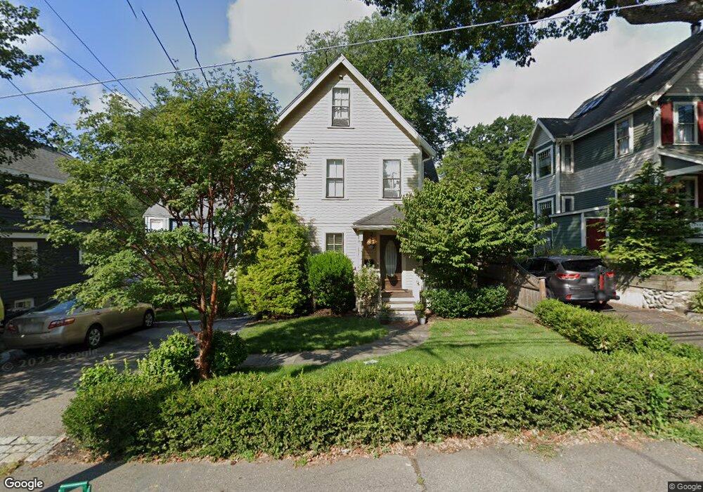
235 Melrose St Unit 235 Auburndale, MA 02466
Auburndale NeighborhoodEstimated Value: $1,524,000 - $1,820,000
4
Beds
4
Baths
1,800
Sq Ft
$930/Sq Ft
Est. Value
About This Home
This home is located at 235 Melrose St Unit 235, Auburndale, MA 02466 and is currently estimated at $1,674,031, approximately $930 per square foot. 235 Melrose St Unit 235 is a home located in Middlesex County with nearby schools including C.C. Burr, F.A. Day Middle School, and Newton North High School.
Ownership History
Date
Name
Owned For
Owner Type
Purchase Details
Closed on
Mar 7, 2014
Sold by
Nighswander Jonathan C and Monihan Hilary A
Bought by
Gold Eric M and Nguyen Chau M
Current Estimated Value
Home Financials for this Owner
Home Financials are based on the most recent Mortgage that was taken out on this home.
Original Mortgage
$751,200
Outstanding Balance
$570,462
Interest Rate
4.39%
Mortgage Type
Purchase Money Mortgage
Estimated Equity
$1,103,569
Purchase Details
Closed on
Dec 29, 1999
Sold by
Clarke Kathleen T
Bought by
Brown Robert J and Mirrer Angela
Home Financials for this Owner
Home Financials are based on the most recent Mortgage that was taken out on this home.
Original Mortgage
$238,000
Interest Rate
7.71%
Mortgage Type
Purchase Money Mortgage
Create a Home Valuation Report for This Property
The Home Valuation Report is an in-depth analysis detailing your home's value as well as a comparison with similar homes in the area
Home Values in the Area
Average Home Value in this Area
Purchase History
| Date | Buyer | Sale Price | Title Company |
|---|---|---|---|
| Gold Eric M | $939,000 | -- | |
| Brown Robert J | $297,500 | -- |
Source: Public Records
Mortgage History
| Date | Status | Borrower | Loan Amount |
|---|---|---|---|
| Open | Gold Eric M | $751,200 | |
| Previous Owner | Brown Robert J | $399,000 | |
| Previous Owner | Brown Robert J | $238,000 |
Source: Public Records
Tax History Compared to Growth
Tax History
| Year | Tax Paid | Tax Assessment Tax Assessment Total Assessment is a certain percentage of the fair market value that is determined by local assessors to be the total taxable value of land and additions on the property. | Land | Improvement |
|---|---|---|---|---|
| 2025 | $13,942 | $1,422,700 | $896,400 | $526,300 |
| 2024 | $13,481 | $1,381,300 | $870,300 | $511,000 |
| 2023 | $12,935 | $1,270,600 | $652,600 | $618,000 |
| 2022 | $12,377 | $1,176,500 | $604,300 | $572,200 |
| 2021 | $11,943 | $1,109,900 | $570,100 | $539,800 |
| 2020 | $11,587 | $1,109,900 | $570,100 | $539,800 |
| 2019 | $11,261 | $1,077,600 | $553,500 | $524,100 |
| 2018 | $10,584 | $978,200 | $499,400 | $478,800 |
| 2017 | $10,262 | $922,800 | $471,100 | $451,700 |
| 2016 | $9,814 | $862,400 | $440,300 | $422,100 |
| 2015 | $9,358 | $806,000 | $411,500 | $394,500 |
Source: Public Records
Map
Nearby Homes
- 283 Melrose St
- 2202 Commonwealth Ave Unit 2
- 2202 Commonwealth Ave Unit 1
- 226 Auburn St Unit 226
- 224 Auburn St Unit 224
- 224 Auburn St Unit A
- 17 Lasell St
- 62-64 Rowe St Unit B
- 13 Weir St
- 49 Staniford St
- 160 Pine St Unit 12
- 27 Oakwood Rd
- 17 Crescent St
- 10 Crescent St Unit 1
- 10 Crescent St Unit 2
- 51 Bourne St
- 283 Woodland Rd
- 17 Gilbert St
- 1639 Washington St
- 0 Duncan Rd Unit 72925240
- 235 Melrose St
- 2133 Commonwealth Ave
- 231 Melrose St
- 2139 Commonwealth Ave
- 2139 Commonwealth Ave
- 2139 Commonwealth Ave Unit 1
- 227 Melrose St
- 10 Higgins St
- 2143 Commonwealth Ave
- 2121 Commonwealth Ave Unit 1
- 2121 Commonwealth Ave
- 232 Melrose St
- 223 Melrose St
- 230 Melrose St
- 18 Higgins St
- 2117 Commonwealth Ave
- 9 Higgins St
- 9 Higgins St Unit 3
- 9 Higgins St Unit 4
- 10 Elberta Terrace