Estimated Value: $402,000 - $607,000
4
Beds
3
Baths
2,545
Sq Ft
$200/Sq Ft
Est. Value
About This Home
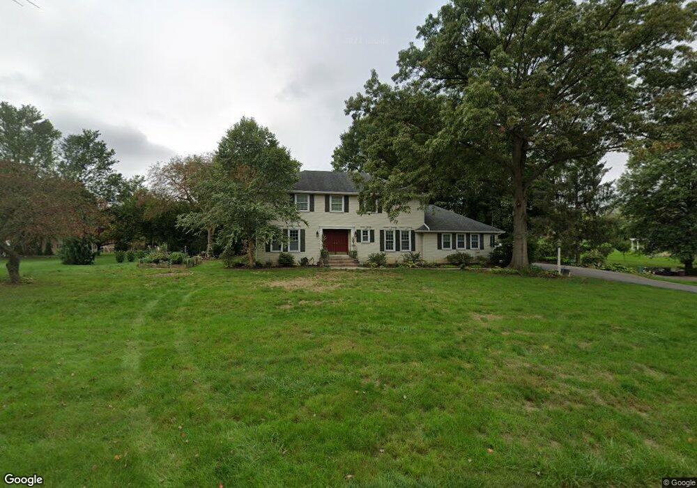
This home is located at 235 Riveredge Dr, Leola, PA 17540 and is currently estimated at $509,367, approximately $200 per square foot. 235 Riveredge Dr is a home located in Lancaster County with nearby schools including Nitrauer School, Landis Run Intermediate School, and Manheim Township Middle School.
Ownership History
Date
Name
Owned For
Owner Type
Purchase Details
Closed on
Apr 15, 1999
Sold by
Umlauf Susan W and Umlauf Robert C
Bought by
Adams Gregory S and Adams Barbara B
Current Estimated Value
Home Financials for this Owner
Home Financials are based on the most recent Mortgage that was taken out on this home.
Original Mortgage
$152,050
Interest Rate
7.02%
Create a Home Valuation Report for This Property
The Home Valuation Report is an in-depth analysis detailing your home's value as well as a comparison with similar homes in the area
Home Values in the Area
Average Home Value in this Area
Purchase History
| Date | Buyer | Sale Price | Title Company |
|---|---|---|---|
| Adams Gregory S | $190,120 | -- |
Source: Public Records
Mortgage History
| Date | Status | Borrower | Loan Amount |
|---|---|---|---|
| Closed | Adams Gregory S | $152,050 |
Source: Public Records
Tax History Compared to Growth
Tax History
| Year | Tax Paid | Tax Assessment Tax Assessment Total Assessment is a certain percentage of the fair market value that is determined by local assessors to be the total taxable value of land and additions on the property. | Land | Improvement |
|---|---|---|---|---|
| 2025 | $5,976 | $276,200 | $63,300 | $212,900 |
| 2024 | $5,976 | $276,200 | $63,300 | $212,900 |
| 2023 | $5,820 | $276,200 | $63,300 | $212,900 |
| 2022 | $5,722 | $276,200 | $63,300 | $212,900 |
| 2021 | $5,595 | $276,200 | $63,300 | $212,900 |
| 2020 | $5,595 | $276,200 | $63,300 | $212,900 |
| 2019 | $5,540 | $276,200 | $63,300 | $212,900 |
| 2018 | $4,174 | $276,200 | $63,300 | $212,900 |
| 2017 | $5,127 | $201,500 | $45,600 | $155,900 |
| 2016 | $5,127 | $201,500 | $45,600 | $155,900 |
| 2015 | $1,289 | $201,500 | $45,600 | $155,900 |
| 2014 | $3,756 | $201,500 | $45,600 | $155,900 |
Source: Public Records
Map
Nearby Homes
- 191 Pinetown Rd
- 70 Millstone Dr
- 1400 Hunsicker Rd
- 130 Snapdragon Dr
- 1217 Hunsicker Rd
- 1233 Hunsicker Rd
- 827 Disston View Dr
- 50 Allen Rd
- 1339 Beaconfield Ln
- 1326 Stillwater Rd
- 205 E Main St
- 2524 Saddle Dr
- 2607 Hazelwood Rd
- 283 Skyview Ln
- Charleston Plan at Devon Creek - Terraces
- Wyndham Plan at Devon Creek - Cottages
- Preston Plan at Devon Creek - Cottages
- Livingston Plan at Devon Creek - Cottages
- 1041 Hunsicker Rd
- 2221 Brentford St
- 243 Riveredge Dr
- 219 Riveredge Dr
- 153 Skymeadow Ln
- 203 Riveredge Dr
- 234 Riveredge Dr
- 157 Shreiner Rd
- 145 Skymeadow Ln
- 230 Riveredge Dr
- 154 Skymeadow Ln
- 260 Shreiner Rd
- 210 Riveredge Dr
- 137 Skymeadow Ln
- 140 Skymeadow Ln
- 202 Riveredge Dr
- 218 Riveredge Dr
- 163 Riveredge Dr
- 129 Skymeadow Ln
- 130 Skymeadow Ln
- 133 Shreiner Rd
- 270 Shreiner Rd