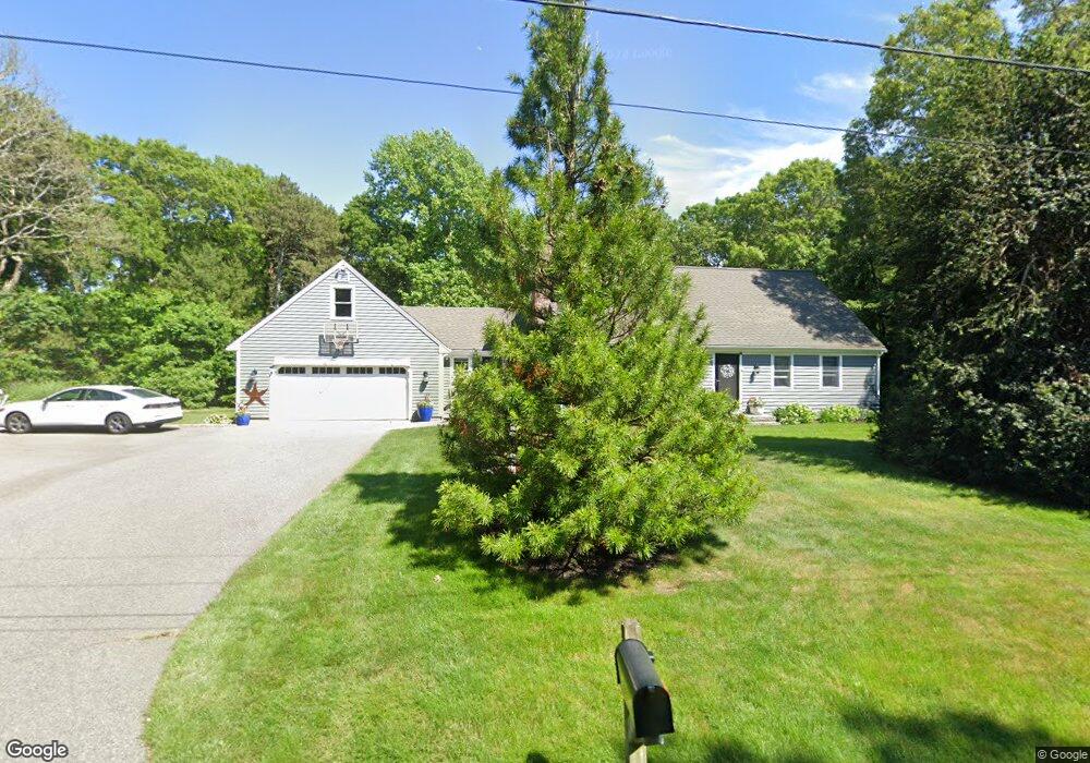
235 Rolling Hitch Rd Centerville, MA 02632
Centerville NeighborhoodEstimated Value: $760,325 - $823,000
5
Beds
2
Baths
2,392
Sq Ft
$330/Sq Ft
Est. Value
About This Home
This home is located at 235 Rolling Hitch Rd, Centerville, MA 02632 and is currently estimated at $790,331, approximately $330 per square foot. 235 Rolling Hitch Rd is a home located in Barnstable County with nearby schools including Centerville Elementary School, Barnstable United Elementary School, and Barnstable Intermediate School.
Ownership History
Date
Name
Owned For
Owner Type
Purchase Details
Closed on
Jan 19, 2023
Sold by
Fredo Christopher and Fredo Jennifer
Bought by
C & J Fredo 2023 Ret
Current Estimated Value
Purchase Details
Closed on
Jul 18, 2012
Sold by
Nugnes John A and Nugnes Catherine P
Bought by
Fredo Christopher
Home Financials for this Owner
Home Financials are based on the most recent Mortgage that was taken out on this home.
Original Mortgage
$405,175
Interest Rate
3.7%
Mortgage Type
New Conventional
Create a Home Valuation Report for This Property
The Home Valuation Report is an in-depth analysis detailing your home's value as well as a comparison with similar homes in the area
Home Values in the Area
Average Home Value in this Area
Purchase History
| Date | Buyer | Sale Price | Title Company |
|---|---|---|---|
| C & J Fredo 2023 Ret | -- | None Available | |
| Fredo Christopher | $426,500 | -- |
Source: Public Records
Mortgage History
| Date | Status | Borrower | Loan Amount |
|---|---|---|---|
| Previous Owner | Fredo Christopher | $405,175 |
Source: Public Records
Tax History
| Year | Tax Paid | Tax Assessment Tax Assessment Total Assessment is a certain percentage of the fair market value that is determined by local assessors to be the total taxable value of land and additions on the property. | Land | Improvement |
|---|---|---|---|---|
| 2025 | $6,180 | $763,900 | $170,400 | $593,500 |
| 2024 | $5,665 | $725,300 | $170,400 | $554,900 |
| 2023 | $5,393 | $646,700 | $154,900 | $491,800 |
| 2022 | $5,131 | $532,300 | $114,800 | $417,500 |
| 2021 | $4,981 | $474,800 | $114,800 | $360,000 |
| 2020 | $5,050 | $460,800 | $114,800 | $346,000 |
| 2019 | $4,759 | $421,900 | $114,800 | $307,100 |
| 2018 | $4,356 | $388,200 | $120,800 | $267,400 |
| 2017 | $4,019 | $373,500 | $120,800 | $252,700 |
| 2016 | $4,038 | $370,500 | $117,800 | $252,700 |
| 2015 | $4,022 | $370,700 | $119,600 | $251,100 |
Source: Public Records
Map
Nearby Homes
- 66 Tern Ln
- 62 Three Ponds Dr
- 324 Patriot Way
- 900 Old Stage Rd
- 296 Buckskin Path
- 315 Prince Hinckley Rd
- 82 Yacht Club Rd
- 87 Foxglove Rd
- 1044 Old Falmouth Rd
- 1028 Old Falmouth Rd
- 74 Saddler Ln
- 19 Marrick Ct
- 481 Lakeside Dr W
- 5 Chickadee Ln
- 357 Lakeside Dr W
- 83 Lake Dr
- 51 Larch Ln
- 10 Sail a Way
- 10 Sail -A-way
- 282 Parker Rd
- 223 Rolling Hitch Rd
- 236 Rolling Hitch Rd
- 242 Rolling Hitch Rd
- 246 Rolling Hitch Rd
- 244 Rolling Hitch Rd
- 69 High Noon Dr
- 14 Masthead Ln
- 41 Oxner Rd
- 209 Rolling Hitch Rd
- 83 High Noon Dr
- 49 Oxner Rd
- 15 Judith Eve Ln
- 26 Masthead Ln
- 60 High Noon Dr
- 33 Oxner Rd
- 25 Judith Eve Ln
- 53 High Noon Dr
- 202 Rolling Hitch Rd
- 41 Haviland Way
- 197 Rolling Hitch Rd
Your Personal Tour Guide
Ask me questions while you tour the home.