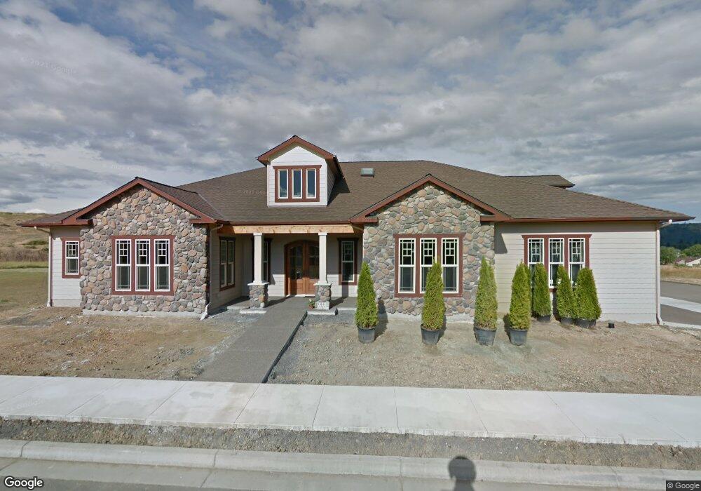
235 Wil Way Winston, OR 97496
Estimated Value: $517,000 - $598,128
3
Beds
2
Baths
3,000
Sq Ft
$187/Sq Ft
Est. Value
About This Home
This home is located at 235 Wil Way, Winston, OR 97496 and is currently estimated at $560,282, approximately $186 per square foot. 235 Wil Way is a home located in Douglas County with nearby schools including Douglas High School.
Ownership History
Date
Name
Owned For
Owner Type
Purchase Details
Closed on
Jan 19, 2011
Sold by
Indymac Venture Llc
Bought by
Williamson Robert M and Williamson Susan J
Current Estimated Value
Purchase Details
Closed on
Oct 27, 2010
Sold by
Perkins Gail and Perkins Gary
Bought by
Indymac Venture Llc
Purchase Details
Closed on
Oct 3, 2006
Sold by
Safari Estates Ii Llc
Bought by
Perkins Gail and Perkins Gary
Home Financials for this Owner
Home Financials are based on the most recent Mortgage that was taken out on this home.
Original Mortgage
$352,000
Interest Rate
8.37%
Mortgage Type
Construction
Create a Home Valuation Report for This Property
The Home Valuation Report is an in-depth analysis detailing your home's value as well as a comparison with similar homes in the area
Home Values in the Area
Average Home Value in this Area
Purchase History
| Date | Buyer | Sale Price | Title Company |
|---|---|---|---|
| Williamson Robert M | $140,000 | First American Title Ins Co | |
| Indymac Venture Llc | $56,663 | First American Title Ins Co | |
| Perkins Gail | $85,000 | First American Title Ins Co |
Source: Public Records
Mortgage History
| Date | Status | Borrower | Loan Amount |
|---|---|---|---|
| Previous Owner | Perkins Gail | $352,000 |
Source: Public Records
Tax History Compared to Growth
Tax History
| Year | Tax Paid | Tax Assessment Tax Assessment Total Assessment is a certain percentage of the fair market value that is determined by local assessors to be the total taxable value of land and additions on the property. | Land | Improvement |
|---|---|---|---|---|
| 2025 | $7,010 | $421,861 | -- | -- |
| 2024 | $6,813 | $409,574 | -- | -- |
| 2023 | $6,621 | $397,645 | $0 | $0 |
| 2022 | $6,424 | $386,064 | $0 | $0 |
| 2021 | $6,250 | $374,820 | $0 | $0 |
| 2020 | $6,070 | $363,903 | $0 | $0 |
| 2019 | $5,926 | $353,304 | $0 | $0 |
| 2018 | $5,767 | $343,014 | $0 | $0 |
| 2017 | $5,616 | $333,024 | $0 | $0 |
| 2016 | $5,465 | $323,325 | $0 | $0 |
| 2015 | $5,331 | $313,908 | $0 | $0 |
| 2014 | $5,212 | $304,766 | $0 | $0 |
| 2013 | -- | $295,890 | $0 | $0 |
Source: Public Records
Map
Nearby Homes
- 0 Wil Way Unit 24292479
- 0 Wil Way Unit 24094727
- 0 Wil Way Unit 24278136
- 160 Wil Way
- 150 Wil Way
- 102 Sarah Bear Ln
- 0 Danielle Dr Unit 122251646
- 165 Danielle Dr
- 13224 Lookingglass Rd
- 635 Wil Way
- 2414 Brockway Rd
- 139 Teresa Ln
- 411 Woodland Dr
- 109 Citation Ct
- 222 NW Broc Dr
- 210 NW Timothy Ave
- 364 NW Teal St
- 841 NW Lori St
- 0 NW Galaxy Dr
- 308 NW Civil Bend Ave