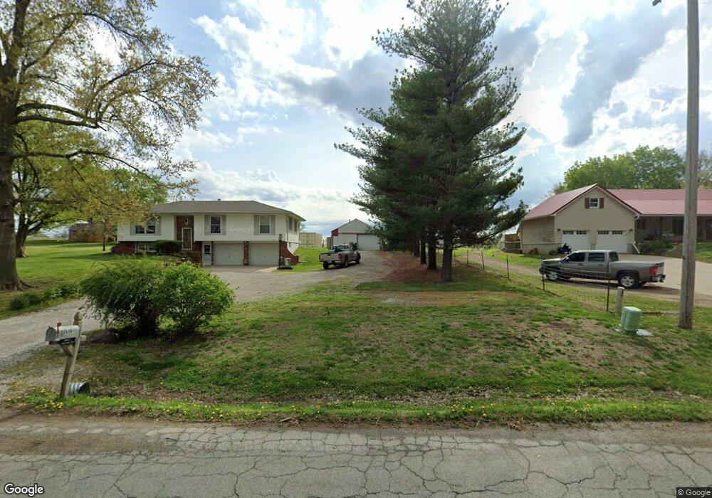
23515 Highway Ee Dearborn, MO 64439
Estimated Value: $267,000 - $366,000
3
Beds
3
Baths
1,864
Sq Ft
$169/Sq Ft
Est. Value
About This Home
This home is located at 23515 Highway Ee, Dearborn, MO 64439 and is currently estimated at $315,268, approximately $169 per square foot. 23515 Highway Ee is a home located in Platte County with nearby schools including North Platte Elementary School, North Platte Intermediate School, and North Platte Junior High School.
Ownership History
Date
Name
Owned For
Owner Type
Purchase Details
Closed on
Sep 22, 2017
Sold by
Crockett Jamey E and Crockett Barbara D
Bought by
Crockett Jamey Eugene
Current Estimated Value
Purchase Details
Closed on
Jul 11, 2005
Sold by
Seider Werley E and Seider Mildred L
Bought by
Crockett James E
Home Financials for this Owner
Home Financials are based on the most recent Mortgage that was taken out on this home.
Original Mortgage
$125,100
Outstanding Balance
$64,346
Interest Rate
5.63%
Mortgage Type
New Conventional
Estimated Equity
$250,922
Create a Home Valuation Report for This Property
The Home Valuation Report is an in-depth analysis detailing your home's value as well as a comparison with similar homes in the area
Purchase History
| Date | Buyer | Sale Price | Title Company |
|---|---|---|---|
| Crockett Jamey Eugene | -- | None Available | |
| Crockett James E | -- | Platte Cnty Title & Abstract |
Source: Public Records
Mortgage History
| Date | Status | Borrower | Loan Amount |
|---|---|---|---|
| Open | Crockett James E | $125,100 |
Source: Public Records
Tax History
| Year | Tax Paid | Tax Assessment Tax Assessment Total Assessment is a certain percentage of the fair market value that is determined by local assessors to be the total taxable value of land and additions on the property. | Land | Improvement |
|---|---|---|---|---|
| 2025 | $2,322 | $33,414 | $4,589 | $28,825 |
| 2024 | $2,221 | $33,414 | $4,589 | $28,825 |
| 2023 | $2,221 | $33,414 | $4,589 | $28,825 |
| 2022 | $2,091 | $31,199 | $4,589 | $26,610 |
| 2021 | $2,098 | $31,199 | $4,589 | $26,610 |
| 2020 | $1,885 | $27,683 | $4,589 | $23,094 |
| 2019 | $1,885 | $27,683 | $4,589 | $23,094 |
| 2018 | $1,638 | $23,894 | $2,850 | $21,044 |
| 2017 | $1,638 | $23,894 | $2,850 | $21,044 |
| 2016 | $1,628 | $23,894 | $2,850 | $21,044 |
| 2015 | $1,628 | $23,894 | $2,850 | $21,044 |
| 2013 | $1,577 | $23,894 | $0 | $0 |
Source: Public Records
Map
Nearby Homes
- 103 Johnson Cir
- 521 E 2nd St
- 601 Main St
- 108 Johnson Cir
- 109 Johnson Cir
- 107 Johnson Cir
- 24110 Highway Y N A
- 7693 SE Benner Lake Rd
- 17391 SE State Route 371
- 0 S East 95th Rd
- 0001 Edgerton Junction Rd
- 0000 Edgerton Junction Rd
- 21970 Lamar Rd
- 207 2nd St E
- 21195 Edgerton Junction Rd
- 19710 Kansas City Blvd
- 12120 SE West Rd
- U Highway
- 0 U Hwy Unit HMS2588353
- 501 N Platte Ave
- 23535 Ee Hwy
- 23535 Highway Ee
- 23495 Highway Ee
- 23495 Highway Ee
- 23480 Highway Ee
- 23585 Highway Ee
- 23450 Highway Ee
- 23445 Highway Ee
- 23415 Highway Ee
- 23605 Ferguson Dr
- 23415 Ee Hwy
- 23415 Highway Ee N A
- 23375 Highway Ee
- 23365 Highway Ee
- 13750 Highway Z
- 13750 Highway Z
- 23335 Highway Ee
- 23335 Ee Hwy
- 23705 Ferguson Dr
- 23305 Highway Ee
Your Personal Tour Guide
Ask me questions while you tour the home.