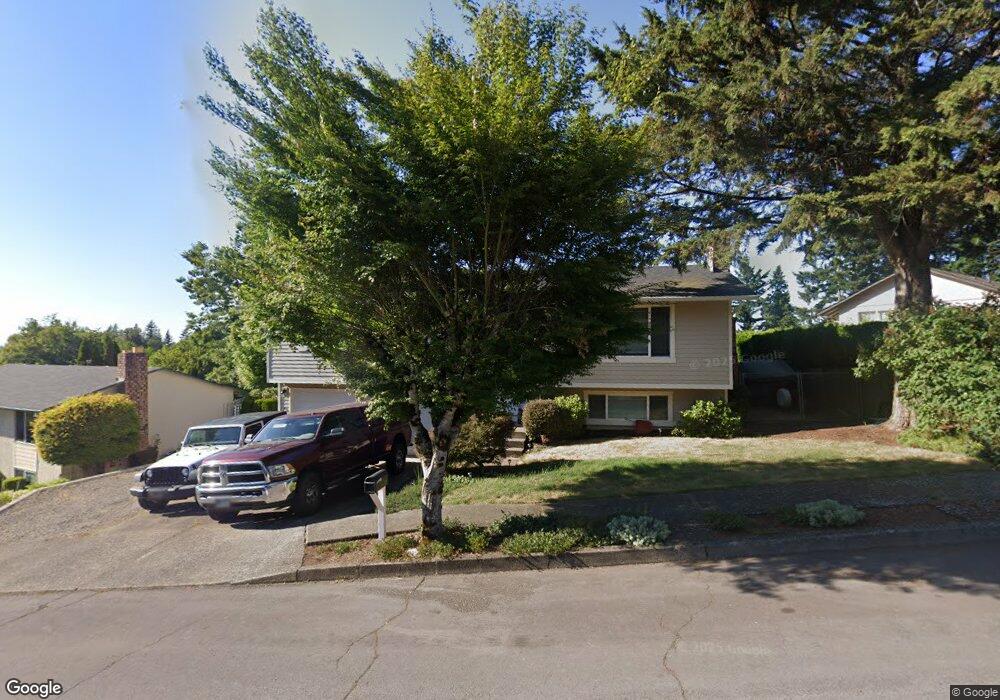
2353 SW 20th St Gresham, OR 97080
Southwest Gresham NeighborhoodEstimated Value: $470,676 - $525,000
3
Beds
2
Baths
1,234
Sq Ft
$403/Sq Ft
Est. Value
About This Home
This home is located at 2353 SW 20th St, Gresham, OR 97080 and is currently estimated at $497,419, approximately $403 per square foot. 2353 SW 20th St is a home located in Multnomah County with nearby schools including Hollydale Elementary School, Dexter McCarty Middle School, and Gresham High School.
Ownership History
Date
Name
Owned For
Owner Type
Purchase Details
Closed on
Feb 22, 2019
Sold by
Bowlsby Gary F
Bought by
Bowlsby Bonnie L and The Bowslby Family Trust
Current Estimated Value
Purchase Details
Closed on
Dec 10, 2003
Sold by
Bowlsby Phyllis E
Bought by
Bowlsby Gary F
Purchase Details
Closed on
Nov 4, 1998
Sold by
Browning Allen D
Bought by
Bowlsby Gary F and Bowlsby Phyllis E
Purchase Details
Closed on
Jun 30, 1995
Sold by
Collins Andrew D
Bought by
Browning Allen D and Browning Tracie D
Home Financials for this Owner
Home Financials are based on the most recent Mortgage that was taken out on this home.
Original Mortgage
$116,950
Interest Rate
7.61%
Mortgage Type
Purchase Money Mortgage
Create a Home Valuation Report for This Property
The Home Valuation Report is an in-depth analysis detailing your home's value as well as a comparison with similar homes in the area
Home Values in the Area
Average Home Value in this Area
Purchase History
| Date | Buyer | Sale Price | Title Company |
|---|---|---|---|
| Bowlsby Bonnie L | -- | None Available | |
| Bowlsby Gary F | -- | -- | |
| Bowlsby Gary F | $152,000 | First American Title Ins Co | |
| Browning Allen D | $129,950 | Ticor Title Insurance |
Source: Public Records
Mortgage History
| Date | Status | Borrower | Loan Amount |
|---|---|---|---|
| Previous Owner | Browning Allen D | $116,950 |
Source: Public Records
Tax History
| Year | Tax Paid | Tax Assessment Tax Assessment Total Assessment is a certain percentage of the fair market value that is determined by local assessors to be the total taxable value of land and additions on the property. | Land | Improvement |
|---|---|---|---|---|
| 2025 | $4,852 | $238,430 | -- | -- |
| 2024 | $4,645 | $231,490 | -- | -- |
| 2023 | $4,232 | $224,750 | $0 | $0 |
| 2022 | $4,113 | $218,210 | $0 | $0 |
| 2021 | $4,010 | $211,860 | $0 | $0 |
| 2020 | $3,773 | $205,690 | $0 | $0 |
| 2019 | $3,674 | $199,700 | $0 | $0 |
| 2018 | $3,503 | $193,890 | $0 | $0 |
| 2017 | $3,361 | $188,250 | $0 | $0 |
| 2016 | $2,963 | $182,770 | $0 | $0 |
Source: Public Records
Map
Nearby Homes
- 1963 SW Myers Place
- 2401 SW Eleven Mile Dr
- 3079 SW 22nd St
- 2398 SW Tegart Ave
- 2160 SW 26th St
- 3198 SW 16th Cir
- 2715 SW 31st St
- 1960 SW 13th Ct
- 2092 SW Thomas Place
- 3605 SW 25th St
- 1421 SW Binford Lake Pkwy
- 3519 SW 28th Terrace
- 1441 SW 23rd Ct
- 1645 SW 27th St
- 2607 SW Pleasant View Dr
- 3857 SW Brittany Dr
- 2294 SW Wallula Ln
- 2263 SW Phyllis Place
- 3120 SW Orchard Place
- 3506 SW Battaglia Ave
- 2361 SW 20th St
- 2342 SW Binford Lake Pkwy
- 2362 SW Binford Lake Pkwy
- 2401 SW 20th St
- 2422 SW 20th St
- 2392 SW 20th St
- 2452 SW 20th St
- 2372 SW Binford Lake Pkwy
- 2382 SW 20th St
- 2462 SW 20th St
- 1962 SW Mawrcrest Ct
- 1932 SW Mawrcrest Ct
- 2351 SW Binford Lake Pkwy
- 2361 SW Binford Lake Pkwy
- 2332 SW Binford Lake Pkwy
- 2472 SW 20th St
- 2341 SW Binford Lake Pkwy
- 2535 SW 22nd St
- 2371 SW Binford Lake Pkwy
- 2515 SW 22nd St
Your Personal Tour Guide
Ask me questions while you tour the home.