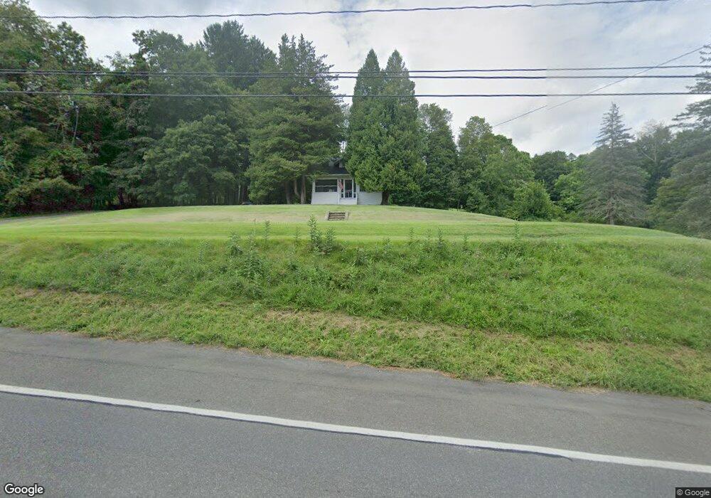
2355 State Route 82 Ancram, NY 12502
Estimated Value: $308,000 - $433,000
4
Beds
2
Baths
1,458
Sq Ft
$266/Sq Ft
Est. Value
About This Home
This home is located at 2355 State Route 82, Ancram, NY 12502 and is currently estimated at $387,640, approximately $265 per square foot. 2355 State Route 82 is a home with nearby schools including Taconic Hills Elementary School and Taconic Hills Junior/Senior High School.
Ownership History
Date
Name
Owned For
Owner Type
Purchase Details
Closed on
Oct 17, 2018
Sold by
Mchugh James E and Mchugh Catherine
Bought by
Skoda Alexander and Boice-Skoda Johanna M
Current Estimated Value
Home Financials for this Owner
Home Financials are based on the most recent Mortgage that was taken out on this home.
Original Mortgage
$166,250
Outstanding Balance
$145,288
Interest Rate
4.6%
Mortgage Type
New Conventional
Estimated Equity
$242,352
Create a Home Valuation Report for This Property
The Home Valuation Report is an in-depth analysis detailing your home's value as well as a comparison with similar homes in the area
Home Values in the Area
Average Home Value in this Area
Purchase History
| Date | Buyer | Sale Price | Title Company |
|---|---|---|---|
| Skoda Alexander | $175,000 | -- |
Source: Public Records
Mortgage History
| Date | Status | Borrower | Loan Amount |
|---|---|---|---|
| Open | Skoda Alexander | $166,250 |
Source: Public Records
Tax History Compared to Growth
Tax History
| Year | Tax Paid | Tax Assessment Tax Assessment Total Assessment is a certain percentage of the fair market value that is determined by local assessors to be the total taxable value of land and additions on the property. | Land | Improvement |
|---|---|---|---|---|
| 2024 | $4,078 | $347,000 | $60,000 | $287,000 |
| 2023 | $4,606 | $347,000 | $60,000 | $287,000 |
| 2022 | $3,829 | $183,626 | $50,000 | $133,626 |
| 2021 | $3,842 | $183,626 | $50,000 | $133,626 |
| 2020 | $3,750 | $180,000 | $50,000 | $130,000 |
| 2019 | $3,658 | $180,000 | $50,000 | $130,000 |
| 2018 | $3,658 | $180,000 | $50,000 | $130,000 |
| 2017 | $3,742 | $180,000 | $50,000 | $130,000 |
| 2016 | $3,823 | $180,000 | $50,000 | $130,000 |
| 2015 | -- | $176,293 | $45,000 | $131,293 |
| 2014 | -- | $176,293 | $45,000 | $131,293 |
Source: Public Records
Map
Nearby Homes
- 1301 County Route 7
- 2934 County Route 7
- 0 New York 82
- 2457 State Route 82
- 2456 New York 82
- 0 County Route 7 Unit 20252252
- 0 County Route 7 Unit KEYH6308186
- 0 County Route 7 Unit 20252251
- 0 County Route 7 Unit 152778
- 255 Mill Hill Rd
- 225 Simons Rd
- 420 Roche Dr
- 284 Hall Hill Rd
- 1745 County Route 7
- 0 Westfall Rd Unit 154554
- 0 Westfall Rd
- 91 Decker Rd
- 65 Tims Rd
- 1820 County Route 7
- 717 County Route 7
- 2349 State Route 82
- 2385 State Route 82
- 2360 State Route 82
- 2360 Ny-82 --
- 2360 New York 82
- 2380 State Route 82
- 1291 County Route 7
- 2349 New York 82
- 2387 State Route 82
- 2387 New York 82
- 2349 County Route 7
- 2385 County Route 7
- 2399 County Route 7
- 1295 County Route 7
- 1301 County Route 7
- 2345 State Route 82
- 3635 County Route 7
- 4061 County Route 7
- 3260 County Route 7
- 3609 County Route 7