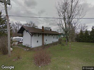
23550 State Route 739 Raymond, OH 43067
Estimated Value: $223,000 - $229,150
2
Beds
2
Baths
1,140
Sq Ft
$197/Sq Ft
Est. Value
About This Home
This home is located at 23550 State Route 739, Raymond, OH 43067 and is currently estimated at $225,038, approximately $197 per square foot. 23550 State Route 739 is a home located in Union County with nearby schools including Raymond Elementary School, Creekview Intermediate Elementary School, and Bunsold Middle School.
Ownership History
Date
Name
Owned For
Owner Type
Purchase Details
Closed on
May 2, 1994
Bought by
Tillman Richard E and Tillman Janice E
Current Estimated Value
Create a Home Valuation Report for This Property
The Home Valuation Report is an in-depth analysis detailing your home's value as well as a comparison with similar homes in the area
Home Values in the Area
Average Home Value in this Area
Purchase History
| Date | Buyer | Sale Price | Title Company |
|---|---|---|---|
| Tillman Richard E | $60,000 | -- |
Source: Public Records
Mortgage History
| Date | Status | Borrower | Loan Amount |
|---|---|---|---|
| Open | Tillman Richard E | $125,050 | |
| Closed | Tillman Richard E | $69,517 |
Source: Public Records
Tax History Compared to Growth
Tax History
| Year | Tax Paid | Tax Assessment Tax Assessment Total Assessment is a certain percentage of the fair market value that is determined by local assessors to be the total taxable value of land and additions on the property. | Land | Improvement |
|---|---|---|---|---|
| 2024 | $2,842 | $62,880 | $6,310 | $56,570 |
| 2023 | $2,842 | $62,880 | $6,310 | $56,570 |
| 2022 | $2,850 | $62,880 | $6,310 | $56,570 |
| 2021 | $2,566 | $49,680 | $4,850 | $44,830 |
| 2020 | $2,470 | $49,680 | $4,850 | $44,830 |
| 2019 | $2,529 | $49,680 | $4,850 | $44,830 |
| 2018 | $1,712 | $40,000 | $5,290 | $34,710 |
| 2017 | $1,614 | $40,000 | $5,290 | $34,710 |
| 2016 | $1,609 | $40,000 | $5,290 | $34,710 |
| 2015 | $1,623 | $38,040 | $5,290 | $32,750 |
| 2014 | $1,593 | $38,040 | $5,290 | $32,750 |
| 2013 | $1,501 | $38,040 | $5,290 | $32,750 |
Source: Public Records
Map
Nearby Homes
- 21743 Ohio 347
- 0 Powder Lick Rd Unit 1016484
- 21875 Liberty Rd W
- 0 Shirk Rd
- 0 Yearsley Rd
- 20740 Raymond Rd
- 0 Johnson Rd Unit 222024368
- 0 Johnson Rd Unit Lot 2 222024351
- 25947 Lunda Rd
- 26180 Newton-Perkins Rd
- 19015 Powderlick Rd
- 19756 Westlake Lee Rd
- 16838 Martin Welch Rd
- 25437 Patrick Brush Run Rd
- 24455 Honda Pkwy
- 28249 State Route 739
- 19081 Smokey Rd
- 17905 Bear Swamp Rd
- 17916 Allen Center Rd
- 22595 Buck Allen Dr
- 23550 State Route 739
- 23525 State Route 739
- 21528 State Route 347
- 21532 State Route 347
- 21528 Main St
- 21516 Main St
- 21546 Main St
- 23519 State Route 739
- 21468 Main St
- 21468 Ohio 347
- 21566 Main St
- 21574 Main St
- 21549 State Route 347
- 23540 Coe Ave
- 21561 State Route 347
- 21584 Main St
- 21584 Ohio 347
- 21588 Delaware Ave
- 21569 State Route 347
- 21588 Ohio 347