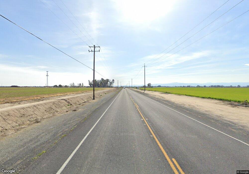
23563 S Airport Way Manteca, CA 95337
Estimated Value: $764,171 - $1,254,000
3
Beds
1
Bath
1,039
Sq Ft
$940/Sq Ft
Est. Value
About This Home
This home is located at 23563 S Airport Way, Manteca, CA 95337 and is currently estimated at $976,390, approximately $939 per square foot. 23563 S Airport Way is a home located in San Joaquin County with nearby schools including Nile Garden Elementary School and Sierra High School.
Ownership History
Date
Name
Owned For
Owner Type
Purchase Details
Closed on
Jun 10, 2003
Sold by
Hays Grant P
Bought by
Hays Ranch Llc
Current Estimated Value
Purchase Details
Closed on
May 11, 2003
Sold by
Hays John W
Bought by
Hays Ranch Llc
Purchase Details
Closed on
Jun 28, 2000
Sold by
Mccurdy Melinda Porter Hays
Bought by
Hays John W
Purchase Details
Closed on
Feb 3, 2000
Sold by
Hays John W
Bought by
Hays Grant P
Purchase Details
Closed on
Nov 17, 1998
Sold by
Hays John W
Bought by
Hays John W
Create a Home Valuation Report for This Property
The Home Valuation Report is an in-depth analysis detailing your home's value as well as a comparison with similar homes in the area
Home Values in the Area
Average Home Value in this Area
Purchase History
| Date | Buyer | Sale Price | Title Company |
|---|---|---|---|
| Hays Ranch Llc | -- | -- | |
| Hays Ranch Llc | -- | -- | |
| Hays John W | -- | -- | |
| Hays Grant P | -- | -- | |
| Hays John W | -- | -- | |
| Hays John W | -- | -- | |
| Hays John W | -- | -- |
Source: Public Records
Tax History Compared to Growth
Tax History
| Year | Tax Paid | Tax Assessment Tax Assessment Total Assessment is a certain percentage of the fair market value that is determined by local assessors to be the total taxable value of land and additions on the property. | Land | Improvement |
|---|---|---|---|---|
| 2025 | $14,735 | $1,100,360 | $986,602 | $113,758 |
| 2024 | $14,390 | $1,078,786 | $967,258 | $111,528 |
| 2023 | $14,246 | $1,057,635 | $948,293 | $109,342 |
| 2022 | $14,070 | $1,036,898 | $929,699 | $107,199 |
| 2021 | $13,944 | $1,016,568 | $911,470 | $105,098 |
| 2020 | $13,479 | $1,006,145 | $902,124 | $104,021 |
| 2019 | $13,336 | $986,418 | $884,436 | $101,982 |
| 2018 | $13,397 | $1,145,678 | $883,990 | $261,688 |
| 2017 | $14,304 | $1,063,023 | $963,040 | $99,983 |
| 2016 | $13,746 | $1,017,815 | $919,792 | $98,023 |
| 2014 | $9,900 | $703,960 | $609,302 | $94,658 |
Source: Public Records
Map
Nearby Homes
- 2038 Wawona St
- 2182 River Willow Ave
- 2851 Ski Beach St
- 2178 Al Fonseca Ln
- 1969 Hedaro Place
- 20109 S Union Rd
- 2422 Sather St
- 2468 Sather St
- The Toscana Plan at Griffin Park - Solera
- The Andalusia Plan at Griffin Park - Solera
- The Patagonia Plan at Griffin Park - Solera
- The Provence Plan at Griffin Park - Solera
- The Mendocino Plan at Griffin Park - Solera
- The Castile Plan at Griffin Park - Carriage Collection
- The Chateau Plan at Griffin Park - Carriage Collection
- The Chalet Plan at Griffin Park - Carriage Collection
- The Cottage Plan at Griffin Park - Carriage Collection
- 2492 Sather St
- 2369 Sather St
- 2377 Sather St
- 23675 S Airport Way
- 23400 S Airport Way
- 4865 W Ripon Rd Unit E
- 4919 W Ripon Rd Unit E
- 5040 Almondwood Rd
- 3164 Capistrano St
- 20600 S Airport Way
- 0 Division Rd Unit 90020775
- 0 Division Rd Unit 90090300
- 0 Division Ave Unit 10022579
- 0 S Union&peach Ave Unit 60012566
- 0 *No Site Address* Unit 132008761
- 1763 Forkleaf Ct
- 23549 Oleander Rd
- 23595 Oleander Ave
- 23319 Oleander Rd
- 23319 Oleander Ave
- 5220 Almondwood Rd
- 1365 William Rd
- A, B & C S Pacific Rd
