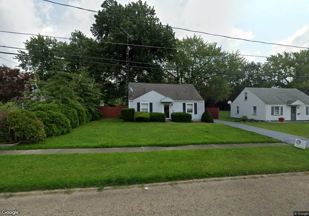
2358 Clark Ave Alliance, OH 44601
Estimated Value: $123,081 - $144,000
2
Beds
1
Bath
1,152
Sq Ft
$118/Sq Ft
Est. Value
About This Home
This home is located at 2358 Clark Ave, Alliance, OH 44601 and is currently estimated at $136,270, approximately $118 per square foot. 2358 Clark Ave is a home located in Stark County with nearby schools including Alliance Elementary School at Rockhill, Alliance Intermediate School at Northside, and Alliance Middle School.
Ownership History
Date
Name
Owned For
Owner Type
Purchase Details
Closed on
Oct 5, 2006
Sold by
Hammer David L and Hammer Caren S
Bought by
Ring Charles D and Ring Lynn A
Current Estimated Value
Home Financials for this Owner
Home Financials are based on the most recent Mortgage that was taken out on this home.
Original Mortgage
$72,000
Outstanding Balance
$43,035
Interest Rate
6.49%
Mortgage Type
Purchase Money Mortgage
Estimated Equity
$93,235
Purchase Details
Closed on
Mar 15, 1990
Create a Home Valuation Report for This Property
The Home Valuation Report is an in-depth analysis detailing your home's value as well as a comparison with similar homes in the area
Home Values in the Area
Average Home Value in this Area
Purchase History
| Date | Buyer | Sale Price | Title Company |
|---|---|---|---|
| Ring Charles D | $72,000 | None Available | |
| -- | $35,000 | -- |
Source: Public Records
Mortgage History
| Date | Status | Borrower | Loan Amount |
|---|---|---|---|
| Open | Ring Charles D | $72,000 |
Source: Public Records
Tax History
| Year | Tax Paid | Tax Assessment Tax Assessment Total Assessment is a certain percentage of the fair market value that is determined by local assessors to be the total taxable value of land and additions on the property. | Land | Improvement |
|---|---|---|---|---|
| 2025 | -- | $29,750 | $8,050 | $21,700 |
| 2024 | -- | $29,750 | $8,050 | $21,700 |
| 2023 | $822 | $29,620 | $10,190 | $19,430 |
| 2022 | $844 | $29,620 | $10,190 | $19,430 |
| 2021 | $845 | $29,620 | $10,190 | $19,430 |
| 2020 | $700 | $24,890 | $8,860 | $16,030 |
| 2019 | $690 | $24,900 | $8,860 | $16,040 |
Source: Public Records
Map
Nearby Homes
- 2364 Shunk Ave
- 2117 Miller Ave
- 2372 S Union Ave
- 2406 S Union Ave
- 2405 Cherry Ave
- 2705 Shunk Ave
- 2041 Watson Ave
- 2408 S Linden Ave
- 549 Linwood Dr
- 2351 S Freedom Ave
- 856 Birchwood Dr
- 3116 Ridgehill Ave
- 720 Vincent Blvd
- 390 E College St
- 555 E Milton St
- 1016 Roseland Rd
- 233 Shadyside Ct
- 2580 Crestview Ave
- 224 Shadyside Ct
- 853 Fairway Dr
- 2370 Clark Ave
- 2340 Clark Ave
- 2378 Clark Ave
- 2405 Miller Ave
- 2343 Miller Ave
- 2421 Miller Ave
- 2324 Clark Ave
- 2325 Miller Ave
- 2402 Clark Ave
- 2357 Clark Ave
- 2369 Clark Ave
- 2341 Clark Ave
- 2315 Miller Ave
- 2414 Clark Ave
- 2377 Clark Ave
- 2327 Clark Ave
- 2306 Clark Ave
- 2364 Miller Ave
- 260 W 23rd St
- 2403 Clark Ave