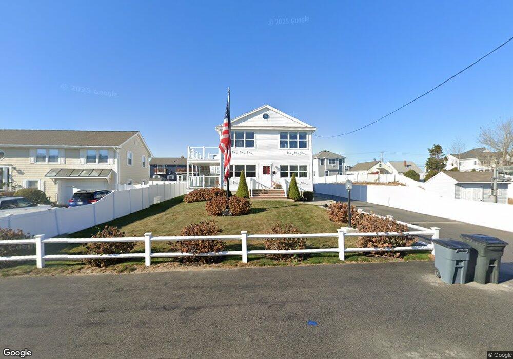
236 Atlantic Ave Seabrook, NH 03874
Seabrook Beach NeighborhoodEstimated Value: $2,017,000 - $2,305,000
7
Beds
4
Baths
3,320
Sq Ft
$654/Sq Ft
Est. Value
About This Home
This home is located at 236 Atlantic Ave, Seabrook, NH 03874 and is currently estimated at $2,171,269, approximately $653 per square foot. 236 Atlantic Ave is a home located in Rockingham County with nearby schools including Seabrook Elementary School, Seabrook Middle School, and Winnacunnet High School.
Ownership History
Date
Name
Owned For
Owner Type
Purchase Details
Closed on
Mar 31, 2017
Sold by
3 Ward Rt and Shea Judith A
Bought by
Kathleen A Shea T and Shea Kathleen A
Current Estimated Value
Home Financials for this Owner
Home Financials are based on the most recent Mortgage that was taken out on this home.
Original Mortgage
$1,000,000
Outstanding Balance
$830,780
Interest Rate
4.15%
Mortgage Type
Purchase Money Mortgage
Estimated Equity
$1,340,489
Create a Home Valuation Report for This Property
The Home Valuation Report is an in-depth analysis detailing your home's value as well as a comparison with similar homes in the area
Home Values in the Area
Average Home Value in this Area
Purchase History
| Date | Buyer | Sale Price | Title Company |
|---|---|---|---|
| Kathleen A Shea T | $1,042,200 | -- | |
| 3 Ward Rt | -- | -- |
Source: Public Records
Mortgage History
| Date | Status | Borrower | Loan Amount |
|---|---|---|---|
| Open | Kathleen A Shea T | $1,000,000 |
Source: Public Records
Tax History Compared to Growth
Tax History
| Year | Tax Paid | Tax Assessment Tax Assessment Total Assessment is a certain percentage of the fair market value that is determined by local assessors to be the total taxable value of land and additions on the property. | Land | Improvement |
|---|---|---|---|---|
| 2024 | $18,566 | $1,584,100 | $985,800 | $598,300 |
| 2023 | $19,293 | $1,278,500 | $782,900 | $495,600 |
| 2022 | $16,940 | $1,278,500 | $782,900 | $495,600 |
| 2021 | $17,554 | $1,278,500 | $782,900 | $495,600 |
| 2020 | $7,146 | $1,014,100 | $626,100 | $388,000 |
| 2019 | $15,972 | $1,014,100 | $626,100 | $388,000 |
| 2018 | $16,050 | $987,700 | $612,900 | $374,800 |
| 2017 | $15,121 | $930,500 | $555,700 | $374,800 |
| 2016 | $13,765 | $930,700 | $611,200 | $319,500 |
| 2015 | $11,251 | $760,700 | $472,700 | $288,000 |
| 2014 | $11,616 | $760,700 | $472,700 | $288,000 |
| 2013 | $11,616 | $760,700 | $472,700 | $288,000 |
Source: Public Records
Map
Nearby Homes
- 126 Ocean Blvd
- 9 Tyngsboro St
- 376 Ocean Blvd
- 27 Cross Beach Rd
- 595 N End Blvd Unit 2
- 308 State Route 286 Unit Lot 73
- 308 State Route 286 Unit Lot 108
- 308 State Route 286 Unit Lot 23
- 308 State Route 286 Unit Lot 87
- 18 River St
- 108 Ocean Dr Unit 1
- 522 N End Blvd
- 498 N End Blvd
- 492 N End Blvd
- 308 Route 286 Unit 77
- 308 Route 286 Unit Lot 58
- 312 S Main St
- 432 N End Blvd
- 1 Old Salt Dr
- 13-15 Ocean Blvd
- 242 Atlantic Ave
- 228 Atlantic Ave
- 200 Ocean Blvd
- 204 Ocean Blvd
- 204 Ocean Blvd Unit 205
- 196 Ocean Blvd
- 248 Atlantic Ave
- 224 Atlantic Ave
- 206 Ocean Blvd Unit 206
- 208 Ocean Blvd
- 201 Ocean Blvd
- 212 Ocean Blvd
- 239 Atlantic Ave
- 220 Atlantic Ave
- 231 Atlantic Ave
- 243 Atlantic Ave
- 7 Haverhill St
- 192 Ocean Blvd
- 21 Haverhill St
- 227 Atlantic Ave