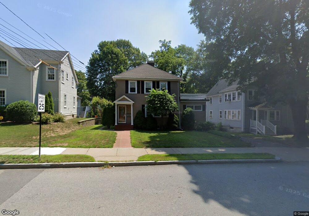
236 Grove St Unit 238 Auburndale, MA 02466
Auburndale NeighborhoodEstimated Value: $1,261,000 - $1,401,198
5
Beds
2
Baths
2,417
Sq Ft
$550/Sq Ft
Est. Value
About This Home
This home is located at 236 Grove St Unit 238, Auburndale, MA 02466 and is currently estimated at $1,329,800, approximately $550 per square foot. 236 Grove St Unit 238 is a home located in Middlesex County with nearby schools including Williams Elementary School, Charles E Brown Middle School, and Newton South High School.
Ownership History
Date
Name
Owned For
Owner Type
Purchase Details
Closed on
Nov 13, 2020
Sold by
Ng Sui K and Chan Kim Y
Bought by
Chan Kin W and Chan Jennifer M
Current Estimated Value
Purchase Details
Closed on
Jan 14, 2005
Sold by
Onanian Dana and Onanian Nancy J
Bought by
Chan Jennifer M and Chan Kin Wah
Home Financials for this Owner
Home Financials are based on the most recent Mortgage that was taken out on this home.
Original Mortgage
$330,000
Interest Rate
5.81%
Mortgage Type
Purchase Money Mortgage
Purchase Details
Closed on
Sep 18, 1996
Sold by
Onanian Berch and Onanian Janet A
Bought by
Onanian Dana L
Home Financials for this Owner
Home Financials are based on the most recent Mortgage that was taken out on this home.
Original Mortgage
$104,000
Interest Rate
7.89%
Mortgage Type
Purchase Money Mortgage
Create a Home Valuation Report for This Property
The Home Valuation Report is an in-depth analysis detailing your home's value as well as a comparison with similar homes in the area
Home Values in the Area
Average Home Value in this Area
Purchase History
| Date | Buyer | Sale Price | Title Company |
|---|---|---|---|
| Chan Kin W | -- | None Available | |
| Chan Jennifer M | $600,000 | -- | |
| Onanian Dana L | $130,000 | -- |
Source: Public Records
Mortgage History
| Date | Status | Borrower | Loan Amount |
|---|---|---|---|
| Previous Owner | Chan Jennifer M | $330,000 | |
| Previous Owner | Onanian Dana L | $106,000 | |
| Previous Owner | Onanian Dana L | $104,000 |
Source: Public Records
Tax History Compared to Growth
Tax History
| Year | Tax Paid | Tax Assessment Tax Assessment Total Assessment is a certain percentage of the fair market value that is determined by local assessors to be the total taxable value of land and additions on the property. | Land | Improvement |
|---|---|---|---|---|
| 2025 | $9,666 | $986,300 | $742,000 | $244,300 |
| 2024 | $9,346 | $957,600 | $720,400 | $237,200 |
| 2023 | $8,997 | $883,800 | $579,000 | $304,800 |
| 2022 | $8,609 | $818,300 | $536,100 | $282,200 |
| 2021 | $8,078 | $750,700 | $491,800 | $258,900 |
| 2020 | $7,837 | $750,700 | $491,800 | $258,900 |
| 2019 | $7,332 | $701,600 | $459,600 | $242,000 |
| 2018 | $7,426 | $686,300 | $440,400 | $245,900 |
| 2017 | $7,001 | $629,600 | $404,000 | $225,600 |
| 2016 | $6,573 | $577,600 | $370,600 | $207,000 |
| 2015 | $6,267 | $539,800 | $346,400 | $193,400 |
Source: Public Records
Map
Nearby Homes
- 27 Oakwood Rd
- 17 Lasell St
- 283 Woodland Rd
- 224 Auburn St Unit 224
- 224 Auburn St Unit A
- 17 Deforest Rd
- 283 Melrose St
- 226 Auburn St Unit 226
- 2202 Commonwealth Ave Unit 2
- 2202 Commonwealth Ave Unit 1
- 1754 Washington St
- 2084 Washington St
- 1639 Washington St
- 13 Weir St
- 62-64 Rowe St Unit B
- 17 Gilbert St
- 10 Lorraine Cir
- 51 Bourne St
- 1640 Commonwealth Ave
- 45 Moulton St
- 238 Grove St Unit 2
- 238 Grove St Unit 238
- 232 Grove St
- 242 Grove St Unit 244
- 228 Grove St
- 248 Grove St
- 222 Grove St
- 233 Grove St
- 245 Grove St
- 225 Grove St
- 225 Grove St Unit 3
- 225 Grove St
- 225 Grove St Unit 1
- 221 Grove St
- 221 Grove St Unit 2
- 221 Grove St Unit 1
- 216 Grove St
- 24 Robin Dell St
- 11 Norumbega Ct
- 18 Norumbega Ct