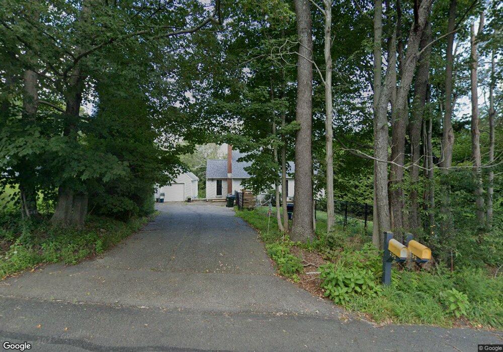
236 Smith Hill Rd Winsted, CT 06098
Estimated Value: $250,000 - $336,000
3
Beds
2
Baths
1,496
Sq Ft
$203/Sq Ft
Est. Value
About This Home
This home is located at 236 Smith Hill Rd, Winsted, CT 06098 and is currently estimated at $303,097, approximately $202 per square foot. 236 Smith Hill Rd is a home located in Litchfield County with nearby schools including Explorations Charter School and The Gilbert School.
Ownership History
Date
Name
Owned For
Owner Type
Purchase Details
Closed on
Oct 16, 2008
Sold by
Martin Donald K
Bought by
Crane Arthur J and Crane Myra M
Current Estimated Value
Home Financials for this Owner
Home Financials are based on the most recent Mortgage that was taken out on this home.
Original Mortgage
$188,000
Outstanding Balance
$124,896
Interest Rate
6.41%
Estimated Equity
$178,201
Purchase Details
Closed on
Oct 15, 1993
Sold by
Seidel Albert E and Dorothy Seidel Mary
Bought by
Messenger Jonathan M and Messenger Jean M
Home Financials for this Owner
Home Financials are based on the most recent Mortgage that was taken out on this home.
Original Mortgage
$112,200
Interest Rate
6.87%
Mortgage Type
Unknown
Create a Home Valuation Report for This Property
The Home Valuation Report is an in-depth analysis detailing your home's value as well as a comparison with similar homes in the area
Home Values in the Area
Average Home Value in this Area
Purchase History
| Date | Buyer | Sale Price | Title Company |
|---|---|---|---|
| Crane Arthur J | $235,000 | -- | |
| Crane Arthur J | $235,000 | -- | |
| Messenger Jonathan M | $110,000 | -- | |
| Messenger Jonathan M | $110,000 | -- |
Source: Public Records
Mortgage History
| Date | Status | Borrower | Loan Amount |
|---|---|---|---|
| Open | Messenger Jonathan M | $188,000 | |
| Closed | Messenger Jonathan M | $188,000 | |
| Previous Owner | Messenger Jonathan M | $15,788 | |
| Previous Owner | Messenger Jonathan M | $112,200 |
Source: Public Records
Tax History Compared to Growth
Tax History
| Year | Tax Paid | Tax Assessment Tax Assessment Total Assessment is a certain percentage of the fair market value that is determined by local assessors to be the total taxable value of land and additions on the property. | Land | Improvement |
|---|---|---|---|---|
| 2025 | $4,574 | $156,800 | $38,360 | $118,440 |
| 2024 | $4,271 | $156,800 | $38,360 | $118,440 |
| 2023 | $4,138 | $156,800 | $38,360 | $118,440 |
| 2022 | $3,853 | $114,870 | $27,790 | $87,080 |
| 2021 | $3,853 | $114,870 | $27,790 | $87,080 |
| 2020 | $3,853 | $114,870 | $27,790 | $87,080 |
| 2019 | $3,853 | $114,870 | $27,790 | $87,080 |
| 2018 | $3,853 | $114,870 | $27,790 | $87,080 |
| 2017 | $3,742 | $111,580 | $27,790 | $83,790 |
| 2016 | $3,742 | $111,580 | $27,790 | $83,790 |
| 2015 | $3,649 | $111,580 | $27,790 | $83,790 |
| 2014 | $3,561 | $111,580 | $27,790 | $83,790 |
Source: Public Records
Map
Nearby Homes
- 197 Spencer Hill Rd
- 208 Spencer Hill Rd
- 151 Losaw Rd
- 115 Old Robertsville Rd
- 503 N Main St
- 0 Old Robertsville Rd
- 111 Riverton Rd Unit 61
- 111 Riverton Rd Unit 90
- 11 Old Creamery Rd
- 256 Colebrook Rd
- 82 Riverton Rd
- 312 Colebrook River Rd
- 430 Smith Hill Rd
- 00 Ramsgate Ln
- 2 Ramsgate Ln
- 32 Norfolk Rd
- 52 White St
- 38 Upland Rd
- 38 Riveredge Dr Unit 38
- 99 Hubbard St
- 234 Smith Hill Rd
- 232 Smith Hill Rd
- 238 Smith Hill Rd
- 233 Smith Hill Rd
- 235 Smith Hill Rd
- 244 Smith Hill Rd
- 228 Smith Hill Rd
- 226 Smith Hill Rd
- 255 Smith Hill Rd
- 225 Smith Hill Rd
- 223 Smith Hill Rd
- 239 Smith Hill Rd
- 101 Deer Hill Rd
- 224 Smith Hill Rd
- 250 Smith Hill Rd
- 13 Gaylord Rd
- 107 Gaylord Rd
- 105 Gaylord Rd
- 222 Smith Hill Rd
- 390 Colebrook Rd