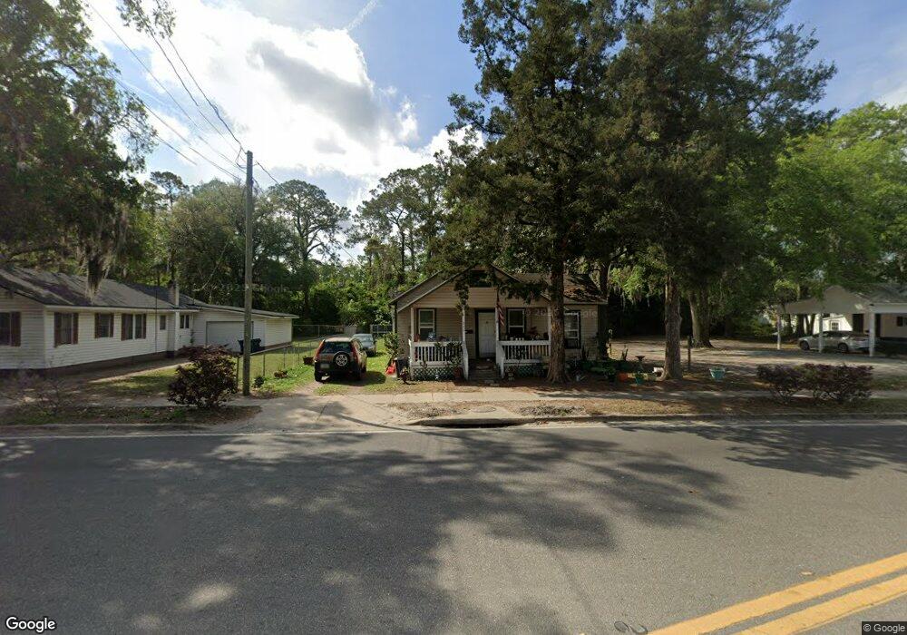
236 W MacClenny Ave MacClenny, FL 32063
Estimated Value: $109,000 - $225,000
4
Beds
1
Bath
1,292
Sq Ft
$137/Sq Ft
Est. Value
About This Home
This home is located at 236 W MacClenny Ave, MacClenny, FL 32063 and is currently estimated at $176,940, approximately $136 per square foot. 236 W MacClenny Ave is a home located in Baker County with nearby schools including Keller Intermediate School, MacClenny Elementary School, and Baker County Middle School.
Ownership History
Date
Name
Owned For
Owner Type
Purchase Details
Closed on
Jul 17, 2024
Sold by
Gob Enterprises Llc
Bought by
Aryan Aarna Llc
Current Estimated Value
Home Financials for this Owner
Home Financials are based on the most recent Mortgage that was taken out on this home.
Original Mortgage
$95,200
Outstanding Balance
$93,893
Interest Rate
6.99%
Mortgage Type
New Conventional
Estimated Equity
$83,047
Purchase Details
Closed on
Apr 12, 2002
Sold by
Herring Robert L and Herring Susanne
Bought by
Gob Enterprises
Create a Home Valuation Report for This Property
The Home Valuation Report is an in-depth analysis detailing your home's value as well as a comparison with similar homes in the area
Home Values in the Area
Average Home Value in this Area
Purchase History
| Date | Buyer | Sale Price | Title Company |
|---|---|---|---|
| Aryan Aarna Llc | $120,000 | Baker Title & Escrow | |
| Gob Enterprises | $43,100 | Baker Title & Escrow Co Inc |
Source: Public Records
Mortgage History
| Date | Status | Borrower | Loan Amount |
|---|---|---|---|
| Open | Aryan Aarna Llc | $95,200 |
Source: Public Records
Tax History Compared to Growth
Tax History
| Year | Tax Paid | Tax Assessment Tax Assessment Total Assessment is a certain percentage of the fair market value that is determined by local assessors to be the total taxable value of land and additions on the property. | Land | Improvement |
|---|---|---|---|---|
| 2025 | $2,289 | $132,701 | $44,625 | $88,076 |
| 2024 | $2,151 | $124,589 | $44,625 | $79,964 |
| 2023 | $2,052 | $116,398 | $0 | $0 |
| 2022 | $1,902 | $105,816 | $0 | $0 |
| 2021 | $1,731 | $96,196 | $44,625 | $51,571 |
| 2020 | $1,697 | $93,299 | $0 | $0 |
| 2019 | $1,636 | $89,242 | $44,625 | $44,617 |
| 2018 | $1,601 | $86,345 | $0 | $0 |
| 2017 | $1,573 | $84,027 | $0 | $0 |
| 2016 | $1,560 | $81,710 | $0 | $0 |
| 2015 | $1,535 | $78,812 | $0 | $0 |
| 2014 | $1,527 | $77,708 | $0 | $0 |
Source: Public Records
Map
Nearby Homes