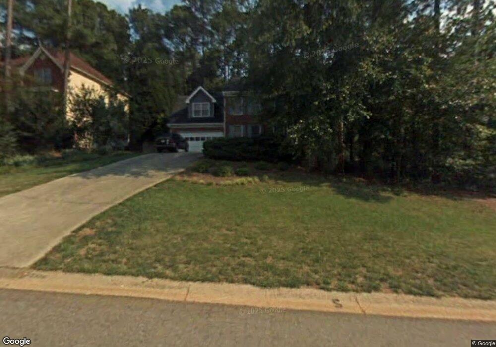
2364 Netherstone Dr NE Marietta, GA 30066
Sandy Plains NeighborhoodEstimated Value: $578,784 - $631,000
4
Beds
3
Baths
2,681
Sq Ft
$226/Sq Ft
Est. Value
About This Home
This home is located at 2364 Netherstone Dr NE, Marietta, GA 30066 and is currently estimated at $605,696, approximately $225 per square foot. 2364 Netherstone Dr NE is a home located in Cobb County with nearby schools including Davis Elementary School, Mabry Middle School, and Lassiter High School.
Ownership History
Date
Name
Owned For
Owner Type
Purchase Details
Closed on
Dec 13, 2002
Sold by
Vill Charles A and Vill Connie W
Bought by
Sulhoff Matthew J and Sulhoff Leslie A
Current Estimated Value
Home Financials for this Owner
Home Financials are based on the most recent Mortgage that was taken out on this home.
Original Mortgage
$176,000
Outstanding Balance
$79,635
Interest Rate
5.92%
Mortgage Type
New Conventional
Estimated Equity
$526,061
Purchase Details
Closed on
Apr 23, 1998
Sold by
Murray Marion K and Murray Teresa G
Bought by
Vill Charles A and Vill Connie H
Home Financials for this Owner
Home Financials are based on the most recent Mortgage that was taken out on this home.
Original Mortgage
$183,300
Interest Rate
7.09%
Mortgage Type
VA
Create a Home Valuation Report for This Property
The Home Valuation Report is an in-depth analysis detailing your home's value as well as a comparison with similar homes in the area
Home Values in the Area
Average Home Value in this Area
Purchase History
| Date | Buyer | Sale Price | Title Company |
|---|---|---|---|
| Sulhoff Matthew J | $220,000 | -- | |
| Vill Charles A | $178,000 | -- |
Source: Public Records
Mortgage History
| Date | Status | Borrower | Loan Amount |
|---|---|---|---|
| Open | Sulhoff Matthew J | $176,000 | |
| Previous Owner | Vill Charles A | $183,300 |
Source: Public Records
Tax History Compared to Growth
Tax History
| Year | Tax Paid | Tax Assessment Tax Assessment Total Assessment is a certain percentage of the fair market value that is determined by local assessors to be the total taxable value of land and additions on the property. | Land | Improvement |
|---|---|---|---|---|
| 2025 | $5,048 | $213,428 | $60,000 | $153,428 |
| 2024 | $4,724 | $198,288 | $36,000 | $162,288 |
| 2023 | $4,182 | $198,288 | $36,000 | $162,288 |
| 2022 | $4,762 | $198,288 | $36,000 | $162,288 |
| 2021 | $3,648 | $147,376 | $32,000 | $115,376 |
| 2020 | $3,648 | $147,376 | $32,000 | $115,376 |
| 2019 | $3,648 | $147,376 | $32,000 | $115,376 |
| 2018 | $3,546 | $142,756 | $29,600 | $113,156 |
| 2017 | $3,438 | $142,756 | $29,600 | $113,156 |
| 2016 | $2,886 | $117,424 | $29,600 | $87,824 |
| 2015 | $2,726 | $107,500 | $24,400 | $83,100 |
| 2014 | $2,448 | $94,196 | $0 | $0 |
Source: Public Records
Map
Nearby Homes
- 4709 Trickum Rd NE
- 2256 Turtle Club Dr NE Unit 1
- 4499 Browning Ct NE
- 4797 North Trail
- 4799 North Trail
- 2423 Turtle Crossing NE
- 4509 N Landing Dr
- 4592 N Landing Dr
- 4509 N Bay Ct
- 4813 Highpoint Dr NE
- 2603 Chadwick Rd
- 2610 Chadwick Rd
- 2958 Forest Chase Terrace NE
- 5100 Ravenwood Dr
- The Arlington Plan at Tanglewood
- The Alston A Plan at Tanglewood
- 4887 Raven Way NE
- 2402 Woodbridge Dr
- 2362 Netherstone Dr NE
- 2366 Netherstone Dr NE Unit 65
- 2366 Netherstone Dr NE
- 4648 Steinhauer Rd NE
- 0 Netherstone Dr NE Unit 8433539
- 0 Netherstone Dr NE Unit 3271580
- 0 Netherstone Dr NE Unit 7431456
- 0 Netherstone Dr NE Unit 7469354
- 0 Netherstone Dr NE Unit 7527219
- 0 Netherstone Dr NE Unit 7616692
- 0 Netherstone Dr NE Unit 8173025
- 2368 Netherstone Dr NE
- 2360 Netherstone Dr NE
- 4701 Hallford Way NE
- 2361 Netherstone Dr NE
- 2370 Netherstone Dr NE
- 2358 Netherstone Dr NE
- 2356 Netherstone Dr NE
- 4703 Hallford Way NE
- 4700 Hallford Way NE