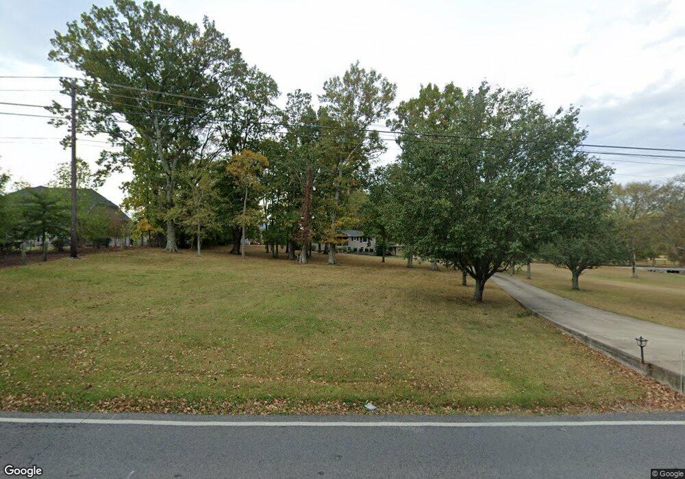
2365 Rocky Fork Rd Nolensville, TN 37135
Estimated Value: $562,000 - $825,000
--
Bed
2
Baths
1,250
Sq Ft
$572/Sq Ft
Est. Value
About This Home
This home is located at 2365 Rocky Fork Rd, Nolensville, TN 37135 and is currently estimated at $714,633, approximately $571 per square foot. 2365 Rocky Fork Rd is a home located in Williamson County with nearby schools including Nolensville Elementary School, Mill Creek Middle School, and Nolensville High School.
Ownership History
Date
Name
Owned For
Owner Type
Purchase Details
Closed on
Jan 21, 2022
Sold by
Stuteville Dawn R and Stuteville Jerry L
Bought by
Jerry L Stuteville And Dawn R Stuteville Livi and Stuteville Dawn R
Current Estimated Value
Purchase Details
Closed on
Sep 30, 1999
Sold by
Hicks Cynthia Elaine
Bought by
Stuteville Jerry L and Stuteville Dawn R
Home Financials for this Owner
Home Financials are based on the most recent Mortgage that was taken out on this home.
Original Mortgage
$164,800
Interest Rate
7.79%
Purchase Details
Closed on
Feb 12, 1997
Sold by
Hicks Dwayne S
Bought by
Hicks Cynthia Elanie
Create a Home Valuation Report for This Property
The Home Valuation Report is an in-depth analysis detailing your home's value as well as a comparison with similar homes in the area
Home Values in the Area
Average Home Value in this Area
Purchase History
| Date | Buyer | Sale Price | Title Company |
|---|---|---|---|
| Jerry L Stuteville And Dawn R Stuteville Livi | -- | None Listed On Document | |
| Stuteville Jerry L | $180,000 | Saturn & Mazer Title Svcs In | |
| Hicks Cynthia Elanie | -- | -- |
Source: Public Records
Mortgage History
| Date | Status | Borrower | Loan Amount |
|---|---|---|---|
| Previous Owner | Stuteville Jerry L | $164,800 |
Source: Public Records
Tax History Compared to Growth
Tax History
| Year | Tax Paid | Tax Assessment Tax Assessment Total Assessment is a certain percentage of the fair market value that is determined by local assessors to be the total taxable value of land and additions on the property. | Land | Improvement |
|---|---|---|---|---|
| 2025 | $2,403 | $237,900 | $192,400 | $45,500 |
| 2024 | $2,403 | $110,750 | $76,400 | $34,350 |
| 2023 | $2,403 | $110,750 | $76,400 | $34,350 |
| 2022 | $2,403 | $110,750 | $76,400 | $34,350 |
| 2021 | $2,403 | $110,750 | $76,400 | $34,350 |
| 2020 | $1,912 | $76,175 | $45,275 | $30,900 |
| 2019 | $1,805 | $76,175 | $45,275 | $30,900 |
| 2018 | $1,752 | $76,175 | $45,275 | $30,900 |
| 2017 | $1,737 | $76,175 | $45,275 | $30,900 |
| 2016 | $0 | $76,175 | $45,275 | $30,900 |
| 2015 | -- | $62,775 | $34,800 | $27,975 |
| 2014 | -- | $62,775 | $34,800 | $27,975 |
Source: Public Records
Map
Nearby Homes
- 0 Rocky Fork Rd
- 1005 Kirkpark Ct
- 1117 Millshed Dr
- 842 Nolenmeade Place
- 1049 Kirkpark Ct
- 1114 Crossfield Dr
- 904 Inglenook Ct
- 3186 Bradfield Dr
- 3231 Bradfield Dr
- 3236 Bradfield Dr
- 3136 Bradfield Dr
- 4604 Robin Ln
- 4601 Robin Ln
- 3025 Ash Dale Ln
- 3051 Ash Dale Ln
- 3019 Ash Dale Ln
- 3027 Ash Dale Ln
- 1525 Halsey Dr
- 825 Piccadilly Dr
- 3009 Canal St
- 1023 Crossfield Dr
- 2361 Rocky Fork Rd
- 721 Harper's Hill Rd
- 1027 Crossfield Dr
- 1035 Crossfield Dr
- 1031 Crossfield Dr
- 1039 Crossfield Dr
- 2357 Rocky Fork Rd
- 906 Whittmore Dr
- 906 Whittmore Dr Unit 2
- 1081 Whittmore Dr
- 910 Whittmore Dr
- 902 Whittmore Dr
- 1043 Crossfield Dr
- 23 Crossfield Dr
- 20 Whittmore Dr
- 2370 Rocky Fork Rd Unit Lot 03
- 2468 Rocky Fork Rd
- 914 Whittmore Dr
- 2370B Rocky Fork Rd
