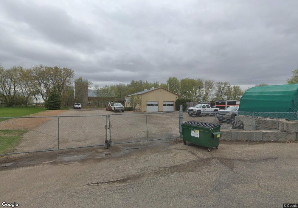
23650 State Highway 55 Loretto, MN 55357
Estimated Value: $440,503
--
Bed
--
Bath
1,980
Sq Ft
$222/Sq Ft
Est. Value
About This Home
This home is located at 23650 State Highway 55, Loretto, MN 55357 and is currently estimated at $440,503, approximately $222 per square foot. 23650 State Highway 55 is a home located in Hennepin County with nearby schools including Delano Elementary School, Delano Middle School, and Delano Senior High School.
Ownership History
Date
Name
Owned For
Owner Type
Purchase Details
Closed on
Oct 22, 2014
Sold by
Dolliff Roger P and Dolliff Vivian M
Bought by
Remsaw Llc
Current Estimated Value
Home Financials for this Owner
Home Financials are based on the most recent Mortgage that was taken out on this home.
Original Mortgage
$195,000
Interest Rate
4.13%
Mortgage Type
Commercial
Purchase Details
Closed on
Jun 7, 2010
Sold by
Dolliff Roger P and Dolliff Viviam M
Bought by
Remsaw Llc
Home Financials for this Owner
Home Financials are based on the most recent Mortgage that was taken out on this home.
Original Mortgage
$210,000
Interest Rate
6.5%
Mortgage Type
Land Contract Argmt. Of Sale
Purchase Details
Closed on
May 4, 2001
Sold by
Moy Richard K and Moy Mari L
Bought by
Dolliff Roger P
Create a Home Valuation Report for This Property
The Home Valuation Report is an in-depth analysis detailing your home's value as well as a comparison with similar homes in the area
Home Values in the Area
Average Home Value in this Area
Purchase History
| Date | Buyer | Sale Price | Title Company |
|---|---|---|---|
| Remsaw Llc | $260,000 | Midland Title | |
| Remsaw Llc | $260,000 | -- | |
| Dolliff Roger P | $184,000 | -- |
Source: Public Records
Mortgage History
| Date | Status | Borrower | Loan Amount |
|---|---|---|---|
| Closed | Remsaw Llc | $195,000 | |
| Previous Owner | Remsaw Llc | $210,000 |
Source: Public Records
Tax History Compared to Growth
Tax History
| Year | Tax Paid | Tax Assessment Tax Assessment Total Assessment is a certain percentage of the fair market value that is determined by local assessors to be the total taxable value of land and additions on the property. | Land | Improvement |
|---|---|---|---|---|
| 2024 | $11,908 | $448,000 | $134,000 | $314,000 |
| 2023 | $11,740 | $448,000 | $134,000 | $314,000 |
| 2022 | $10,601 | $400,000 | $134,000 | $266,000 |
| 2021 | $10,389 | $360,000 | $293,000 | $67,000 |
| 2020 | $9,825 | $349,000 | $293,000 | $56,000 |
| 2019 | $9,446 | $320,000 | $264,000 | $56,000 |
| 2018 | $9,188 | $300,000 | $247,000 | $53,000 |
| 2017 | $8,616 | $249,000 | $204,000 | $45,000 |
| 2016 | $8,471 | $239,000 | $199,000 | $40,000 |
| 2015 | $7,271 | $221,000 | $181,000 | $40,000 |
| 2014 | -- | $221,000 | $181,000 | $40,000 |
Source: Public Records
Map
Nearby Homes
- xxxx Town Line Rd
- 4132 Chippewa Rd
- 150 Loretto St
- 200 Meadow Dr
- 3600 Pioneer Trail
- 7050 Pioneer Trail
- 253x Pioneer Trail
- 2535 Pioneer Trail
- 2515 Pioneer Trail
- 5814 Kochs Crossing
- 5946 Kochs Crossing
- 6235 N Shore Dr
- 3695 William Way
- 5230 Rebecca Park Trail
- 6231 County Road 11
- 3602 William Way
- 3425 Leawood Dr
- 3512 William Way
- 3490 William Way
- 2805 Pioneer Trail
- 23710 State Highway 55
- 4695 State Highway 55
- 23730 State Highway 55
- 4445 State Highway 55
- 6415 County Road 19 Unit 177
- 6415 County Road 19 Unit 176
- 6415 County Road 19 Unit 175
- 6415 County Road 19 Unit 174
- 6415 County Road 19 Unit 173
- 6415 County Road 19 Unit 172
- 6415 County Road 19 Unit 171
- 6415 County Road 19 Unit 170
- 6415 County Road 19 Unit 169
- 6415 County Road 19 Unit 168
- 6415 County Road 19 Unit 167
- 6415 County Road 19 Unit 166
- 6415 County Road 19 Unit 165
- 6415 County Road 19 Unit 164
- 6415 County Road 19 Unit 163
- 6415 County Road 19 Unit 162