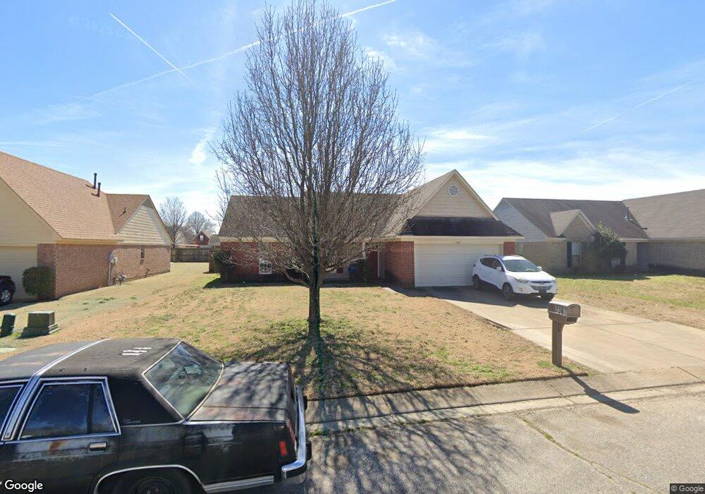
2367 Lasonya Ln Horn Lake, MS 38637
Estimated Value: $229,000 - $244,000
3
Beds
2
Baths
1,430
Sq Ft
$166/Sq Ft
Est. Value
About This Home
This home is located at 2367 Lasonya Ln, Horn Lake, MS 38637 and is currently estimated at $236,932, approximately $165 per square foot. 2367 Lasonya Ln is a home located in DeSoto County with nearby schools including Horn Lake Elementary School, Horn Lake Intermediate School, and Horn Lake Middle School.
Ownership History
Date
Name
Owned For
Owner Type
Purchase Details
Closed on
Apr 19, 2011
Sold by
Bank Of America Na
Bought by
Hebron Crystal
Current Estimated Value
Home Financials for this Owner
Home Financials are based on the most recent Mortgage that was taken out on this home.
Original Mortgage
$82,618
Outstanding Balance
$57,132
Interest Rate
4.85%
Mortgage Type
FHA
Estimated Equity
$179,800
Purchase Details
Closed on
Jan 11, 2011
Sold by
Moreno Guillermo and Tapia Rosa M
Bought by
Bank Of America Na
Create a Home Valuation Report for This Property
The Home Valuation Report is an in-depth analysis detailing your home's value as well as a comparison with similar homes in the area
Home Values in the Area
Average Home Value in this Area
Purchase History
| Date | Buyer | Sale Price | Title Company |
|---|---|---|---|
| Hebron Crystal | $84,800 | First National Title Llc | |
| Bank Of America Na | $74,700 | None Available |
Source: Public Records
Mortgage History
| Date | Status | Borrower | Loan Amount |
|---|---|---|---|
| Open | Hebron Crystal | $82,618 |
Source: Public Records
Tax History Compared to Growth
Tax History
| Year | Tax Paid | Tax Assessment Tax Assessment Total Assessment is a certain percentage of the fair market value that is determined by local assessors to be the total taxable value of land and additions on the property. | Land | Improvement |
|---|---|---|---|---|
| 2024 | $1,308 | $10,814 | $2,000 | $8,814 |
| 2023 | $1,308 | $10,814 | $0 | $0 |
| 2022 | $1,308 | $10,814 | $2,000 | $8,814 |
| 2021 | $1,308 | $10,814 | $2,000 | $8,814 |
| 2020 | $1,204 | $10,108 | $2,000 | $8,108 |
| 2019 | $1,204 | $10,108 | $2,000 | $8,108 |
| 2017 | $1,186 | $17,876 | $9,938 | $7,938 |
| 2016 | $1,146 | $9,938 | $2,000 | $7,938 |
| 2015 | $1,438 | $17,876 | $9,938 | $7,938 |
| 2014 | $1,146 | $9,938 | $0 | $0 |
| 2013 | $1,441 | $9,938 | $0 | $0 |
Source: Public Records
Map
Nearby Homes
- 2388 Pappy Ln
- 2655 Hillcrest Dr
- 6670 Embassy Cir
- 2952 Churchwell Dr
- 2848 Normandy Dr
- 1873 Merrimac Cove
- 7135 Hampton Dr
- 7088 Foxhall Dr
- 1810 Dorchester Dr
- 2919 Normandy Dr
- 2880 Briarwood Dr
- 3031 Caitlynn Cir S
- 2950 Briarwood Dr
- 7429 Perrin Ln
- 7764 Auburn Cove
- 7424 Crystal Dr
- 2283 Natchez Cove
- 8147 Charleston Dr
- 6787 Chase Cove
- 6265 Foxbriar Dr
- 2379 Lasonya Ln
- 2353 Lasonya Ln
- 2360 Mooneyham Ln
- 2372 Mooneyham Ln
- 2393 Lasonya Ln
- 2337 Lasonya Ln
- 2348 Mooneyham Ln
- 2384 Mooneyham Ln
- 2364 Lasonya Ln
- 2376 Lasonya Ln
- 2350 Lasonya Ln
- 2405 Lasonya Ln
- 2390 Lasonya Ln
- 2330 Mooneyham Ln
- 2402 Lasonya Ln
- 2410 Mooneyham Ln
- 2419 Lasonya Ln
- 2361 Easley Ln
- 2365 Mooneyham Ln
- 2414 Lasonya Ln