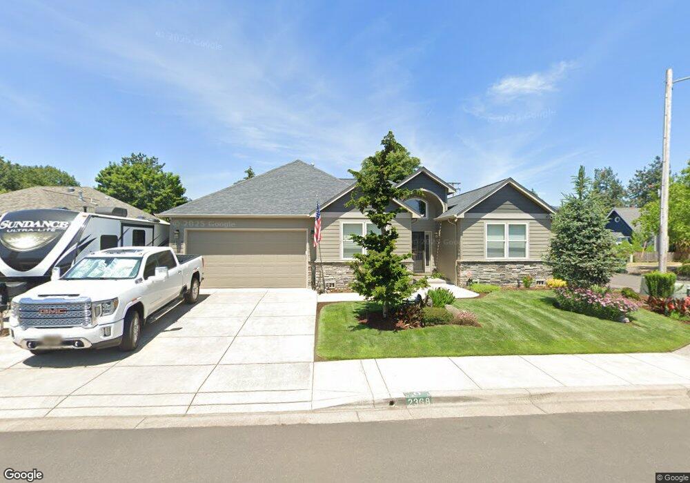
2368 Clear Vue Ln Springfield, OR 97477
Gateway NeighborhoodEstimated Value: $544,597 - $608,000
4
Beds
2
Baths
1,995
Sq Ft
$294/Sq Ft
Est. Value
About This Home
This home is located at 2368 Clear Vue Ln, Springfield, OR 97477 and is currently estimated at $586,899, approximately $294 per square foot. 2368 Clear Vue Ln is a home located in Lane County with nearby schools including Guy Lee Elementary School, Hamlin Middle School, and Springfield High School.
Ownership History
Date
Name
Owned For
Owner Type
Purchase Details
Closed on
Nov 18, 2016
Sold by
Welsh Carl John and Welsh Carolyn H
Bought by
Denham William L and Denham Diane R
Current Estimated Value
Home Financials for this Owner
Home Financials are based on the most recent Mortgage that was taken out on this home.
Original Mortgage
$215,680
Outstanding Balance
$27,191
Interest Rate
3.52%
Mortgage Type
Seller Take Back
Estimated Equity
$559,708
Purchase Details
Closed on
Sep 6, 2016
Sold by
Shelley Audrey D and Shelley Jeffrey M
Bought by
Welsh Carl John and Welsh Carolyn H
Purchase Details
Closed on
Jan 6, 2014
Sold by
Shelley Philip N and Shelley Lois V
Bought by
Shelley Audrea D and Shelley Jeffrey M
Home Financials for this Owner
Home Financials are based on the most recent Mortgage that was taken out on this home.
Original Mortgage
$280,000
Interest Rate
4.17%
Mortgage Type
VA
Create a Home Valuation Report for This Property
The Home Valuation Report is an in-depth analysis detailing your home's value as well as a comparison with similar homes in the area
Home Values in the Area
Average Home Value in this Area
Purchase History
| Date | Buyer | Sale Price | Title Company |
|---|---|---|---|
| Denham William L | $315,680 | First American | |
| Welsh Carl John | $315,000 | First American Title | |
| Shelley Audrea D | $280,000 | Evergreen Land Title Co |
Source: Public Records
Mortgage History
| Date | Status | Borrower | Loan Amount |
|---|---|---|---|
| Open | Denham William L | $215,680 | |
| Previous Owner | Shelley Audrea D | $280,000 |
Source: Public Records
Tax History Compared to Growth
Tax History
| Year | Tax Paid | Tax Assessment Tax Assessment Total Assessment is a certain percentage of the fair market value that is determined by local assessors to be the total taxable value of land and additions on the property. | Land | Improvement |
|---|---|---|---|---|
| 2025 | $6,047 | $329,768 | -- | -- |
| 2024 | $5,949 | $320,164 | -- | -- |
| 2023 | $5,949 | $310,839 | $0 | $0 |
| 2022 | $5,510 | $301,786 | $0 | $0 |
| 2021 | $5,411 | $292,997 | $0 | $0 |
| 2020 | $5,253 | $284,464 | $0 | $0 |
| 2019 | $5,095 | $276,179 | $0 | $0 |
| 2018 | $4,803 | $260,325 | $0 | $0 |
| 2017 | $4,618 | $260,325 | $0 | $0 |
| 2016 | $4,521 | $252,743 | $0 | $0 |
| 2015 | $4,392 | $245,382 | $0 | $0 |
| 2014 | $4,326 | $238,235 | $0 | $0 |
Source: Public Records
Map
Nearby Homes
- 484 Scotts Glen Dr
- 650 Harlow Rd Unit 209
- 650 Harlow Rd Unit 233
- 650 Harlow Rd Unit 240
- 2150 Laura (#57) St Unit 57
- 2150 Laura St Unit 119
- 2150 Laura St Unit 111
- 2150 Laura St Unit 39
- 2150 Laura St Unit 57
- 2150 Laura St Unit 83
- 2150 Laura St Unit 44
- 364 Scotts Glen Dr
- 2567 Game Farm Rd
- 2846 El Toro Ct
- 1267 Kenray Loop
- 40 Allen Ave
- 1120 W Fairview Dr Unit 3
- 1310 W Quinalt St
- 114 Hayden Bridge Way
- 872 W N St
- 2360 Clear Vue Ln
- 2363 Clear Vue Ln
- 2330 Clear Vue Ln
- 2354 Clear Vue Ln
- 2338 Clear Vue Ln
- 2385 Clear Vue Ln
- 2346 Clear Vue Ln
- 2335 Clear Vue Ln
- 2357 Clear Vue Ln
- 2342 Clear Vue Ln
- 2391 Clear Vue Ln
- 2412 Clear Vue Ln
- 2327 Clear Vue Ln
- 2379 Clear Vue Ln
- 2341 Clear Vue Ln
- 2349 Clear Vue Ln
- 2298 Clear Vue Ln
- 2418 Clear Vue Ln
- 2323 Clear Vue Ln
- 2284 Clear Vue Ln