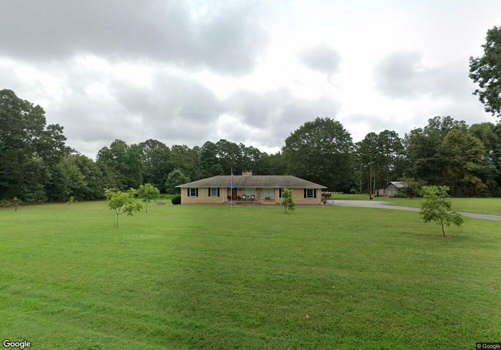
2369 Devine Rd Iron Station, NC 28080
Estimated Value: $321,000 - $406,599
3
Beds
3
Baths
1,642
Sq Ft
$218/Sq Ft
Est. Value
About This Home
This home is located at 2369 Devine Rd, Iron Station, NC 28080 and is currently estimated at $357,650, approximately $217 per square foot. 2369 Devine Rd is a home located in Lincoln County with nearby schools including Iron Station Elementary School, East Lincoln Middle School, and East Lincoln High School.
Ownership History
Date
Name
Owned For
Owner Type
Purchase Details
Closed on
Feb 9, 2018
Sold by
Estate Of Martha C Hovis
Bought by
Bumgarner Keith and Bumgarner Sandra
Current Estimated Value
Home Financials for this Owner
Home Financials are based on the most recent Mortgage that was taken out on this home.
Original Mortgage
$125,000
Outstanding Balance
$71,082
Interest Rate
3.99%
Mortgage Type
New Conventional
Estimated Equity
$286,568
Purchase Details
Closed on
Jun 28, 2005
Sold by
Hovis Stacy E
Bought by
Hovis Yates G and Hovis Martha C
Create a Home Valuation Report for This Property
The Home Valuation Report is an in-depth analysis detailing your home's value as well as a comparison with similar homes in the area
Purchase History
| Date | Buyer | Sale Price | Title Company |
|---|---|---|---|
| Bumgarner Keith | $180,000 | None Available | |
| Hovis Yates G | -- | None Available |
Source: Public Records
Mortgage History
| Date | Status | Borrower | Loan Amount |
|---|---|---|---|
| Open | Bumgarner Keith | $125,000 |
Source: Public Records
Tax History
| Year | Tax Paid | Tax Assessment Tax Assessment Total Assessment is a certain percentage of the fair market value that is determined by local assessors to be the total taxable value of land and additions on the property. | Land | Improvement |
|---|---|---|---|---|
| 2025 | $2,435 | $370,774 | $75,826 | $294,948 |
| 2024 | $2,415 | $370,774 | $75,826 | $294,948 |
| 2023 | $2,360 | $370,774 | $75,826 | $294,948 |
| 2022 | $1,606 | $202,681 | $54,566 | $148,115 |
| 2021 | $1,606 | $202,681 | $54,566 | $148,115 |
| 2020 | $1,450 | $202,681 | $54,566 | $148,115 |
| 2019 | $1,450 | $202,681 | $54,566 | $148,115 |
| 2018 | $1,458 | $186,496 | $51,884 | $134,612 |
| 2017 | $1,357 | $186,496 | $51,884 | $134,612 |
| 2016 | $1,357 | $186,496 | $51,884 | $134,612 |
| 2015 | $1,416 | $186,496 | $51,884 | $134,612 |
| 2014 | $1,507 | $201,184 | $53,066 | $148,118 |
Source: Public Records
Map
Nearby Homes
- 1987 & 1981 Magnolia Grove Rd
- 1481 Depot St
- 1371 Alexis High Shoals Rd
- 3132 Fox Den Cir
- 4242 John Ritchie Rd
- 1279 Craig Dr
- 1466 Pressley Dr
- 3163 Loomis St
- 4432 E Highway 27
- 853 Spring Lake Dr
- 0 Hovis Rd
- 1259 Hardin Rd
- 2336 Salem Church Rd
- 1862 Salem Church Rd
- 325 Holly Ridge Rd
- 1743 Autumn Banks Way Unit 73p
- 1747 Autumn Banks Way Unit 75p
- 1753 Autumn Banks Way Unit 76p
- 1755 Autumn Banks Way Unit 77p
- 00 Southmont Rd
- 2453 Devine Rd
- Lot #6 Bryce Ln
- Lot 4 Bryce Ln
- 1.91 Acres Devine Rd
- Lot 5 Bryce Ln
- Lot 3 Bryce Ln
- 2473 Devine Rd
- 3009 Bryce Ln
- 2822 Greystone Ln
- 2995 Bryce Ln
- 2388 Devine Rd
- 00 Bryce Ln
- 3046 Bryce Ln
- 2516 Devine Rd
- 2362 Devine Rd
- 2343 Devine Rd
- 3032 Bryce Ln
- 2495 Devine Rd
- 0 Bryce Ln Unit 3027880
- 2352 Devine Rd
Your Personal Tour Guide
Ask me questions while you tour the home.