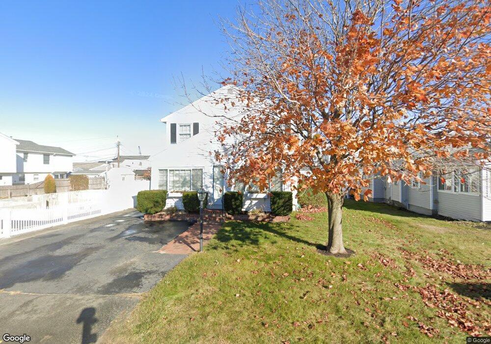
237 Bristol St Seabrook, NH 03874
Seabrook Beach NeighborhoodEstimated Value: $1,261,144 - $1,354,000
3
Beds
3
Baths
1,914
Sq Ft
$692/Sq Ft
Est. Value
About This Home
This home is located at 237 Bristol St, Seabrook, NH 03874 and is currently estimated at $1,325,036, approximately $692 per square foot. 237 Bristol St is a home located in Rockingham County with nearby schools including Seabrook Elementary School, Seabrook Middle School, and Winnacunnet High School.
Ownership History
Date
Name
Owned For
Owner Type
Purchase Details
Closed on
Jul 25, 2017
Sold by
Mccarthy Francis W and Mccarthy Marilyn J
Bought by
Barry Jonathan K and Barry Kimberly
Current Estimated Value
Home Financials for this Owner
Home Financials are based on the most recent Mortgage that was taken out on this home.
Original Mortgage
$480,000
Outstanding Balance
$389,146
Interest Rate
3.13%
Mortgage Type
New Conventional
Estimated Equity
$935,890
Purchase Details
Closed on
Jun 23, 2017
Sold by
Mccarthy Francis W and Mccarty Marilyn J
Bought by
Barry Jonathan K and Barry Kimberly
Home Financials for this Owner
Home Financials are based on the most recent Mortgage that was taken out on this home.
Original Mortgage
$480,000
Outstanding Balance
$389,146
Interest Rate
3.13%
Mortgage Type
New Conventional
Estimated Equity
$935,890
Purchase Details
Closed on
Feb 4, 2016
Sold by
Mccarthy 3Rd Francis W
Bought by
Mccarthy Francis W and Mccarthy Marilyn J
Purchase Details
Closed on
Apr 27, 1999
Sold by
Longo Anthony J and Longo Patricia A
Bought by
Mccarthy Francis W and Mccarthy Marilyn J
Home Financials for this Owner
Home Financials are based on the most recent Mortgage that was taken out on this home.
Original Mortgage
$100,000
Interest Rate
7.02%
Mortgage Type
Purchase Money Mortgage
Purchase Details
Closed on
May 19, 1998
Sold by
Lafontaine Elizabeth J and Lafontaine Raymond R
Bought by
Longo Anthony J and Longo Patricia A
Home Financials for this Owner
Home Financials are based on the most recent Mortgage that was taken out on this home.
Original Mortgage
$70,000
Interest Rate
7.08%
Mortgage Type
Purchase Money Mortgage
Create a Home Valuation Report for This Property
The Home Valuation Report is an in-depth analysis detailing your home's value as well as a comparison with similar homes in the area
Home Values in the Area
Average Home Value in this Area
Purchase History
| Date | Buyer | Sale Price | Title Company |
|---|---|---|---|
| Barry Jonathan K | $679,000 | -- | |
| Barry Jonathan K | $679,000 | -- | |
| Mccarthy Francis W | -- | -- | |
| Mccarthy 3Rd Francis W | -- | -- | |
| Mccarthy Francis W | $245,000 | -- | |
| Longo Anthony J | $235,000 | -- |
Source: Public Records
Mortgage History
| Date | Status | Borrower | Loan Amount |
|---|---|---|---|
| Open | Barry Jonathan K | $480,000 | |
| Previous Owner | Longo Anthony J | $100,000 | |
| Previous Owner | Longo Anthony J | $70,000 |
Source: Public Records
Tax History Compared to Growth
Tax History
| Year | Tax Paid | Tax Assessment Tax Assessment Total Assessment is a certain percentage of the fair market value that is determined by local assessors to be the total taxable value of land and additions on the property. | Land | Improvement |
|---|---|---|---|---|
| 2024 | $12,082 | $1,030,900 | $721,900 | $309,000 |
| 2023 | $12,061 | $799,300 | $549,100 | $250,200 |
| 2022 | $10,591 | $799,300 | $549,100 | $250,200 |
| 2021 | $10,974 | $799,300 | $549,100 | $250,200 |
| 2020 | $9,772 | $611,900 | $426,200 | $185,700 |
| 2019 | $9,637 | $611,900 | $426,200 | $185,700 |
| 2018 | $9,943 | $611,900 | $426,200 | $185,700 |
| 2017 | $8,941 | $550,200 | $364,500 | $185,700 |
| 2016 | $7,515 | $508,100 | $330,900 | $177,200 |
| 2015 | $6,620 | $447,600 | $314,300 | $133,300 |
| 2014 | $6,520 | $427,000 | $293,700 | $133,300 |
| 2013 | $6,520 | $427,000 | $293,700 | $133,300 |
Source: Public Records
Map
Nearby Homes
- 376 Ocean Blvd
- 18 River St
- 9 Tyngsboro St
- 13-15 Ocean Blvd
- 13 Ocean Blvd
- 15 Ocean Blvd
- 27 Cross Beach Rd
- 3 Harris Ave
- 5 Fellows Ave
- 10 Haverhill Ave Unit 1
- 10 Haverhill Ave Unit 2
- 19 Riverview Terrace
- 17 Johnson Ave
- 7 Perkins Ave
- 3 Perkins Ave Unit 2
- 3 Perkins Ave Unit 1
- 27 Perkins Ave
- 22 Perkins Ave
- 128 Ashworth Ave Unit 303
- 27 Hobson Ave
- 236 Bristol St
- 238 Bristol St
- 235 Bristol St
- 239 Bristol St
- 246 Ashland St
- 247 Ashland St
- 245 Ashland St
- 2 2 4 Bristol St
- 204 Bristol St
- 244 Ashland St
- 248 Ashland St
- 203 Bristol St
- 234 Bristol St
- 205 Bristol St
- 205 Bristol St Unit 205-206
- 205 Bristol St Unit 206-206
- 206 Bristol St
- 240 Bristol St
- 241 Portsmouth Ave
- 202 Bristol St