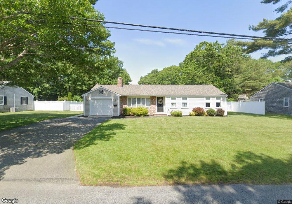
237 Buckskin Path Centerville, MA 02632
Centerville NeighborhoodEstimated Value: $552,000 - $717,000
3
Beds
2
Baths
1,501
Sq Ft
$429/Sq Ft
Est. Value
About This Home
This home is located at 237 Buckskin Path, Centerville, MA 02632 and is currently estimated at $644,163, approximately $429 per square foot. 237 Buckskin Path is a home located in Barnstable County with nearby schools including Centerville Elementary School, Barnstable United Elementary School, and Barnstable Intermediate School.
Ownership History
Date
Name
Owned For
Owner Type
Purchase Details
Closed on
May 13, 2019
Sold by
Harron Lawrence and Harron Mary S
Bought by
Harron Mary S and Harron Lawrence
Current Estimated Value
Home Financials for this Owner
Home Financials are based on the most recent Mortgage that was taken out on this home.
Original Mortgage
$235,000
Outstanding Balance
$178,482
Interest Rate
4.1%
Mortgage Type
New Conventional
Estimated Equity
$465,681
Purchase Details
Closed on
Mar 30, 1995
Sold by
Boland Robert F and Boland Kathleen M
Bought by
Harron Thomas J
Home Financials for this Owner
Home Financials are based on the most recent Mortgage that was taken out on this home.
Original Mortgage
$109,800
Interest Rate
8.8%
Mortgage Type
Purchase Money Mortgage
Create a Home Valuation Report for This Property
The Home Valuation Report is an in-depth analysis detailing your home's value as well as a comparison with similar homes in the area
Home Values in the Area
Average Home Value in this Area
Purchase History
| Date | Buyer | Sale Price | Title Company |
|---|---|---|---|
| Harron Mary S | -- | -- | |
| Harron Thomas J | $122,500 | -- |
Source: Public Records
Mortgage History
| Date | Status | Borrower | Loan Amount |
|---|---|---|---|
| Open | Harron Mary S | $235,000 | |
| Previous Owner | Harron Thomas J | $292,500 | |
| Previous Owner | Harron Thomas J | $190,000 | |
| Previous Owner | Harron Thomas J | $109,800 | |
| Previous Owner | Harron Thomas J | $103,000 |
Source: Public Records
Tax History
| Year | Tax Paid | Tax Assessment Tax Assessment Total Assessment is a certain percentage of the fair market value that is determined by local assessors to be the total taxable value of land and additions on the property. | Land | Improvement |
|---|---|---|---|---|
| 2025 | $4,761 | $588,500 | $152,900 | $435,600 |
| 2024 | $4,588 | $587,400 | $152,900 | $434,500 |
| 2023 | $4,335 | $519,800 | $139,000 | $380,800 |
| 2022 | $4,187 | $434,300 | $103,000 | $331,300 |
| 2021 | $3,942 | $375,800 | $103,000 | $272,800 |
| 2020 | $4,089 | $373,100 | $103,000 | $270,100 |
| 2019 | $3,905 | $346,200 | $103,000 | $243,200 |
| 2018 | $3,529 | $314,500 | $108,400 | $206,100 |
| 2017 | $3,294 | $306,100 | $108,400 | $197,700 |
| 2016 | $3,158 | $289,700 | $109,300 | $180,400 |
| 2015 | $3,059 | $281,900 | $106,000 | $175,900 |
Source: Public Records
Map
Nearby Homes
- 315 Prince Hinckley Rd
- 900 Old Stage Rd
- 52 Windlass Ln
- 1115 Shootflying Hill Rd
- 97 Yacht Club Rd
- 1309 Shootflying Hill Rd
- 1309 Shootflying Hill Rd
- 169 Cedric Rd
- 82 Yacht Club Rd
- 51 Larch Ln
- 352 Nye Rd
- 436 Nye Rd
- 73 Tern Ln
- 87 Foxglove Rd
- 66 Tern Ln
- 19 Marrick Ct
- 159 Willow Run Dr
- 53 Meadow Farm Rd
- 324 Patriot Way
- 52 Meadow Farm Rd
- 227 Buckskin Path
- 247 Buckskin Path
- 222 Skunknet Rd
- 212 Skunknet Rd
- 217 Buckskin Path
- 234 Buckskin Path
- 257 Buckskin Path
- 244 Buckskin Path
- 232 Skunknet Rd
- 202 Skunknet Rd
- 224 Buckskin Path
- 26 Skunknet Rd
- 256 Buckskin Path
- 205 Buckskin Path
- 192 Skunknet Rd
- 267 Buckskin Path
- 212 Buckskin Path
- 231 Monomoy Cir
- 221 Monomoy Cir
- 266 Buckskin Path
Your Personal Tour Guide
Ask me questions while you tour the home.