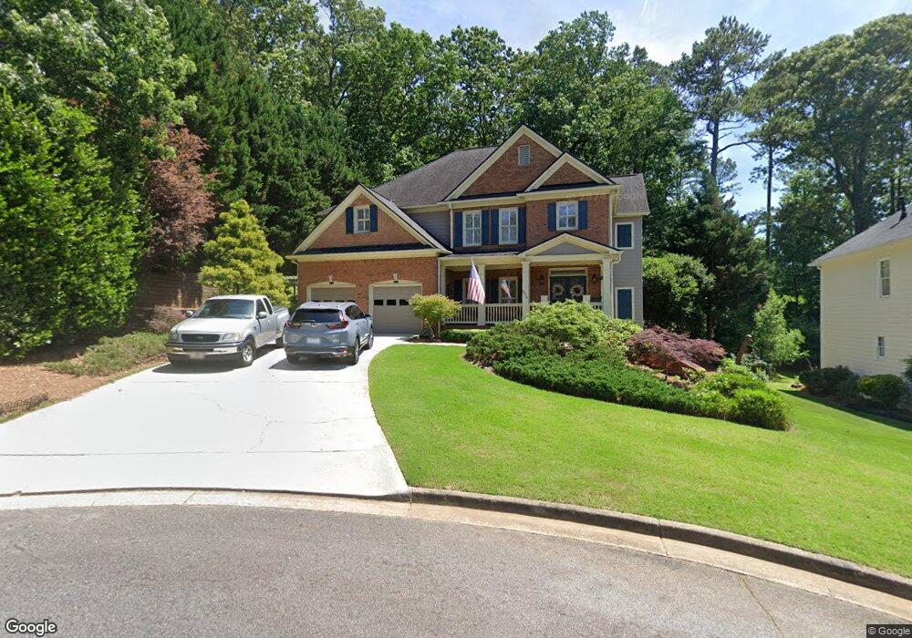
2370 Timberbrook Trace Unit 1 Marietta, GA 30066
Sandy Plains NeighborhoodEstimated Value: $725,000 - $899,000
6
Beds
5
Baths
3,650
Sq Ft
$221/Sq Ft
Est. Value
About This Home
This home is located at 2370 Timberbrook Trace Unit 1, Marietta, GA 30066 and is currently estimated at $808,307, approximately $221 per square foot. 2370 Timberbrook Trace Unit 1 is a home located in Cobb County with nearby schools including Rocky Mount Elementary School, Mabry Middle School, and Lassiter High School.
Ownership History
Date
Name
Owned For
Owner Type
Purchase Details
Closed on
Aug 11, 2021
Sold by
Mccosh Burl E
Bought by
Burl E Mccosh And Shelly A Mccosh Living Trus and Mcc Shelly
Current Estimated Value
Purchase Details
Closed on
Aug 12, 2005
Sold by
Sirva Relocation Llc
Bought by
Mccosh Burl E and Mccosh Shelly
Home Financials for this Owner
Home Financials are based on the most recent Mortgage that was taken out on this home.
Original Mortgage
$140,000
Interest Rate
5.57%
Mortgage Type
New Conventional
Purchase Details
Closed on
Oct 14, 1999
Sold by
Peachtree Residential Properties
Bought by
Oriley Robert D and Oriley Mary K
Home Financials for this Owner
Home Financials are based on the most recent Mortgage that was taken out on this home.
Original Mortgage
$236,087
Interest Rate
7.81%
Mortgage Type
New Conventional
Create a Home Valuation Report for This Property
The Home Valuation Report is an in-depth analysis detailing your home's value as well as a comparison with similar homes in the area
Home Values in the Area
Average Home Value in this Area
Purchase History
| Date | Buyer | Sale Price | Title Company |
|---|---|---|---|
| Burl E Mccosh And Shelly A Mccosh Living Trus | -- | None Listed On Document | |
| Mccosh Burl E | -- | None Available | |
| Mccosh Burl E | $387,500 | -- | |
| Sirva Relocation Llc | $387,500 | -- | |
| Oriley Robert D | $291,200 | -- |
Source: Public Records
Mortgage History
| Date | Status | Borrower | Loan Amount |
|---|---|---|---|
| Previous Owner | Sirva Relocation Llc | $140,000 | |
| Previous Owner | Oriley Robert D | $236,087 |
Source: Public Records
Tax History Compared to Growth
Tax History
| Year | Tax Paid | Tax Assessment Tax Assessment Total Assessment is a certain percentage of the fair market value that is determined by local assessors to be the total taxable value of land and additions on the property. | Land | Improvement |
|---|---|---|---|---|
| 2025 | $1,895 | $293,808 | $60,000 | $233,808 |
| 2024 | $1,901 | $293,808 | $60,000 | $233,808 |
| 2023 | $1,519 | $234,844 | $30,000 | $204,844 |
| 2022 | $1,725 | $234,844 | $30,000 | $204,844 |
| 2021 | $1,604 | $194,384 | $30,000 | $164,384 |
| 2020 | $1,566 | $181,928 | $30,000 | $151,928 |
| 2019 | $1,566 | $181,928 | $30,000 | $151,928 |
| 2018 | $1,570 | $183,056 | $30,000 | $153,056 |
| 2017 | $1,383 | $183,056 | $30,000 | $153,056 |
| 2016 | $1,310 | $158,200 | $30,000 | $128,200 |
| 2015 | $1,338 | $138,940 | $26,000 | $112,940 |
| 2014 | $1,369 | $138,940 | $0 | $0 |
Source: Public Records
Map
Nearby Homes
- 2402 Woodbridge Dr
- 2603 Chadwick Rd
- 2610 Chadwick Rd
- 4056 Longford Dr NE
- 4050 Idlewilde Meadows Dr NE
- 4499 Browning Ct NE
- 2124 Lassiter Field Dr NE
- 3844 Havenrock
- 3816 Havenrock Dr
- 2578 Middle Coray Cir
- 3812 Havenrock Dr
- 4509 N Landing Dr
- 3851 Trickum Rd NE
- 4509 N Bay Ct
- 4464 Windsor Oaks Dr
- 3835 Rockhaven Ct
- 4709 Trickum Rd NE
- 4281 Keheley Lake Dr NE
- 2366 Timberbrook Trace Unit 1
- 2362 Timberbrook Trace Unit 1
- 2259 Sparrow Ridge Dr NE
- 2374 Timberbrook Trace
- 2257 Sparrow Ridge Dr NE
- 2378 Timberbrook Trace
- 2261 Sparrow Ridge Dr NE
- 2371 Timberbrook Trace Unit 1
- 2367 Timberbrook Trace
- 2358 Timberbrook Trace Unit 1
- 2379 Timberbrook Trace Unit 1
- 2255 Sparrow Ridge Dr NE
- 2263 Sparrow Ridge Dr NE
- 2363 Timberbrook Trace
- 2375 Timberbrook Trace
- 2354 Timberbrook Trace Unit 1
- 2253 Sparrow Ridge Dr NE
- 2355 Timberbrook Trace Unit 1
- 0 Tutwren Ct Unit 7131061
- 0 Tutwren Ct