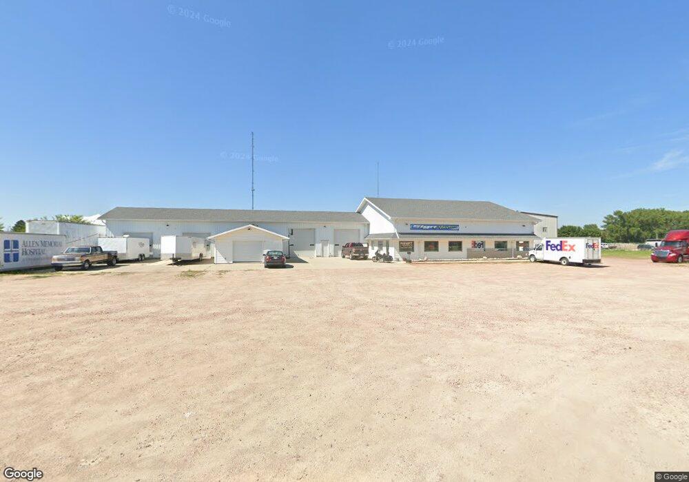
2371 9th Ave South Sioux City, NE 68776
Estimated Value: $615,224
--
Bed
--
Bath
8,400
Sq Ft
$73/Sq Ft
Est. Value
About This Home
This home is located at 2371 9th Ave, South Sioux City, NE 68776 and is currently estimated at $615,224, approximately $73 per square foot. 2371 9th Ave is a home located in Dakota County with nearby schools including Covington Elementary School, South Sioux City Middle School, and South Sioux Senior High School.
Ownership History
Date
Name
Owned For
Owner Type
Purchase Details
Closed on
Dec 31, 2024
Sold by
Merchant Randy R and Merchant Patricia
Bought by
Dc Realty Llc
Current Estimated Value
Purchase Details
Closed on
Apr 29, 2016
Sold by
Carlson Enterprises Inc
Bought by
Merchant Randy R
Home Financials for this Owner
Home Financials are based on the most recent Mortgage that was taken out on this home.
Original Mortgage
$300,000
Interest Rate
3.73%
Mortgage Type
Future Advance Clause Open End Mortgage
Create a Home Valuation Report for This Property
The Home Valuation Report is an in-depth analysis detailing your home's value as well as a comparison with similar homes in the area
Home Values in the Area
Average Home Value in this Area
Purchase History
| Date | Buyer | Sale Price | Title Company |
|---|---|---|---|
| Dc Realty Llc | $426,000 | Lewis & Clark Title | |
| Merchant Randy R | $340,000 | Lewis & Clark Title |
Source: Public Records
Mortgage History
| Date | Status | Borrower | Loan Amount |
|---|---|---|---|
| Previous Owner | Merchant Randy R | $300,000 |
Source: Public Records
Tax History Compared to Growth
Tax History
| Year | Tax Paid | Tax Assessment Tax Assessment Total Assessment is a certain percentage of the fair market value that is determined by local assessors to be the total taxable value of land and additions on the property. | Land | Improvement |
|---|---|---|---|---|
| 2024 | $4,823 | $365,335 | $102,095 | $263,240 |
| 2023 | $5,463 | $307,655 | $102,095 | $205,560 |
| 2022 | $5,884 | $307,655 | $102,095 | $205,560 |
| 2021 | $6,098 | $307,655 | $102,095 | $205,560 |
| 2020 | $6,344 | $317,310 | $102,095 | $215,215 |
| 2019 | $6,362 | $317,310 | $102,095 | $215,215 |
| 2018 | $6,415 | $317,310 | $102,095 | $215,215 |
| 2017 | $6,245 | $309,600 | $93,600 | $216,000 |
| 2016 | $6,139 | $309,600 | $93,600 | $216,000 |
| 2014 | $16,333 | $793,265 | $186,000 | $607,265 |
Source: Public Records
Map
Nearby Homes
- 2434 U S 77
- 3312 Cedar Mill Way
- 3200 Cider Mill Way
- 389 Willow Gardens
- 114 Oakmont Dr
- 405 W 17th St
- 202 E 23rd St
- 1401 & 1402 5th Ave
- 214 W 31st St
- 125 E 30th St
- 423 Golf Rd
- 424 S Ridge Dr
- 314 E 17th St
- 2101 F St
- 605 Stagecoach Rd
- 429 E 15th St
- 300 Kerri Ln
- 1018 & 1018 1/2 B St
- 324 Regency Ct
- 1840 Ogden Ct
- 929 W 25th St
- 930 W 25th St
- 2450 9th Ave
- 1030 W 25th St
- 800 W 25th St
- 900 W 21st St
- 920 W 21st St
- 915 W 27th St Unit 917
- 730 W 21st St Unit (Office/Retail)
- 2513 Willow St
- 1033 W 21st St
- 201 S Fork
- 901 W 21st St Unit 2
- 901 W 21st St Unit 1
- 901 W 21st St
- 725 W 25th St
- 121 Liberty Dr
- 1035 W 21st St
- 2600 Cornhusker Dr
- 1027 W 21st St