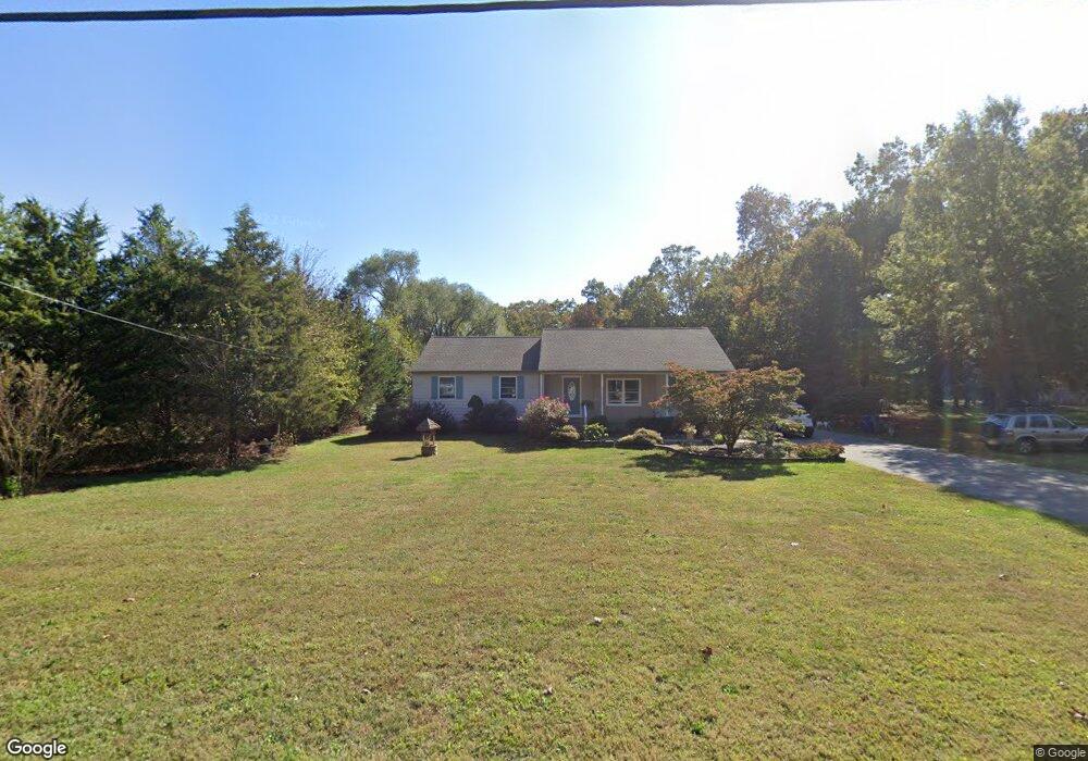
2372 Grant Ave Williamstown, NJ 08094
Franklin Township NeighborhoodEstimated Value: $439,142 - $457,000
--
Bed
--
Bath
2,288
Sq Ft
$196/Sq Ft
Est. Value
About This Home
This home is located at 2372 Grant Ave, Williamstown, NJ 08094 and is currently estimated at $449,036, approximately $196 per square foot. 2372 Grant Ave is a home located in Gloucester County with nearby schools including Delsea Regional Middle School and Delsea Regional High School.
Ownership History
Date
Name
Owned For
Owner Type
Purchase Details
Closed on
Aug 30, 2004
Sold by
Paul Kenneth A and Paul Anneliese D
Bought by
Brewin James N and Brewin Julie B
Current Estimated Value
Home Financials for this Owner
Home Financials are based on the most recent Mortgage that was taken out on this home.
Original Mortgage
$136,300
Outstanding Balance
$67,211
Interest Rate
5.81%
Mortgage Type
Purchase Money Mortgage
Estimated Equity
$381,825
Purchase Details
Closed on
Aug 31, 1995
Sold by
Benedetto Robert M and Benedetto Elizabeth A
Bought by
Paul Kenneth A and Paul Anneliese D
Create a Home Valuation Report for This Property
The Home Valuation Report is an in-depth analysis detailing your home's value as well as a comparison with similar homes in the area
Home Values in the Area
Average Home Value in this Area
Purchase History
| Date | Buyer | Sale Price | Title Company |
|---|---|---|---|
| Brewin James N | $170,400 | Precision Title Agency | |
| Paul Kenneth A | $112,900 | Surety Title Corporation |
Source: Public Records
Mortgage History
| Date | Status | Borrower | Loan Amount |
|---|---|---|---|
| Open | Brewin James N | $136,300 |
Source: Public Records
Tax History Compared to Growth
Tax History
| Year | Tax Paid | Tax Assessment Tax Assessment Total Assessment is a certain percentage of the fair market value that is determined by local assessors to be the total taxable value of land and additions on the property. | Land | Improvement |
|---|---|---|---|---|
| 2025 | $8,743 | $231,000 | $33,400 | $197,600 |
| 2024 | $8,515 | $231,000 | $33,400 | $197,600 |
| 2023 | $8,515 | $231,000 | $33,400 | $197,600 |
| 2022 | $8,293 | $231,000 | $33,400 | $197,600 |
| 2021 | $8,177 | $231,000 | $33,400 | $197,600 |
| 2020 | $8,090 | $231,000 | $33,400 | $197,600 |
| 2019 | $7,983 | $231,000 | $33,400 | $197,600 |
| 2018 | $7,877 | $231,000 | $33,400 | $197,600 |
| 2017 | $7,729 | $231,000 | $33,400 | $197,600 |
| 2016 | $7,695 | $231,000 | $33,400 | $197,600 |
| 2015 | $7,366 | $230,400 | $32,800 | $197,600 |
| 2014 | $7,092 | $192,000 | $32,800 | $159,200 |
Source: Public Records
Map
Nearby Homes
- 2323 Sheridan Ave
- 2243 Stanton Ave
- 3653 Tuckahoe Rd
- 0 E Grant Ave
- 4516 Tuckahoe Rd
- 0 Tuckahoe & Coles Mill Rd
- 3060 Williamstown Rd
- 3292 Tuckahoe Rd
- 236 S Tuckahoe Rd
- 18 Crysta Ct
- 43 Queensferry Dr
- 3050 Tuckahoe Rd
- 613 Cedar Ave
- 664 Scotland Run Ave
- 61 Howard Ave
- 2803 Tuckahoe Rd
- 1121 Lafayette St
- xxx Berlin Rd
- 148 Trimmel Ave
- 2406 Exposition Dr Unit 2406
- 2356 Grant Ave
- 2005 Stanton Ave
- 2377 Grant Ave
- 2365 Grant Ave
- 2344 Grant Ave
- 2043 Stanton Ave
- 1981 Stanton Ave
- 2345 Grant Ave
- 2016 Stanton Ave
- 2004 Stanton Ave
- 2332 Grant Ave
- 1992 Stanton Ave
- 1992 Stanton Ave Unit B
- 2044 Stanton Ave
- 1980 Stanton Ave
- 1968 Stanton Ave
- 2435 Grant Ave
- 2319 Grant Ave
- 2442 Grant Ave
- 2305 Grant Ave