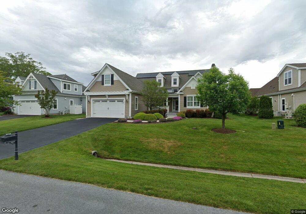
23729 Samuel Adams Cir Millsboro, DE 19966
Harbeson NeighborhoodEstimated Value: $585,000 - $602,821
4
Beds
--
Bath
2,461
Sq Ft
$240/Sq Ft
Est. Value
About This Home
This home is located at 23729 Samuel Adams Cir, Millsboro, DE 19966 and is currently estimated at $591,455, approximately $240 per square foot. 23729 Samuel Adams Cir is a home located in Sussex County with nearby schools including Love Creek Elementary School, Mariner Middle School, and Cape Henlopen High School.
Ownership History
Date
Name
Owned For
Owner Type
Purchase Details
Closed on
Nov 17, 2020
Sold by
Hardy Terry L and Hardy Rosemary
Bought by
Terry L & R Hardy Ret
Current Estimated Value
Purchase Details
Closed on
Jul 7, 2011
Bought by
Hardy Terry L and Hardy Rosemary Hardy
Purchase Details
Closed on
Jul 6, 2011
Bought by
Hardy Terry L and Hardy Rosemary Hardy
Create a Home Valuation Report for This Property
The Home Valuation Report is an in-depth analysis detailing your home's value as well as a comparison with similar homes in the area
Home Values in the Area
Average Home Value in this Area
Purchase History
| Date | Buyer | Sale Price | Title Company |
|---|---|---|---|
| Terry L & R Hardy Ret | -- | None Available | |
| Hardy Terry L | $419,500 | -- | |
| Hardy Terry L | $419,500 | -- |
Source: Public Records
Tax History Compared to Growth
Tax History
| Year | Tax Paid | Tax Assessment Tax Assessment Total Assessment is a certain percentage of the fair market value that is determined by local assessors to be the total taxable value of land and additions on the property. | Land | Improvement |
|---|---|---|---|---|
| 2025 | $137 | $38,450 | $5,000 | $33,450 |
| 2024 | $175 | $38,450 | $5,000 | $33,450 |
| 2023 | $174 | $38,450 | $5,000 | $33,450 |
| 2022 | $129 | $38,450 | $5,000 | $33,450 |
| 2021 | $1,411 | $38,450 | $5,000 | $33,450 |
| 2020 | $1,405 | $38,450 | $5,000 | $33,450 |
| 2019 | $1,808 | $38,450 | $5,000 | $33,450 |
| 2018 | $1,289 | $38,450 | $0 | $0 |
| 2017 | $1,217 | $38,450 | $0 | $0 |
| 2016 | $1,036 | $38,450 | $0 | $0 |
| 2015 | $968 | $38,450 | $0 | $0 |
| 2014 | $947 | $38,200 | $0 | $0 |
Source: Public Records
Map
Nearby Homes
- 29738 Oliver Wolcott Dr
- 23862 Samuel Adams Cir
- 23792 Samuel Adams Cir
- 29432 Andrew Jackson Dr
- 24006 Benjamin Harrison Cir
- 24877 Stevenson Rd
- 29688 Patrick Henry Cir
- 2 Falcon Crest Dr
- TBB Scarough Ln Unit ANTIGUA
- Iris Plan at Autumndale
- Saybrook Plan at Autumndale
- Stonefield Plan at Autumndale
- Montauk Plan at Autumndale
- Monterey Plan at Autumndale
- Camden Plan at Autumndale
- Chatham Plan at Autumndale
- Coronado Plan at Autumndale
- Astoria Plan at Autumndale
- 24330 Inkberry Dr
- Southport Plan at Autumndale
- 23727 Samuel Adams Cir
- 23733 Samuel Adams Cir
- 29688 Franklin Roosevelt Ln
- 29690 Franklin Roosevelt Ln
- 23723 Samuel Adams Cir
- 29684 Franklin Roosevelt Ln
- 23737 Samuel Adams Cir
- 23730 Samuel Adams Cir
- 23728 Samuel Adams Cir
- 29694 Franklin Roosevelt Ln
- 23734 Samuel Adams Cir
- 29680 Franklin Roosevelt Ln
- 23724 Samuel Adams Cir
- 23719 Samuel Adams Cir
- 23738 Samuel Adams Cir
- 23741 Samuel Adams Cir
- 23720 Samuel Adams Cir
- 29676 Franklin Roosevelt Ln
- 29700 Franklin Roosevelt Ln
- 29687 Franklin Roosevelt Ln