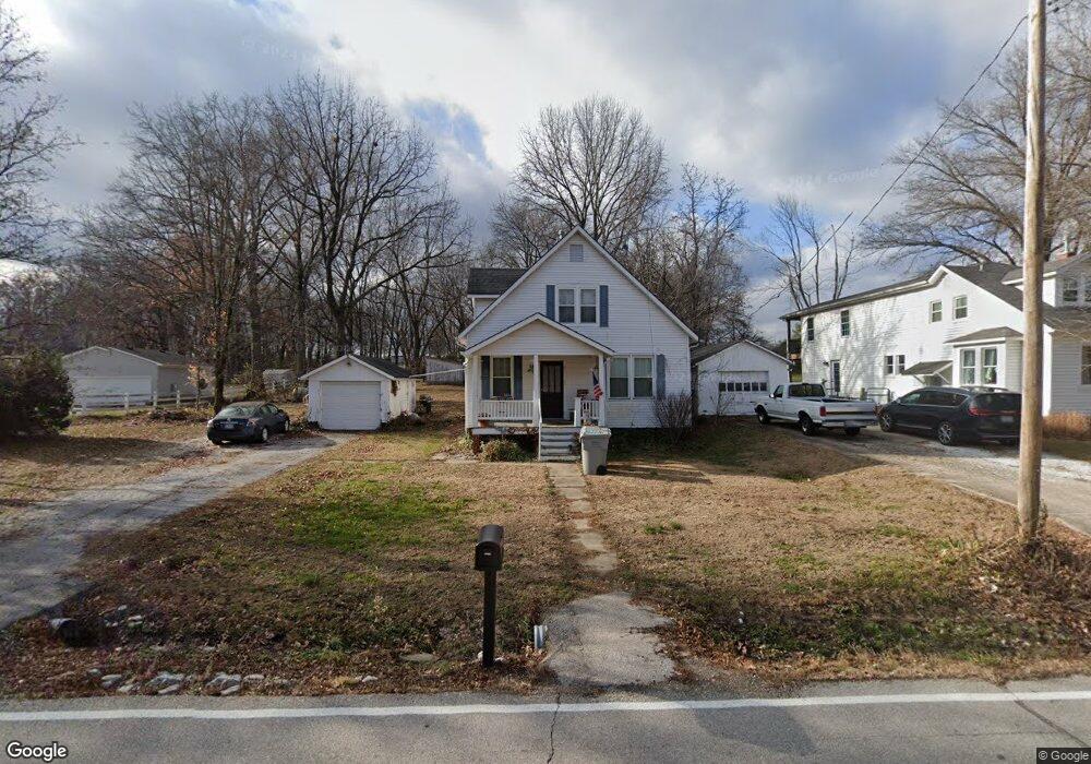
2373 Saint Paul Rd O Fallon, MO 63366
Estimated Value: $253,038 - $335,000
2
Beds
1
Bath
1,271
Sq Ft
$227/Sq Ft
Est. Value
About This Home
This home is located at 2373 Saint Paul Rd, O Fallon, MO 63366 and is currently estimated at $289,010, approximately $227 per square foot. 2373 Saint Paul Rd is a home located in St. Charles County with nearby schools including Mount Hope Elementary School, Fort Zumwalt North Middle School, and Fort Zumwalt North High School.
Ownership History
Date
Name
Owned For
Owner Type
Purchase Details
Closed on
Sep 29, 2004
Sold by
Dreckshage Leslie A and Dreckshage Gary G
Bought by
Dreckshage Leslie A
Current Estimated Value
Home Financials for this Owner
Home Financials are based on the most recent Mortgage that was taken out on this home.
Original Mortgage
$114,300
Interest Rate
6.99%
Mortgage Type
New Conventional
Purchase Details
Closed on
Dec 31, 1996
Sold by
Hembrock John R and Hembrock Helen
Bought by
Hembrock Helen and Hembrock John R
Create a Home Valuation Report for This Property
The Home Valuation Report is an in-depth analysis detailing your home's value as well as a comparison with similar homes in the area
Home Values in the Area
Average Home Value in this Area
Purchase History
| Date | Buyer | Sale Price | Title Company |
|---|---|---|---|
| Dreckshage Leslie A | -- | Northwest Title & Escrow | |
| Hembrock Helen | -- | -- |
Source: Public Records
Mortgage History
| Date | Status | Borrower | Loan Amount |
|---|---|---|---|
| Closed | Dreckshage Leslie A | $114,300 |
Source: Public Records
Tax History Compared to Growth
Tax History
| Year | Tax Paid | Tax Assessment Tax Assessment Total Assessment is a certain percentage of the fair market value that is determined by local assessors to be the total taxable value of land and additions on the property. | Land | Improvement |
|---|---|---|---|---|
| 2025 | $1,934 | $32,219 | -- | -- |
| 2023 | $1,933 | $30,843 | $0 | $0 |
| 2022 | $1,648 | $24,469 | $0 | $0 |
| 2021 | $1,647 | $24,469 | $0 | $0 |
| 2020 | $1,578 | $22,653 | $0 | $0 |
| 2019 | $1,573 | $22,653 | $0 | $0 |
| 2018 | $1,611 | $22,162 | $0 | $0 |
| 2017 | $1,603 | $22,162 | $0 | $0 |
| 2016 | $1,462 | $20,132 | $0 | $0 |
| 2015 | $1,359 | $20,132 | $0 | $0 |
| 2014 | $1,343 | $19,407 | $0 | $0 |
Source: Public Records
Map
Nearby Homes
- 267 Clodagh Ln
- 272 Clodagh Ln
- 266 Clodagh Ln
- 422 Ena Ln
- 244 Clodagh Ln
- 0 McMorland Dr
- 232 Clodagh Ln
- 400 Ena Ln
- 401 Ena Ln
- 355 Shamrock St
- 160 McMorland Dr
- 166 McMorland Dr
- 152 McMorland Dr
- 349 Shamrock St
- 135 McMorland Dr
- 171 McMorland Dr
- 340 Shamrock St
- 330 Shamrock St
- 142 McMorland Dr
- 127 McMorland Dr
- 2369 Saint Paul Rd
- 2379 Saint Paul Rd
- 2365 Saint Paul Rd
- 2370 Saint Paul Rd
- 2380 Saint Paul Rd
- 2368 Saint Paul Rd
- 2362 Saint Paul Rd
- 2347 Saint Paul Rd
- 2364 Saint Paul Rd
- 2358 Saint Paul Rd
- 2351 Saint Paul Rd
- 2352 Saint Paul Rd Unit A
- 2345 Saint Paul Rd
- 2339 Saint Paul Rd
- 2425 Saint Paul Rd
- 2400 Saint Paul Rd
- 2335 Saint Paul Rd
- 2333 Saint Paul Rd
- 2330 Saint Paul Rd
- 2321 Saint Paul Rd