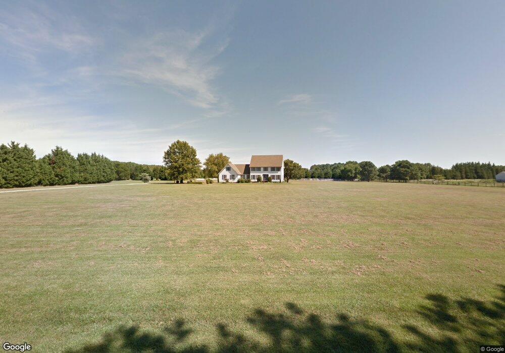
23769 Mount Pleasant Landing Cir Saint Michaels, MD 21663
Estimated Value: $778,022 - $2,110,000
--
Bed
3
Baths
2,394
Sq Ft
$581/Sq Ft
Est. Value
About This Home
This home is located at 23769 Mount Pleasant Landing Cir, Saint Michaels, MD 21663 and is currently estimated at $1,391,006, approximately $581 per square foot. 23769 Mount Pleasant Landing Cir is a home located in Talbot County with nearby schools including St. Michaels Elementary School, St. Michaels Middle/High School, and Easton High School.
Ownership History
Date
Name
Owned For
Owner Type
Purchase Details
Closed on
Apr 14, 2010
Sold by
Fischgrund Gene
Bought by
Fischgrund Gene
Current Estimated Value
Purchase Details
Closed on
Sep 24, 1993
Sold by
Mcdade Bernard Raymond
Bought by
Fischgrund Gene
Purchase Details
Closed on
Aug 11, 1986
Sold by
Evans Gary E and Evans Rosalie E
Bought by
Mcdade Bernard Raymond
Create a Home Valuation Report for This Property
The Home Valuation Report is an in-depth analysis detailing your home's value as well as a comparison with similar homes in the area
Home Values in the Area
Average Home Value in this Area
Purchase History
| Date | Buyer | Sale Price | Title Company |
|---|---|---|---|
| Fischgrund Gene | $120,000 | -- | |
| Fischgrund Gene | $265,000 | -- | |
| Mcdade Bernard Raymond | $27,000 | -- |
Source: Public Records
Tax History Compared to Growth
Tax History
| Year | Tax Paid | Tax Assessment Tax Assessment Total Assessment is a certain percentage of the fair market value that is determined by local assessors to be the total taxable value of land and additions on the property. | Land | Improvement |
|---|---|---|---|---|
| 2025 | $2,453 | $481,600 | $186,500 | $295,100 |
| 2024 | $2,453 | $461,900 | $0 | $0 |
| 2023 | $2,318 | $442,200 | $0 | $0 |
| 2022 | $2,150 | $422,500 | $186,500 | $236,000 |
| 2021 | $2,039 | $420,333 | $0 | $0 |
| 2020 | $2,039 | $418,167 | $0 | $0 |
| 2019 | $2,037 | $416,000 | $184,500 | $231,500 |
| 2018 | $1,978 | $416,000 | $184,500 | $231,500 |
| 2017 | $1,893 | $416,000 | $0 | $0 |
| 2016 | $1,836 | $450,600 | $0 | $0 |
| 2015 | $1,654 | $450,600 | $0 | $0 |
| 2014 | $1,654 | $450,600 | $0 | $0 |
Source: Public Records
Map
Nearby Homes
- 23869 Mount Misery Rd
- 0 Bozman Neavitt Rd Unit MDTA2011976
- 8620 Bozman Neavitt Rd
- 216 Brooks Ln
- 23961 Lynnewood Dr
- 300 Perry St
- 102 Gloria Ave
- 209 Webb Ln
- 207 Dodson Ave
- 0 Grace St Unit MDTA2012346
- 408 Spinnaker Ln
- 8034 Bozman Neavitt Rd
- 24318 Oakwood Park Rd
- 100 Grace St
- 7983 Bozman Neavitt Rd
- 107 E Chestnut St
- 24362 Widgeon Place Unit 4
- 24390 Oakwood Park Rd
- 9171 Deepwater Point Rd
- 24420 Mallard Place
- 23696 Mount Pleasant Rd
- 23795 Mount Pleasant Landing Cir
- 23651 Mount Pleasant Landing Cir
- 23651 Mount Pleasant Landing Cir
- 23751 Mount Pleasant Landing Cir
- 23751 Mount Pleasant Landing Cir
- 23641 Mnt Plsnt Lndng Cir
- 23758 Mount Pleasant Landing Cir
- 23758 Mount Pleasant Landing Cir
- 23776 Mount Pleasant Landing Cir
- 23657 Mount Pleasant Landing Cir
- 23746 Mount Pleasant Landing Cir
- 23776 Mount Pleasant Landing Cir
- 23746 Mount Pleasant Landing Cir
- 23754 Mount Pleasant Landing Cir
- 23754 Mnt Plsnt Lndng Cir
- 8721 Mount Pleasant Ct
- 23772 Mount Pleasant Landing Cir
- 23848 Mount Pleasant Landing Cir
- 23848 Mount Pleasant Landing Cir