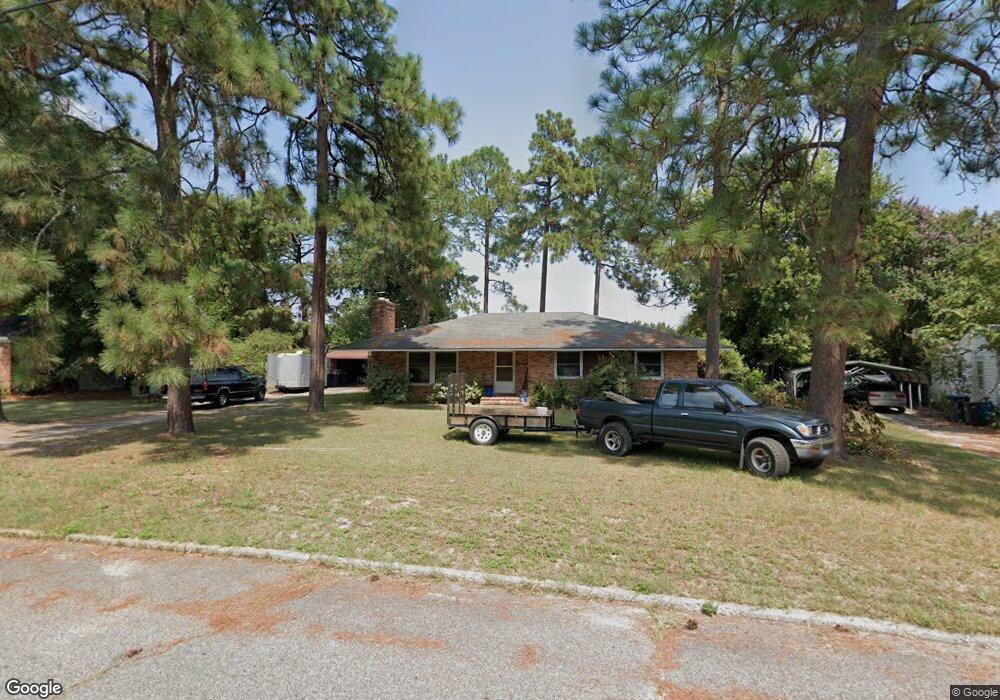
2379 Leslie Cir Augusta, GA 30906
Richmond Hill NeighborhoodEstimated Value: $134,000 - $168,000
3
Beds
2
Baths
1,419
Sq Ft
$110/Sq Ft
Est. Value
About This Home
This home is located at 2379 Leslie Cir, Augusta, GA 30906 and is currently estimated at $156,267, approximately $110 per square foot. 2379 Leslie Cir is a home located in Richmond County with nearby schools including Wheeless Road Elementary School, Murphey Middle School, and Johnson Magnet.
Ownership History
Date
Name
Owned For
Owner Type
Purchase Details
Closed on
Dec 28, 1999
Sold by
Carmack Ruth M
Bought by
Tucker John D
Current Estimated Value
Home Financials for this Owner
Home Financials are based on the most recent Mortgage that was taken out on this home.
Original Mortgage
$74,100
Outstanding Balance
$23,214
Interest Rate
7.87%
Estimated Equity
$133,053
Purchase Details
Closed on
Jan 2, 1992
Sold by
Carmack Clarence W
Bought by
Carmack Ruth M
Purchase Details
Closed on
Dec 23, 1991
Sold by
Carmack Clarence W
Bought by
Carmack Ruth M
Create a Home Valuation Report for This Property
The Home Valuation Report is an in-depth analysis detailing your home's value as well as a comparison with similar homes in the area
Home Values in the Area
Average Home Value in this Area
Purchase History
| Date | Buyer | Sale Price | Title Company |
|---|---|---|---|
| Tucker John D | $78,000 | -- | |
| Carmack Ruth M | -- | -- | |
| Carmack Ruth M | -- | -- |
Source: Public Records
Mortgage History
| Date | Status | Borrower | Loan Amount |
|---|---|---|---|
| Open | Tucker John D | $74,100 |
Source: Public Records
Tax History Compared to Growth
Tax History
| Year | Tax Paid | Tax Assessment Tax Assessment Total Assessment is a certain percentage of the fair market value that is determined by local assessors to be the total taxable value of land and additions on the property. | Land | Improvement |
|---|---|---|---|---|
| 2025 | $891 | $56,780 | $5,600 | $51,180 |
| 2024 | $891 | $63,344 | $5,600 | $57,744 |
| 2023 | $1,350 | $60,576 | $5,600 | $54,976 |
| 2022 | $1,648 | $49,733 | $5,600 | $44,133 |
| 2021 | $1,338 | $35,656 | $5,600 | $30,056 |
| 2020 | $1,320 | $35,656 | $5,600 | $30,056 |
| 2019 | $1,387 | $35,656 | $5,600 | $30,056 |
| 2018 | $1,396 | $35,656 | $5,600 | $30,056 |
| 2017 | $1,324 | $35,140 | $5,600 | $29,540 |
| 2016 | $1,325 | $35,140 | $5,600 | $29,540 |
| 2015 | $1,333 | $35,140 | $5,600 | $29,540 |
| 2014 | $1,378 | $36,466 | $5,600 | $30,866 |
Source: Public Records
Map
Nearby Homes
- 2349 Henry Cir
- 2318 Getzen St
- 2533 Lyman St
- 2537 Lyman St
- 2558 Lyman St
- 2916 Whistler Ln
- 2567 Lyman St
- 2803 King St
- 2550 Sheraton Dr
- 2813 King St
- 2816 King St
- 2958 Shelby Dr
- 3085 Lumpkin Park Dr
- 2820 Richmond Hill Rd
- 2810 Anne St
- 2208 Richards Rd
- 2903 Rocky Creek Rd
- 2447 Ridge Rd
- 3010 Acorn Rd
- 2433 Wheeless Rd
- 2377 Leslie Cir
- 2381 Leslie Cir
- 2378 Franklin St
- 2376 Franklin St
- 2376 Leslie Cir
- 2374 Franklin St
- 2375 Leslie Cir
- 2382 Franklin St
- 2383 Leslie Cir
- 2372 Franklin St
- 2378 Leslie Cir
- 2374 Leslie Cir
- 2370 Franklin St
- 2384 Franklin St
- 2380 Leslie Cir
- 2368 Franklin St
- 2432 Leslie Cir
- 2385 Leslie Cir
- 2439 Leslie Cir
- 2366 Franklin St