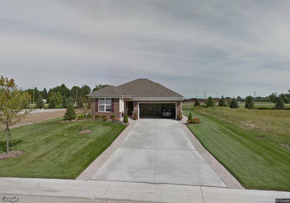
23841 Higgins Way Brownstown, MI 48134
Estimated Value: $399,000 - $422,395
2
Beds
2
Baths
1,697
Sq Ft
$241/Sq Ft
Est. Value
About This Home
This home is located at 23841 Higgins Way, Brownstown, MI 48134 and is currently estimated at $409,599, approximately $241 per square foot. 23841 Higgins Way is a home located in Wayne County with nearby schools including Ethel C. Bobcean Elementary School, John M. Barnes Elementary School, and Thomas Simpson Middle School.
Ownership History
Date
Name
Owned For
Owner Type
Purchase Details
Closed on
Aug 30, 2023
Sold by
Beckett Lynne G
Bought by
Beckett Lynne D and Demarti Daniel R
Current Estimated Value
Purchase Details
Closed on
Oct 14, 2021
Sold by
Council Claudia M and Robert T Council & Claudia M C
Bought by
Beckett Lynne G
Purchase Details
Closed on
Oct 4, 2010
Sold by
Pulte Land Company Llc
Bought by
Robert T & Claudia M Council Revocable T
Create a Home Valuation Report for This Property
The Home Valuation Report is an in-depth analysis detailing your home's value as well as a comparison with similar homes in the area
Home Values in the Area
Average Home Value in this Area
Purchase History
| Date | Buyer | Sale Price | Title Company |
|---|---|---|---|
| Beckett Lynne D | -- | None Listed On Document | |
| Beckett Lynne G | $340,100 | Lawyers Title Agcy Of Monroe | |
| Robert T & Claudia M Council Revocable T | $51,000 | None Available |
Source: Public Records
Tax History Compared to Growth
Tax History
| Year | Tax Paid | Tax Assessment Tax Assessment Total Assessment is a certain percentage of the fair market value that is determined by local assessors to be the total taxable value of land and additions on the property. | Land | Improvement |
|---|---|---|---|---|
| 2025 | $4,208 | $197,800 | $0 | $0 |
| 2024 | $4,208 | $193,400 | $0 | $0 |
| 2023 | $4,014 | $171,100 | $0 | $0 |
| 2022 | $7,103 | $151,300 | $0 | $0 |
| 2021 | $5,599 | $136,000 | $0 | $0 |
| 2020 | $5,513 | $124,300 | $0 | $0 |
| 2019 | $5,474 | $119,900 | $0 | $0 |
| 2018 | $2,963 | $115,000 | $0 | $0 |
| 2017 | $4,823 | $148,600 | $0 | $0 |
| 2016 | $5,268 | $110,800 | $0 | $0 |
| 2015 | $11,674 | $117,600 | $0 | $0 |
| 2013 | $11,490 | $119,900 | $0 | $0 |
| 2012 | -- | $113,600 | $39,700 | $73,900 |
Source: Public Records
Map
Nearby Homes
- 27200 Telegraph Rd
- 00000 Arsenal Rd
- 25182 Frontier Cir
- 26607 Teton Ln Unit 693
- 26718 Arcadia Dr
- 24946 Peters Rd
- 26721 W Huron River Dr
- 27003 Celtic Dr
- 27031 W Huron River Dr
- 26926 Celtic Dr
- 24161 Senate Dr
- 25712 Telegraph Rd
- 26878 Celtic Dr
- 26806 Celtic Dr
- 26980 James Ave
- 0 James Ave
- 26312 Ypsilanti St
- 27145 James Ave
- 26256 Ypsilanti St
- 28453 Church St
- 26988 Telegraph Rd
- 000 Brown St
- 0 Brown Unit 5445400
- 0 Brown Unit 216054028
- 27104 Wager St
- 27110 Wager St
- 27127 Brown St
- 27118 Wager St
- 27250 Telegraph Rd
- 27153 Brown St
- 26854 Telegraph Rd
- 27228 Wager St
- 27203 Brown St
- 27250 Wager St
- 24161 Thomas St
- 26801 Emma Ave
- 27227 Brown St
- 27243 Brown St
- 26767 Emma Ave
- 26029 Thomas St