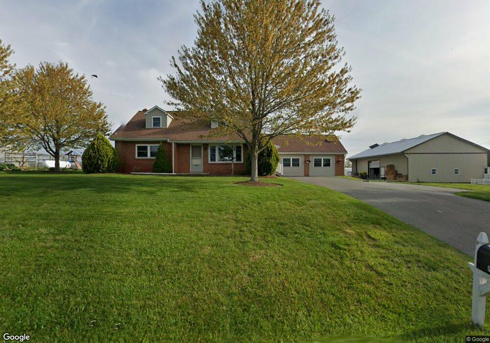
2385 Cambridge Rd Honey Brook, PA 19344
Estimated Value: $314,000 - $529,000
3
Beds
2
Baths
1,528
Sq Ft
$265/Sq Ft
Est. Value
About This Home
This home is located at 2385 Cambridge Rd, Honey Brook, PA 19344 and is currently estimated at $405,398, approximately $265 per square foot. 2385 Cambridge Rd is a home located in Chester County with nearby schools including Honey Brook Elementary Center, Twin Valley Middle School, and Twin Valley High School.
Ownership History
Date
Name
Owned For
Owner Type
Purchase Details
Closed on
Aug 8, 2003
Sold by
Honey Brook Community Church
Bought by
Stoltzfus Stephen R and Stoltzfus Lavina
Current Estimated Value
Home Financials for this Owner
Home Financials are based on the most recent Mortgage that was taken out on this home.
Original Mortgage
$896,344
Interest Rate
5.28%
Mortgage Type
Unknown
Purchase Details
Closed on
Mar 3, 2003
Sold by
Gabel John C
Bought by
Honey Brook Community Church
Create a Home Valuation Report for This Property
The Home Valuation Report is an in-depth analysis detailing your home's value as well as a comparison with similar homes in the area
Home Values in the Area
Average Home Value in this Area
Purchase History
| Date | Buyer | Sale Price | Title Company |
|---|---|---|---|
| Stoltzfus Stephen R | $256,000 | -- | |
| Honey Brook Community Church | $180,000 | First American Title Ins Co |
Source: Public Records
Mortgage History
| Date | Status | Borrower | Loan Amount |
|---|---|---|---|
| Closed | Stoltzfus Stephen R | $896,344 |
Source: Public Records
Tax History Compared to Growth
Tax History
| Year | Tax Paid | Tax Assessment Tax Assessment Total Assessment is a certain percentage of the fair market value that is determined by local assessors to be the total taxable value of land and additions on the property. | Land | Improvement |
|---|---|---|---|---|
| 2025 | $3,474 | $117,130 | $27,340 | $89,790 |
| 2024 | $3,474 | $117,130 | $27,340 | $89,790 |
| 2023 | $3,395 | $117,130 | $27,340 | $89,790 |
| 2022 | $3,357 | $117,130 | $27,340 | $89,790 |
| 2021 | $3,259 | $117,130 | $27,340 | $89,790 |
| 2020 | $3,243 | $117,130 | $27,340 | $89,790 |
| 2019 | $139 | $117,130 | $27,340 | $89,790 |
| 2018 | $4,073 | $117,130 | $27,340 | $89,790 |
| 2017 | $3,977 | $117,130 | $27,340 | $89,790 |
| 2016 | $3,297 | $117,130 | $27,340 | $89,790 |
| 2015 | $3,297 | $117,130 | $27,340 | $89,790 |
| 2014 | $3,297 | $117,130 | $27,340 | $89,790 |
Source: Public Records
Map
Nearby Homes
- 407 Cahill Cir Unit 4
- 110 Petrelia Dr
- 650 Broad St
- 0 Westbrook Dr
- 0 Westbrook Dr
- 0 Westbrook Dr
- 0 Westbrook Dr
- 14 Blue Spruce Dr
- 339 Churchtown Rd
- 607 Buchland Rd
- 241 Dove Dr
- 211 Michael Rd
- 1022 Elwood St
- 5892 Meadville Rd
- 490 Red Hill Rd
- 40 Cupola Rd
- 114 Jacobs Dr
- 116 Cornwall Place
- 158 Leary Rd
- 194 Joyce Ln
- 991 Compass Rd
- 991 Compass Rd
- 2325 Cambridge Rd
- 2455 Cambridge Rd
- 2475 Cambridge Rd
- 2495 Cambridge Rd
- 2485 Cambridge Rd
- 2505 Cambridge Rd
- 2464 Cambridge Rd
- 817 Compass Rd
- 1060 Compass Rd
- 1185 Compass Rd
- 824 Mill Rd
- 13 Mount Pleasant Rd
- 55 Mount Pleasant Rd
- 1184 Compass Rd
- 75 Mount Pleasant Rd
- 101 Mount Pleasant Rd
- 59 Diane Dr