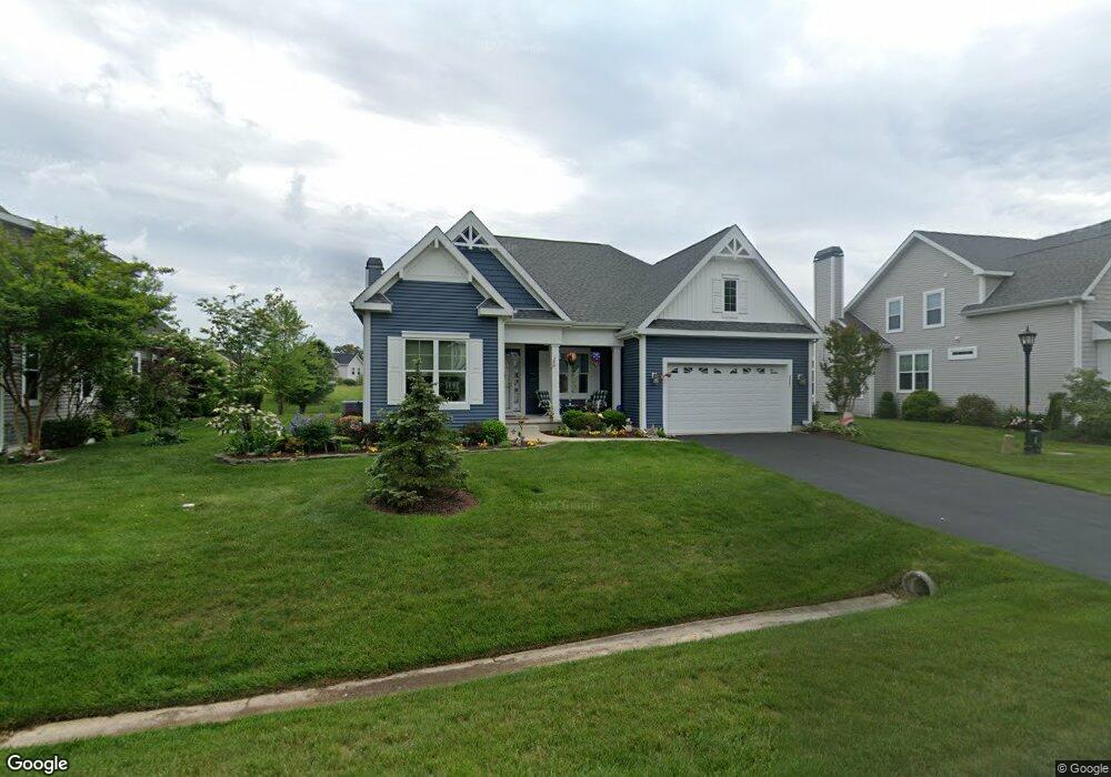
23851 Samuel Adams Cir Millsboro, DE 19966
Harbeson NeighborhoodEstimated Value: $540,451 - $687,000
3
Beds
2
Baths
2,427
Sq Ft
$243/Sq Ft
Est. Value
About This Home
This home is located at 23851 Samuel Adams Cir, Millsboro, DE 19966 and is currently estimated at $588,863, approximately $242 per square foot. 23851 Samuel Adams Cir is a home located in Sussex County with nearby schools including Love Creek Elementary School, Mariner Middle School, and Cape Henlopen High School.
Ownership History
Date
Name
Owned For
Owner Type
Purchase Details
Closed on
May 19, 2015
Sold by
The Lynn D Sorf Revocable Trust
Bought by
The Sorf Family Trust
Current Estimated Value
Purchase Details
Closed on
Nov 9, 2012
Sold by
Sussex Group Partners Llc
Bought by
Dolce Donna M
Home Financials for this Owner
Home Financials are based on the most recent Mortgage that was taken out on this home.
Original Mortgage
$100,000
Interest Rate
3.42%
Create a Home Valuation Report for This Property
The Home Valuation Report is an in-depth analysis detailing your home's value as well as a comparison with similar homes in the area
Home Values in the Area
Average Home Value in this Area
Purchase History
| Date | Buyer | Sale Price | Title Company |
|---|---|---|---|
| The Sorf Family Trust | -- | None Available | |
| Dolce Donna M | $369,505 | -- |
Source: Public Records
Mortgage History
| Date | Status | Borrower | Loan Amount |
|---|---|---|---|
| Previous Owner | Dolce Donna M | $100,000 |
Source: Public Records
Tax History Compared to Growth
Tax History
| Year | Tax Paid | Tax Assessment Tax Assessment Total Assessment is a certain percentage of the fair market value that is determined by local assessors to be the total taxable value of land and additions on the property. | Land | Improvement |
|---|---|---|---|---|
| 2025 | $668 | $32,400 | $5,000 | $27,400 |
| 2024 | $1,097 | $32,400 | $5,000 | $27,400 |
| 2023 | $1,096 | $32,400 | $5,000 | $27,400 |
| 2022 | $1,040 | $32,400 | $5,000 | $27,400 |
| 2021 | $1,126 | $32,400 | $5,000 | $27,400 |
| 2020 | $1,121 | $32,400 | $5,000 | $27,400 |
| 2019 | $1,123 | $32,400 | $5,000 | $27,400 |
| 2018 | $1,023 | $32,400 | $0 | $0 |
| 2017 | $1,363 | $32,400 | $0 | $0 |
| 2016 | $1,294 | $32,400 | $0 | $0 |
| 2015 | $744 | $32,400 | $0 | $0 |
| 2014 | $730 | $32,400 | $0 | $0 |
Source: Public Records
Map
Nearby Homes
- 23862 Samuel Adams Cir
- 29738 Oliver Wolcott Dr
- 23792 Samuel Adams Cir
- 29432 Andrew Jackson Dr
- 2 Falcon Crest Dr
- 24006 Benjamin Harrison Cir
- 24877 Stevenson Rd
- Iris Plan at Autumndale
- Saybrook Plan at Autumndale
- Stonefield Plan at Autumndale
- Montauk Plan at Autumndale
- Monterey Plan at Autumndale
- Camden Plan at Autumndale
- Chatham Plan at Autumndale
- Coronado Plan at Autumndale
- Astoria Plan at Autumndale
- 24330 Inkberry Dr
- Southport Plan at Autumndale
- 29688 Patrick Henry Cir
- 24553 Inkberry Dr
- 23853 Samuel Adams Cir
- 23847 Samuel Adams Cir
- 23855 Samuel Adams Cir
- 23845 Samuel Adams Cir
- 23852 Samuel Adams Cir
- 23848 Samuel Adams Cir
- 23854 Samuel Adams Cir
- 23844 Samuel Adams Cir
- 23841 Samuel Adams Cir
- 23859 Samuel Adams Cir
- 23858 Samuel Adams Cir
- 23839 Samuel Adams Cir
- 29759 Oliver Wolcott Dr
- 23838 Samuel Adams Cir
- 29757 Oliver Wolcott Dr
- 23589 Thomas Paine Dr
- 23593 Thomas Paine Dr
- 23597 Thomas Paine Dr
- 29761 Oliver Wolcott Dr
- 23579 Thomas Paine Dr