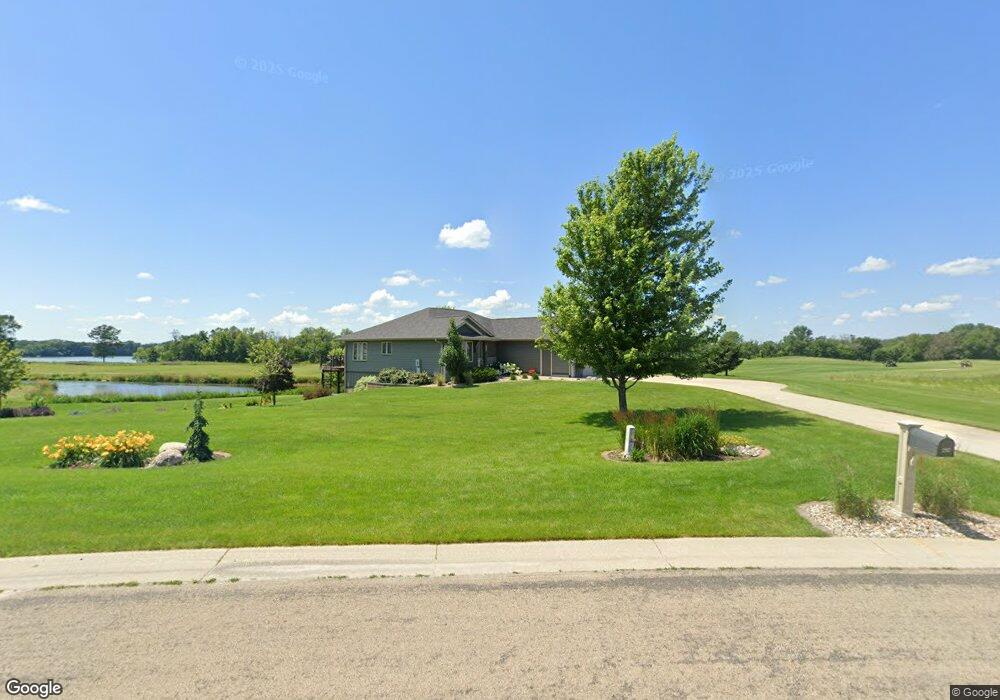
2387 W 9th St Albert Lea, MN 56007
Estimated Value: $470,052 - $566,000
3
Beds
3
Baths
2,330
Sq Ft
$228/Sq Ft
Est. Value
About This Home
This home is located at 2387 W 9th St, Albert Lea, MN 56007 and is currently estimated at $530,263, approximately $227 per square foot. 2387 W 9th St is a home located in Freeborn County with nearby schools including Sibley Elementary School, Southwest Middle School, and Albert Lea Senior High School.
Ownership History
Date
Name
Owned For
Owner Type
Purchase Details
Closed on
Oct 4, 2019
Sold by
Stansberry Jeffrey and Stansberry Margaret
Bought by
Mangskau David P and Mangskau Shelly K
Current Estimated Value
Purchase Details
Closed on
Mar 4, 2009
Sold by
Cove Holdings Llc
Bought by
Stansberry Jeffrey and Stansberry Margaret
Create a Home Valuation Report for This Property
The Home Valuation Report is an in-depth analysis detailing your home's value as well as a comparison with similar homes in the area
Home Values in the Area
Average Home Value in this Area
Purchase History
| Date | Buyer | Sale Price | Title Company |
|---|---|---|---|
| Mangskau David P | $362,000 | None Available | |
| Stansberry Jeffrey | -- | -- |
Source: Public Records
Tax History Compared to Growth
Tax History
| Year | Tax Paid | Tax Assessment Tax Assessment Total Assessment is a certain percentage of the fair market value that is determined by local assessors to be the total taxable value of land and additions on the property. | Land | Improvement |
|---|---|---|---|---|
| 2025 | $6,350 | $481,700 | $30,500 | $451,200 |
| 2024 | $6,268 | $416,600 | $30,500 | $386,100 |
| 2023 | $5,448 | $415,600 | $30,500 | $385,100 |
| 2022 | $5,674 | $364,400 | $30,500 | $333,900 |
| 2021 | $5,262 | $326,600 | $30,500 | $296,100 |
| 2020 | $4,930 | $285,700 | $30,500 | $255,200 |
| 2019 | $4,910 | $286,700 | $30,500 | $256,200 |
| 2018 | $5,030 | $0 | $0 | $0 |
| 2016 | $4,548 | $0 | $0 | $0 |
| 2015 | $4,440 | $0 | $0 | $0 |
| 2014 | $4,392 | $0 | $0 | $0 |
| 2012 | $4,464 | $0 | $0 | $0 |
Source: Public Records
Map
Nearby Homes
- 2334 W 9th St
- 2330 W 9th St
- 2313 W 9th St
- 2200 W 9th St
- 1810 Michaelle Ln
- 1722 Southview Ln
- 1432 Regency Ln
- 1429 Spartan Ave
- 1704 Plainview Ln
- 1614 Gateway Dr
- 2418 W Main St
- 1608 Plainview Ln
- 1115 Swanhill Dr
- 1507 Plainview Ln
- 1406 Southview Ln
- TBD Lake Chapeau Dr
- 1315 W Clark St
- 919 W Front St
- 114 N 6th Ave
- 1302 W Clark St
- TBD2 Nicklaus Dr
- TBD1 Nicklaus Dr
- 1416 Nicklaus Dr
- 2354 2354 9th-Street-w
- 2354 W 9th St
- 1440 Nicklaus Dr
- 2350 W 9th St
- 2350 2350 9th-Street-w
- 1452 Nicklaus Dr
- 1461 Nicklaus Dr
- 2346 W 9th St
- 2342 W 9th St
- 2487 W 9th St
- TBD Palmer Cir
- 2321 W 9th St
- 2316 W 9th St
- 2316 2316 W 9th St
- 2310 2310 9th St W
- 2310 W 9th St
- 2310 W 9th St Unit west