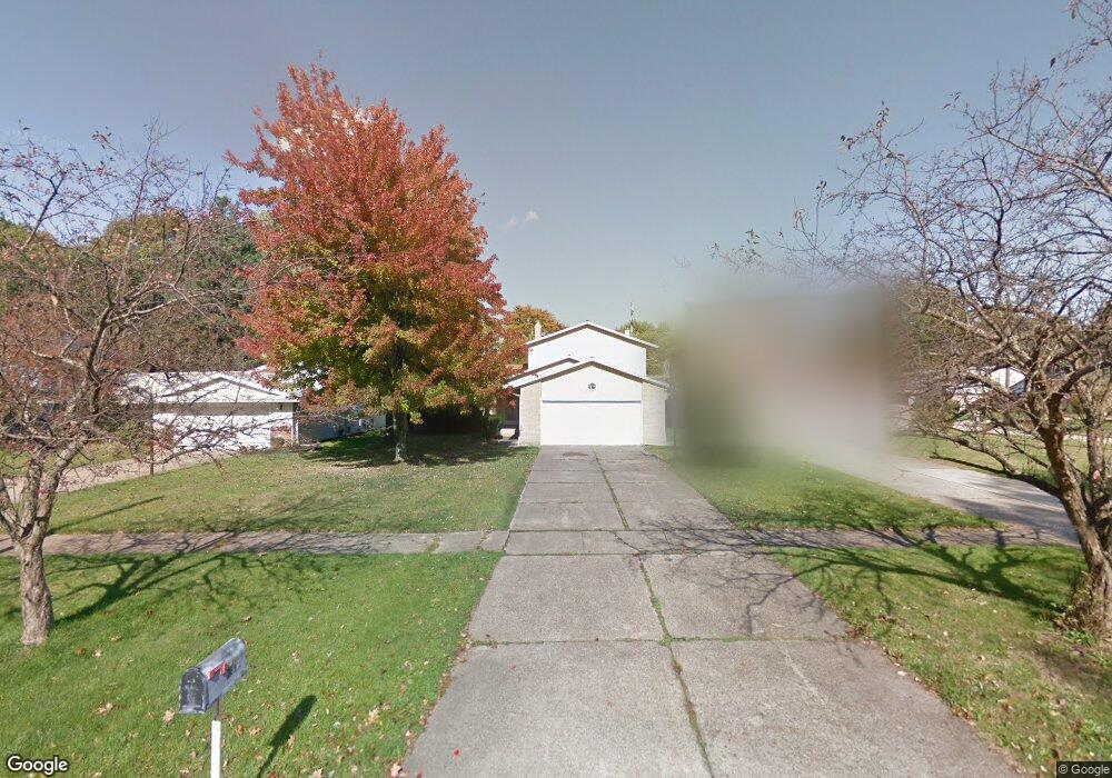
23891 Harms Rd Cleveland, OH 44143
Estimated Value: $181,000 - $270,000
4
Beds
2
Baths
2,293
Sq Ft
$103/Sq Ft
Est. Value
About This Home
This home is located at 23891 Harms Rd, Cleveland, OH 44143 and is currently estimated at $236,812, approximately $103 per square foot. 23891 Harms Rd is a home located in Cuyahoga County with nearby schools including Bluestone Elementary School, Euclid Middle School, and Euclid High School.
Ownership History
Date
Name
Owned For
Owner Type
Purchase Details
Closed on
Jul 16, 2010
Sold by
Bank Of America National Association
Bought by
Layton Leon
Current Estimated Value
Home Financials for this Owner
Home Financials are based on the most recent Mortgage that was taken out on this home.
Original Mortgage
$68,800
Outstanding Balance
$45,512
Interest Rate
4.63%
Mortgage Type
New Conventional
Estimated Equity
$191,300
Purchase Details
Closed on
Apr 19, 2010
Sold by
Maddox Renee
Bought by
Bank Of America National Association
Purchase Details
Closed on
Sep 27, 2006
Sold by
Wilson Chelsea T and Pernell Andrew
Bought by
Maddox Renee
Home Financials for this Owner
Home Financials are based on the most recent Mortgage that was taken out on this home.
Original Mortgage
$37,000
Interest Rate
6.18%
Mortgage Type
Stand Alone Second
Purchase Details
Closed on
Nov 19, 2002
Sold by
Payne Antoinette Mckenzie
Bought by
Pernell Andrew and Wilson Chelsea T
Home Financials for this Owner
Home Financials are based on the most recent Mortgage that was taken out on this home.
Original Mortgage
$178,200
Interest Rate
10.99%
Purchase Details
Closed on
Jun 12, 2000
Sold by
Cermak Melissa and Payne Antoinette Mckenzie
Bought by
Payne Antoinette Mckenzie
Home Financials for this Owner
Home Financials are based on the most recent Mortgage that was taken out on this home.
Original Mortgage
$168,000
Interest Rate
8.18%
Purchase Details
Closed on
Jun 5, 2000
Sold by
Dolgan Mary F
Bought by
Payne Antoinette Mckenzie and Cermak Melissa
Home Financials for this Owner
Home Financials are based on the most recent Mortgage that was taken out on this home.
Original Mortgage
$168,000
Interest Rate
8.18%
Purchase Details
Closed on
Feb 8, 1993
Sold by
Dolgan Mary F
Bought by
Dolgan Mary F
Purchase Details
Closed on
Sep 25, 1992
Sold by
Dolgan Albert A and Dolgan Mary F
Bought by
Dolgan Mary F
Purchase Details
Closed on
Jan 1, 1975
Bought by
Dolgan Albert A and Dolgan Mary F
Create a Home Valuation Report for This Property
The Home Valuation Report is an in-depth analysis detailing your home's value as well as a comparison with similar homes in the area
Home Values in the Area
Average Home Value in this Area
Purchase History
| Date | Buyer | Sale Price | Title Company |
|---|---|---|---|
| Layton Leon | $86,000 | Resource Title Agency | |
| Bank Of America National Association | $100,000 | None Available | |
| Maddox Renee | $185,000 | Southeast Equity | |
| Pernell Andrew | $44,000 | 21St Millennium Title & Escr | |
| Payne Antoinette Mckenzie | $81,000 | -- | |
| Payne Antoinette Mckenzie | $168,000 | Progressive Title Agency Inc | |
| Dolgan Mary F | -- | Progressive Title Agency Inc | |
| Dolgan Mary F | -- | -- | |
| Dolgan Mary F | -- | -- | |
| Dolgan Albert A | -- | -- |
Source: Public Records
Mortgage History
| Date | Status | Borrower | Loan Amount |
|---|---|---|---|
| Open | Layton Leon | $68,800 | |
| Previous Owner | Maddox Renee | $37,000 | |
| Previous Owner | Maddox Renee | $148,000 | |
| Previous Owner | Pernell Andrew | $178,200 | |
| Previous Owner | Payne Antoinette Mckenzie | $168,000 |
Source: Public Records
Tax History Compared to Growth
Tax History
| Year | Tax Paid | Tax Assessment Tax Assessment Total Assessment is a certain percentage of the fair market value that is determined by local assessors to be the total taxable value of land and additions on the property. | Land | Improvement |
|---|---|---|---|---|
| 2024 | $5,258 | $76,265 | $10,220 | $66,045 |
| 2023 | $4,743 | $54,820 | $8,300 | $46,520 |
| 2022 | $4,635 | $54,810 | $8,300 | $46,520 |
| 2021 | $5,191 | $54,810 | $8,300 | $46,520 |
| 2020 | $5,725 | $55,340 | $8,370 | $46,970 |
| 2019 | $5,169 | $158,100 | $23,900 | $134,200 |
| 2018 | $5,313 | $55,340 | $8,370 | $46,970 |
| 2017 | $5,855 | $51,840 | $8,160 | $43,680 |
| 2016 | $5,869 | $51,840 | $8,160 | $43,680 |
| 2015 | $5,341 | $51,840 | $8,160 | $43,680 |
| 2014 | $5,341 | $51,840 | $8,160 | $43,680 |
Source: Public Records
Map
Nearby Homes
- 24720 Dundee Dr
- 321 Royal Oak Blvd
- 22601 Harms Rd
- 2075 E 226th St
- 467 Harris Rd
- 1765 E 238th St
- 24801 Highland Rd
- 1997 E 226th St
- 341 Knollwood Trail
- 2093 Newcome St
- 2084 E 224th St
- 470 Celestia Dr
- 22151 Hadden Rd
- 2010 E 221st St
- 2545 Hilltop Rd
- 502 Jeannette Dr
- 237 Greenbriar Ct Unit F237
- 24 Washington Square
- 24120 Glenbrook Blvd
- 4473 Habersham Ln S Unit 187
- 23901 Harms Rd
- 23881 Harms Rd
- 2140 Brandywine Dr
- 23871 Harms Rd
- 2138 Brandywine Dr
- 23911 Harms Rd
- 23911 Euclid Chagrin Pkwy
- 23861 Harms Rd
- 392 Harris Rd
- 2136 Brandywine Dr
- 2139 Brandywine Dr
- 23860 Harms Rd
- 23921 Harms Rd
- 2134 Brandywine Dr
- 2137 Brandywine Dr
- 394 Harris Rd
- 2135 Brandywine Dr
- 391 Harris Rd
- 2132 Brandywine Dr
- 23931 Euclid Chagrin Pkwy