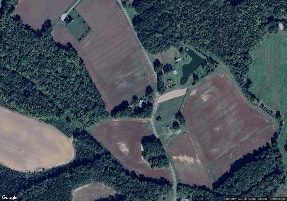
Estimated Value: $188,000 - $268,000
2
Beds
2
Baths
2,248
Sq Ft
$101/Sq Ft
Est. Value
About This Home
This home is located at 239 Corner High Rd, Eure, NC 27935 and is currently estimated at $226,263, approximately $100 per square foot. 239 Corner High Rd is a home with nearby schools including Gates County Senior High School.
Ownership History
Date
Name
Owned For
Owner Type
Purchase Details
Closed on
Dec 4, 2023
Sold by
Vincent Peter
Bought by
Askew Daniel Wynne and Askew Keri Parker
Current Estimated Value
Home Financials for this Owner
Home Financials are based on the most recent Mortgage that was taken out on this home.
Original Mortgage
$80,000
Outstanding Balance
$72,131
Interest Rate
5%
Mortgage Type
New Conventional
Estimated Equity
$154,132
Purchase Details
Closed on
Sep 19, 2002
Bought by
Landing Marie Vincent
Create a Home Valuation Report for This Property
The Home Valuation Report is an in-depth analysis detailing your home's value as well as a comparison with similar homes in the area
Purchase History
| Date | Buyer | Sale Price | Title Company |
|---|---|---|---|
| Askew Daniel Wynne | $100,000 | None Listed On Document | |
| Landing Marie Vincent | -- | -- |
Source: Public Records
Mortgage History
| Date | Status | Borrower | Loan Amount |
|---|---|---|---|
| Open | Askew Daniel Wynne | $80,000 |
Source: Public Records
Tax History
| Year | Tax Paid | Tax Assessment Tax Assessment Total Assessment is a certain percentage of the fair market value that is determined by local assessors to be the total taxable value of land and additions on the property. | Land | Improvement |
|---|---|---|---|---|
| 2025 | $1,475 | $176,027 | $51,872 | $124,155 |
| 2024 | $1,177 | $105,350 | $43,219 | $62,131 |
| 2023 | $649 | $105,350 | $43,219 | $62,131 |
| 2022 | $649 | $105,350 | $43,219 | $62,131 |
| 2021 | $620 | $105,350 | $43,219 | $62,131 |
| 2020 | $620 | $105,350 | $43,219 | $62,131 |
| 2019 | $620 | $10,535,000 | $4,321,900 | $6,213,100 |
| 2018 | $481 | $105,350 | $43,219 | $62,131 |
| 2017 | $801 | $105,350 | $0 | $0 |
| 2016 | -- | $114,353 | $0 | $0 |
| 2015 | -- | $114,353 | $0 | $0 |
| 2014 | -- | $114,353 | $0 | $0 |
Source: Public Records
Map
Nearby Homes
- 1640 U S 158
- 106 White Oak Rd
- 92 Hackley Rd
- 106 Church Dr
- 546 River Rd
- Lot 12 River St
- Lot 13 River St
- 122 River St
- 218 River Trail
- 602 N N King St
- 602 N King St
- 1218 Ellenor Rd
- Lot 10 River View Ct
- Lot 9 Riversedge Dr
- 201 N Main St
- MM Gates Bank (Corapeake) Rd
- MM Gates Bank (Roanoke 2) Rd
- MM Gates Bank (Millpond) Rd
- 0 U S 158 Business
- 116 Farmers Chemical Rd
- 230 Corner High Rd
- 226 Corner High Rd
- 250 Corner High Rd
- 259 Corner High Rd
- 175 Corner High Rd
- 188 Corner High Rd
- 289 Corner High Rd
- 300 Corner High Rd
- 5 Depot Rd
- 302 Corner High Rd
- 1223 Nc 137
- 307 Corner High Rd
- 160 Corner High Rd
- 7 Depot Rd
- 1199 N Carolina 137
- 1227 Nc 137
- 1185 Nc 137
- 149 Corner High Rd
- 0 Hwy 13 Unit 8109008
- 0 Hwy 13 Unit 886629
