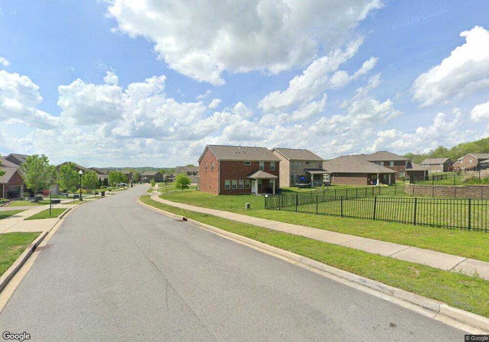
239 Hempstead Ct Unit 160 Gallatin, TN 37066
Estimated Value: $517,116 - $566,000
4
Beds
3
Baths
2,175
Sq Ft
$251/Sq Ft
Est. Value
About This Home
This home is located at 239 Hempstead Ct Unit 160, Gallatin, TN 37066 and is currently estimated at $545,279, approximately $250 per square foot. 239 Hempstead Ct Unit 160 is a home located in Sumner County with nearby schools including Station Camp High School.
Ownership History
Date
Name
Owned For
Owner Type
Purchase Details
Closed on
Oct 26, 2021
Sold by
Sfr Jv 1 Property Llc
Bought by
Sfr Jv 1 2021 1 Borrower Llc
Current Estimated Value
Home Financials for this Owner
Home Financials are based on the most recent Mortgage that was taken out on this home.
Original Mortgage
$733,567,000
Outstanding Balance
$127,154,668
Interest Rate
3.05%
Mortgage Type
Commercial
Estimated Equity
-$126,609,389
Purchase Details
Closed on
Jun 8, 2021
Sold by
Johnson James Carmack and Johnson Melissa Carol
Bought by
Sfr Jv 1 Property Llc
Purchase Details
Closed on
Feb 24, 2017
Sold by
Lennar Homes Of Tennessee Llc
Bought by
Johnson James Carmack and Johnson Melissa Carol Wright
Home Financials for this Owner
Home Financials are based on the most recent Mortgage that was taken out on this home.
Original Mortgage
$298,483
Interest Rate
3.75%
Mortgage Type
FHA
Create a Home Valuation Report for This Property
The Home Valuation Report is an in-depth analysis detailing your home's value as well as a comparison with similar homes in the area
Home Values in the Area
Average Home Value in this Area
Purchase History
| Date | Buyer | Sale Price | Title Company |
|---|---|---|---|
| Sfr Jv 1 2021 1 Borrower Llc | -- | Os National Llc | |
| Sfr Jv 1 Property Llc | $407,400 | Os National Llc | |
| Johnson James Carmack | $303,990 | Foundation Title And Escrow |
Source: Public Records
Mortgage History
| Date | Status | Borrower | Loan Amount |
|---|---|---|---|
| Open | Sfr Jv 1 2021 1 Borrower Llc | $733,567,000 | |
| Previous Owner | Johnson James Carmack | $298,483 |
Source: Public Records
Tax History Compared to Growth
Tax History
| Year | Tax Paid | Tax Assessment Tax Assessment Total Assessment is a certain percentage of the fair market value that is determined by local assessors to be the total taxable value of land and additions on the property. | Land | Improvement |
|---|---|---|---|---|
| 2024 | $2,900 | $204,080 | $36,000 | $168,080 |
| 2023 | $2,500 | $81,925 | $12,000 | $69,925 |
| 2022 | $2,508 | $81,925 | $12,000 | $69,925 |
| 2021 | $2,508 | $81,925 | $12,000 | $69,925 |
| 2020 | $2,508 | $81,925 | $12,000 | $69,925 |
| 2019 | $2,508 | $0 | $0 | $0 |
| 2018 | $2,504 | $0 | $0 | $0 |
| 2017 | $2,232 | $0 | $0 | $0 |
Source: Public Records
Map
Nearby Homes
- 337 Carellton Dr
- 137 Cavalcade Loop
- 360 Turfway Park
- 172 Cavalcade Loop
- 319 Cloverbrook Way
- 249 Cavalcade Loop
- 101 Santa Rosa Dr
- 315 Gulfstream Dr
- 70 Grindstone Dr
- 308 Cheval Dr
- 427 Deveron Dr
- 1670 Long Hollow Pike
- 2039 Liberty Ln
- 1616 Long Hollow Pike
- 402 Upper Station Camp Crk Rd
- 1935 Liberty Ln
- 149 Upper Station Camp Crk Rd
- 1087 Abberley Cir
- 1800 Liberty Ln
- 166 Jennings Rd
- 239 Hempstead Ct
- 239 Hempstead Ct
- 235 Hempstead Ct Unit 161
- 231 Hempstead Ct Unit 162
- 231 Hempstead Ct
- 288 Black Thorn Ln Unit 159
- 288 Black Thorn Ln
- 232 Preston Ln Unit 176
- 232 Preston Ln
- 232 Preston Ln
- 236 Preston Ln Unit 177
- 236 Preston Ln
- 236 Preston Ln
- 292 Blackthorn Ln
- 292 Black Thorn Ln Unit 158
- 292 Black Thorn Ln Unit 58
- 292 Black Thorn Ln
- 240 Preston Ln Unit 178
- 240 Preston Ln
- 228 Preston Ln Unit 175