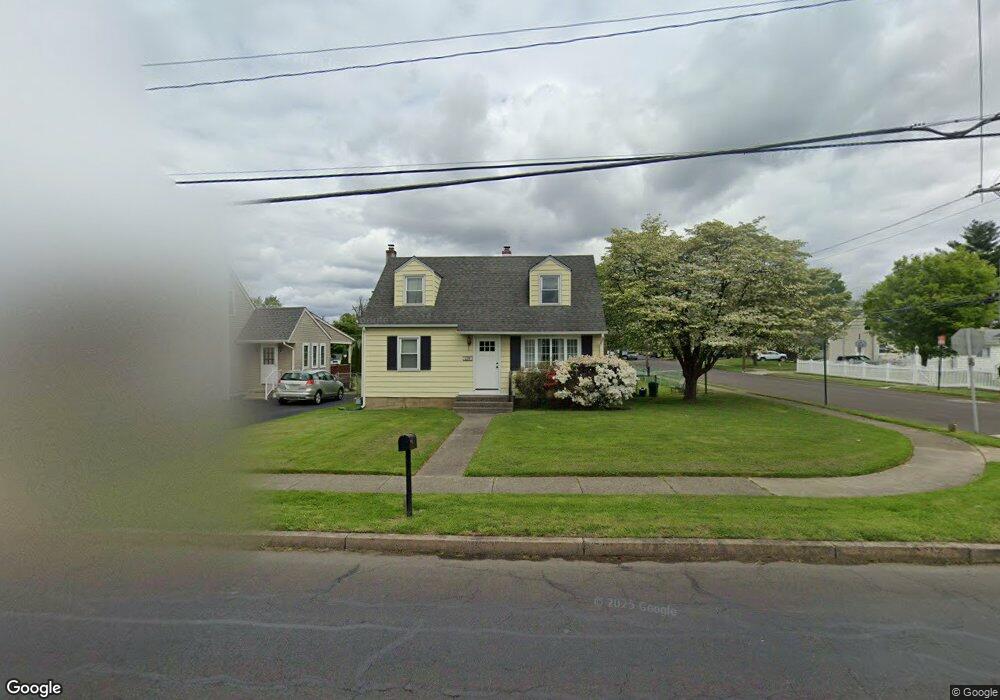
239 Neshaminy St Langhorne, PA 19047
Estimated Value: $323,000 - $389,000
3
Beds
1
Bath
1,199
Sq Ft
$299/Sq Ft
Est. Value
About This Home
This home is located at 239 Neshaminy St, Langhorne, PA 19047 and is currently estimated at $358,405, approximately $298 per square foot. 239 Neshaminy St is a home located in Bucks County with nearby schools including Hoover Elementary School, Maple Point Middle School, and Neshaminy High School.
Ownership History
Date
Name
Owned For
Owner Type
Purchase Details
Closed on
Apr 18, 2001
Sold by
Southard Acosta Sue Ann
Bought by
Wieland Jo Anne
Current Estimated Value
Home Financials for this Owner
Home Financials are based on the most recent Mortgage that was taken out on this home.
Original Mortgage
$109,000
Outstanding Balance
$39,822
Interest Rate
6.9%
Estimated Equity
$318,583
Purchase Details
Closed on
Jun 27, 1962
Bought by
Southard David E and Southard Joan H
Create a Home Valuation Report for This Property
The Home Valuation Report is an in-depth analysis detailing your home's value as well as a comparison with similar homes in the area
Home Values in the Area
Average Home Value in this Area
Purchase History
| Date | Buyer | Sale Price | Title Company |
|---|---|---|---|
| Wieland Jo Anne | $123,500 | -- | |
| Southard David E | -- | -- |
Source: Public Records
Mortgage History
| Date | Status | Borrower | Loan Amount |
|---|---|---|---|
| Open | Wieland Jo Anne | $109,000 |
Source: Public Records
Tax History Compared to Growth
Tax History
| Year | Tax Paid | Tax Assessment Tax Assessment Total Assessment is a certain percentage of the fair market value that is determined by local assessors to be the total taxable value of land and additions on the property. | Land | Improvement |
|---|---|---|---|---|
| 2025 | $3,694 | $16,530 | $3,120 | $13,410 |
| 2024 | $3,694 | $16,530 | $3,120 | $13,410 |
| 2023 | $3,661 | $16,530 | $3,120 | $13,410 |
| 2022 | $3,568 | $16,530 | $3,120 | $13,410 |
| 2021 | $3,618 | $16,530 | $3,120 | $13,410 |
| 2020 | $3,626 | $16,530 | $3,120 | $13,410 |
| 2019 | $3,550 | $16,530 | $3,120 | $13,410 |
| 2018 | $3,480 | $16,530 | $3,120 | $13,410 |
| 2017 | $3,397 | $16,530 | $3,120 | $13,410 |
| 2016 | $3,340 | $16,530 | $3,120 | $13,410 |
| 2015 | -- | $16,530 | $3,120 | $13,410 |
| 2014 | -- | $16,000 | $3,120 | $12,880 |
Source: Public Records
Map
Nearby Homes
- 681 Pennhill Dr
- 790 E Parker St Unit A1
- 547 Hulmeville Ave
- 731 Highland Ave
- 6504 Timothy Ct
- 56 W Lincoln Hwy
- 24 W Lincoln Hwy
- 2937 Hamilton Ct
- 3225 Ethan Allen Ct
- 827 Hulmeville Rd
- 927 Bellevue Ave
- 6313 Congress Ct
- 2823 Avenue E
- 6351 Shewell Rd
- 3351 Carroll Ct Unit S
- 0 Prospect Ave
- 1632 Winter Ave
- 3325 Pasqualone Blvd
- 565 Hulmeville Rd
- 2548 Nashua Rd
- 231 Neshaminy St
- 307 Neshaminy St
- 223 Neshaminy St
- 526 W Woodland Ave
- 215 Neshaminy St
- 317 Neshaminy St
- 518 W Woodland Ave
- 525 W Woodland Ave
- 529 Crescent St
- 806 Highpointe Cir
- 314 Neshaminy St
- 510 W Woodland Ave
- 804 Highpointe Cir
- 209 Neshaminy St
- 802 Highpointe Cir
- 327 Neshaminy St
- 515 W Woodland Ave
- 519 Crescent St
- 502 W Woodland Ave
- 511 Crescent St