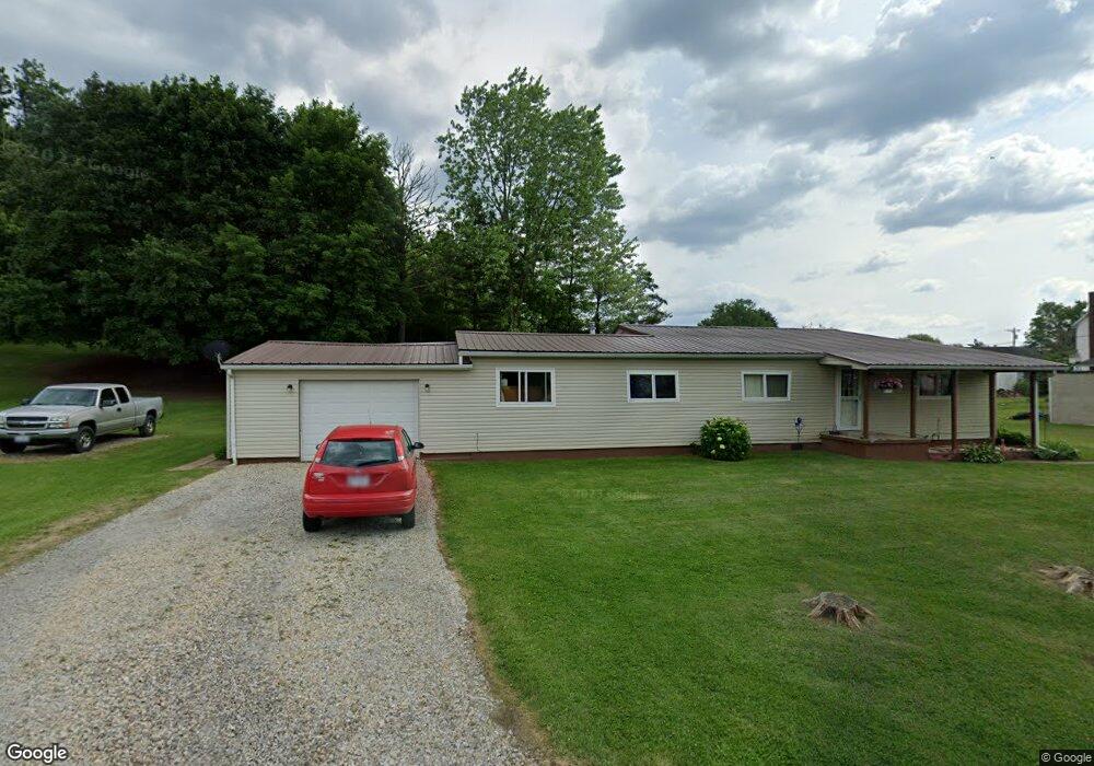
239 Penn St Woodsfield, OH 43793
Estimated Value: $136,723 - $180,000
4
Beds
2
Baths
1,890
Sq Ft
$86/Sq Ft
Est. Value
About This Home
This home is located at 239 Penn St, Woodsfield, OH 43793 and is currently estimated at $161,681, approximately $85 per square foot. 239 Penn St is a home located in Monroe County with nearby schools including Woodsfield Elementary School, River Elementary School, and Monroe Central High School.
Ownership History
Date
Name
Owned For
Owner Type
Purchase Details
Closed on
Feb 8, 2021
Sold by
Hogue Geraldine T
Bought by
Lucy Robert
Current Estimated Value
Purchase Details
Closed on
Dec 22, 2016
Bought by
Eugene L Hogue and Hogue
Home Financials for this Owner
Home Financials are based on the most recent Mortgage that was taken out on this home.
Interest Rate
4.3%
Purchase Details
Closed on
Nov 8, 2016
Bought by
Gena Mae Komrada
Home Financials for this Owner
Home Financials are based on the most recent Mortgage that was taken out on this home.
Interest Rate
4.3%
Purchase Details
Closed on
Oct 5, 1993
Bought by
Hogue Eugene L and Hogue Geraldine T
Create a Home Valuation Report for This Property
The Home Valuation Report is an in-depth analysis detailing your home's value as well as a comparison with similar homes in the area
Home Values in the Area
Average Home Value in this Area
Purchase History
| Date | Buyer | Sale Price | Title Company |
|---|---|---|---|
| Lucy Robert | $86,000 | None Available | |
| Eugene L Hogue | -- | -- | |
| Gena Mae Komrada | -- | -- | |
| Hogue Eugene L | $42,000 | -- |
Source: Public Records
Mortgage History
| Date | Status | Borrower | Loan Amount |
|---|---|---|---|
| Previous Owner | Gena Mae Komrada | -- | |
| Previous Owner | Gena Mae Komrada | -- |
Source: Public Records
Tax History Compared to Growth
Tax History
| Year | Tax Paid | Tax Assessment Tax Assessment Total Assessment is a certain percentage of the fair market value that is determined by local assessors to be the total taxable value of land and additions on the property. | Land | Improvement |
|---|---|---|---|---|
| 2024 | $925 | $29,370 | $2,090 | $27,280 |
| 2023 | $925 | $29,370 | $2,090 | $27,280 |
| 2022 | $836 | $29,370 | $2,090 | $27,280 |
| 2021 | $585 | $29,090 | $1,720 | $27,370 |
| 2020 | $585 | $29,090 | $1,720 | $27,370 |
| 2019 | $585 | $29,090 | $1,720 | $27,370 |
| 2018 | $560 | $27,490 | $1,430 | $26,060 |
| 2017 | $824 | $27,490 | $1,430 | $26,060 |
| 2016 | $570 | $27,490 | $1,430 | $26,060 |
| 2015 | $506 | $24,460 | $1,210 | $23,250 |
| 2014 | $506 | $24,460 | $1,210 | $23,250 |
| 2013 | $520 | $23,770 | $1,180 | $22,590 |
Source: Public Records
Map
Nearby Homes
- 147 Andover Rd
- 167 Andover Rd
- 418 Eastern Ave
- 315 Eastern Ave
- 206 Ohio St
- 198 N Monroe St
- 108 Oaklawn Ave
- 208 Center St
- 220 Oaklawn Ave
- 108.5 S Paul Alley
- 108 S Paul St
- 210 E Church St
- 302 High St
- 407 High St
- 303 High St
- 333 S Main St
- 0 Barber Ridge Rd
- 49402 Patton Rd
- 39709 State Route 255
- 42617 Ohio 800
- 312 Fairground Rd
- 312 Fairground Rd
- 324 Fairground Rd
- 306 Fairground Rd
- 318 Fairground Rd
- 300 Fairground Rd
- 298 Penn St
- 218 Fairground Rd
- 212 Fairground Rd
- 200 Hancock St
- 336 Fairground Rd
- 206 Fairground Rd
- 317 Fairground Rd
- 200 Fairground Rd
- 200 Fairground Rd
- 104 Hancock St
- 103 John St
- 102 Hancock St
- 103 Hancock St
- 106 Fairground Rd