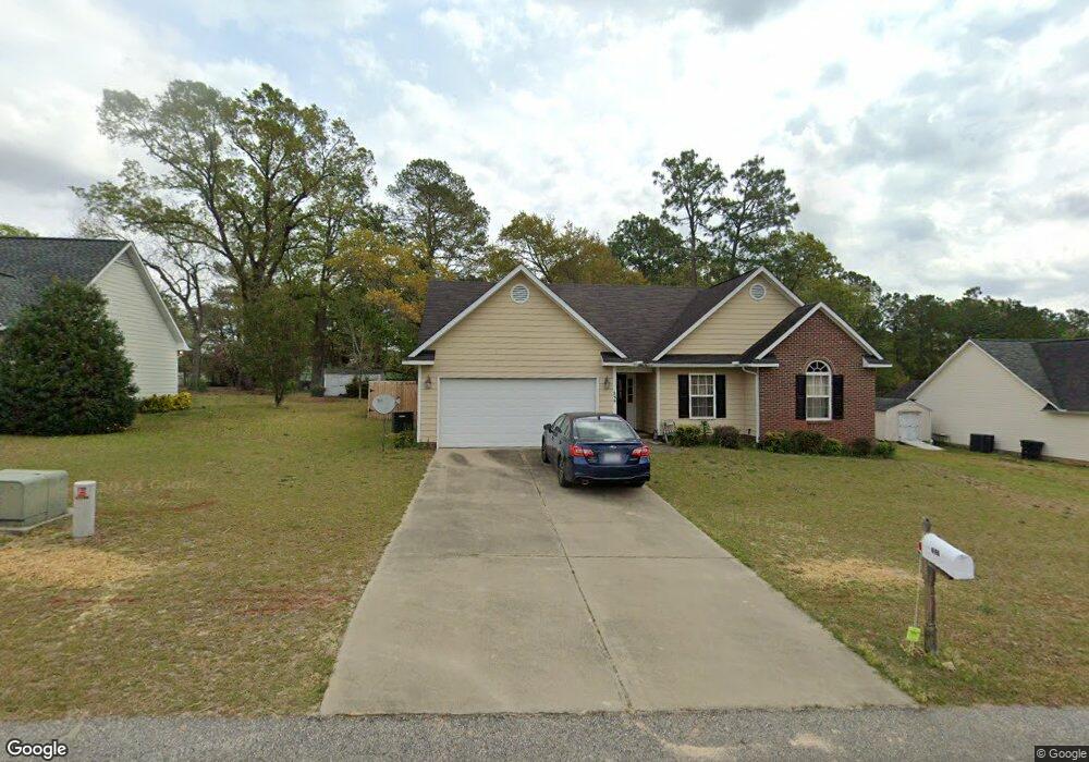
239 Ridgeview Dr Raeford, NC 28376
Estimated Value: $254,000 - $278,000
--
Bed
2
Baths
1,523
Sq Ft
$174/Sq Ft
Est. Value
About This Home
This home is located at 239 Ridgeview Dr, Raeford, NC 28376 and is currently estimated at $264,642, approximately $173 per square foot. 239 Ridgeview Dr is a home located in Hoke County with nearby schools including Scurlock Elementary School, East Hoke Middle, and Hoke County High.
Ownership History
Date
Name
Owned For
Owner Type
Purchase Details
Closed on
Jul 18, 2007
Sold by
New South Properties Inc
Bought by
Mcgee Anna M
Current Estimated Value
Home Financials for this Owner
Home Financials are based on the most recent Mortgage that was taken out on this home.
Original Mortgage
$139,500
Outstanding Balance
$87,464
Interest Rate
6.65%
Mortgage Type
New Conventional
Estimated Equity
$177,178
Create a Home Valuation Report for This Property
The Home Valuation Report is an in-depth analysis detailing your home's value as well as a comparison with similar homes in the area
Home Values in the Area
Average Home Value in this Area
Purchase History
| Date | Buyer | Sale Price | Title Company |
|---|---|---|---|
| Mcgee Anna M | $139,500 | None Available |
Source: Public Records
Mortgage History
| Date | Status | Borrower | Loan Amount |
|---|---|---|---|
| Open | Mcgee Anna M | $139,500 |
Source: Public Records
Tax History Compared to Growth
Tax History
| Year | Tax Paid | Tax Assessment Tax Assessment Total Assessment is a certain percentage of the fair market value that is determined by local assessors to be the total taxable value of land and additions on the property. | Land | Improvement |
|---|---|---|---|---|
| 2025 | $833 | $169,510 | $23,000 | $146,510 |
| 2024 | $833 | $169,510 | $23,000 | $146,510 |
| 2023 | $1,537 | $169,510 | $23,000 | $146,510 |
| 2022 | $1,537 | $169,510 | $23,000 | $146,510 |
| 2021 | $1,339 | $145,080 | $23,000 | $122,080 |
| 2020 | $1,347 | $145,080 | $23,000 | $122,080 |
| 2019 | $1,347 | $145,080 | $23,000 | $122,080 |
| 2018 | $1,347 | $145,080 | $23,000 | $122,080 |
| 2017 | $1,347 | $145,080 | $23,000 | $122,080 |
| 2016 | $1,322 | $145,080 | $23,000 | $122,080 |
| 2015 | $1,322 | $145,080 | $23,000 | $122,080 |
| 2014 | $1,300 | $145,080 | $23,000 | $122,080 |
| 2013 | -- | $136,790 | $30,000 | $106,790 |
Source: Public Records
Map
Nearby Homes
- 499 Southerland Peak Dr
- 147 Smokey Mountain Dr
- 2911 Rockfish Rd
- 176 Grove Walk Rd
- 739 Southerland Peak Rd
- 731 Southerland Peak (Lot 45) Dr
- 531 Southerland Peak
- 192 Grove Walk Rd
- 731 Southerland Peak Dr
- 711 Southerland Peak Rd
- 723 Southerland Peak Dr
- Bellwood Plan at Wood Lake II
- Southport II Plan at Wood Lake II
- Kent Plan at Wood Lake II
- Topsail Plan at Wood Lake II
- 512 Townsend Rd
- 739 Southerland Peak (Lot 46) Dr
- 711 Southerland Peak (Lot 43) Dr
- 499 Dr
- 260 Dartmoor Ln
- 257 Ridgeview Dr
- 215 Ridgeview Dr
- 2532 Rockfish Rd
- 197 Ridgeview Dr
- 265 Ridgeview Dr
- 120 Rocky Mountain Dr
- 260 Ridgeview Dr
- 179 Ridgeview Dr
- 139 Rocky Mountain Dr
- 161 Ridgeview Dr
- 525 Smokey Mountain Dr
- 505 Smokey Mountain Dr
- 163 Wolfbridge Dr
- 191 Wolfbridge Dr
- 505 Smokey Mountain #45 Dr
- 2556 Rockfish Rd
- 155 Rocky Mountain Dr
- 525 Smokey Mountain Lot 46 Dr
- 191 Wolfbridge #31 Dr
- 141 Wolfbridge Dr