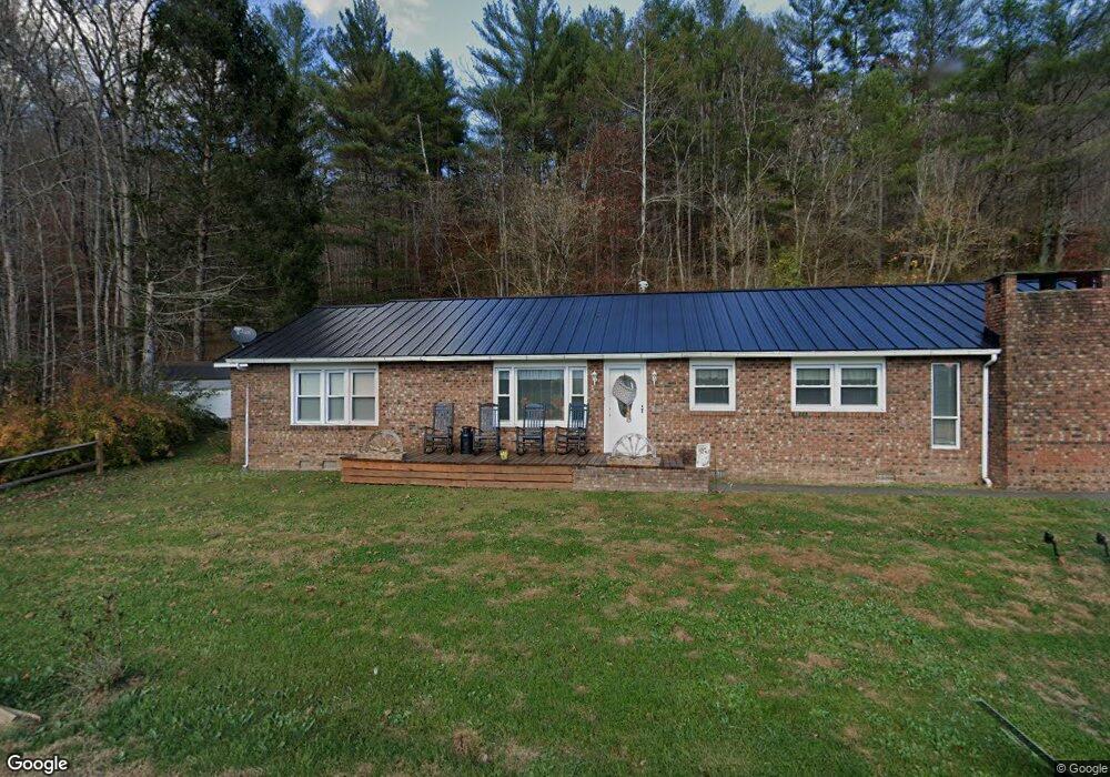
239 State Route 34 Hurricane, WV 25526
Estimated Value: $233,000 - $254,096
2
Beds
2
Baths
1,686
Sq Ft
$146/Sq Ft
Est. Value
About This Home
This home is located at 239 State Route 34, Hurricane, WV 25526 and is currently estimated at $246,524, approximately $146 per square foot. 239 State Route 34 is a home.
Ownership History
Date
Name
Owned For
Owner Type
Purchase Details
Closed on
May 3, 2021
Sold by
Kidd Michael
Bought by
Bodette William E
Current Estimated Value
Home Financials for this Owner
Home Financials are based on the most recent Mortgage that was taken out on this home.
Original Mortgage
$191,500
Outstanding Balance
$173,177
Interest Rate
3.1%
Mortgage Type
VA
Estimated Equity
$73,347
Purchase Details
Closed on
Feb 26, 2020
Sold by
Lsf9 Master Participation Trust
Bought by
Kidd Michael
Create a Home Valuation Report for This Property
The Home Valuation Report is an in-depth analysis detailing your home's value as well as a comparison with similar homes in the area
Home Values in the Area
Average Home Value in this Area
Purchase History
| Date | Buyer | Sale Price | Title Company |
|---|---|---|---|
| Bodette William E | $191,500 | None Available | |
| Kidd Michael | $58,500 | None Available |
Source: Public Records
Mortgage History
| Date | Status | Borrower | Loan Amount |
|---|---|---|---|
| Open | Bodette William E | $191,500 |
Source: Public Records
Tax History Compared to Growth
Tax History
| Year | Tax Paid | Tax Assessment Tax Assessment Total Assessment is a certain percentage of the fair market value that is determined by local assessors to be the total taxable value of land and additions on the property. | Land | Improvement |
|---|---|---|---|---|
| 2024 | $706 | $73,080 | $18,360 | $54,720 |
| 2023 | $598 | $70,440 | $18,360 | $52,080 |
| 2022 | $585 | $68,520 | $18,000 | $50,520 |
| 2021 | $1,245 | $51,420 | $14,580 | $36,840 |
| 2020 | $2,392 | $98,880 | $15,180 | $83,700 |
| 2019 | $2,285 | $93,060 | $15,180 | $77,880 |
| 2018 | $1,165 | $94,620 | $11,700 | $82,920 |
| 2017 | $1,017 | $81,960 | $11,700 | $70,260 |
| 2016 | $964 | $77,280 | $11,700 | $65,580 |
| 2015 | $980 | $75,120 | $11,700 | $63,420 |
| 2014 | $980 | $78,000 | $15,420 | $62,580 |
Source: Public Records
Map
Nearby Homes
- 58 Lonesome Cedar
- 5535 Sycamore Ridge Rd
- 1287 Harvey Creek Rd
- 395 Buff Creek Rd
- 000 Hungry Creek Rd Unit Lot WP001
- 0 Daniel Boone Trail
- 3274 Big Creek Rd
- 306 Lake Dr
- 7892 Highway 60
- 27 Rd
- 101 Thompson Rd
- 408 Harbour Ln
- 410 Harbour Ln
- 926 Midland Trail
- 0 Kellys Dr
- 5108 US Route 60
- 356 Charleys Creek Rd
- 204 Jarvis Ridge
- 1042 Pendleton Place
- 2486 Walnut St