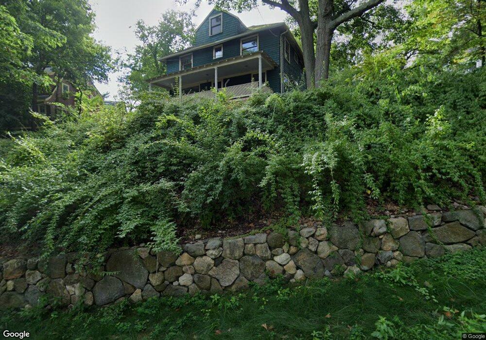
2396 Commonwealth Ave Auburndale, MA 02466
Auburndale NeighborhoodEstimated Value: $1,064,334 - $1,523,000
4
Beds
4
Baths
1,854
Sq Ft
$699/Sq Ft
Est. Value
About This Home
This home is located at 2396 Commonwealth Ave, Auburndale, MA 02466 and is currently estimated at $1,295,834, approximately $698 per square foot. 2396 Commonwealth Ave is a home located in Middlesex County with nearby schools including Williams Elementary School, Charles E Brown Middle School, and Newton South High School.
Ownership History
Date
Name
Owned For
Owner Type
Purchase Details
Closed on
Jun 8, 1999
Sold by
Chaisson Robert H
Bought by
Chaisson Jean E and Persons Robert W
Current Estimated Value
Home Financials for this Owner
Home Financials are based on the most recent Mortgage that was taken out on this home.
Original Mortgage
$7,000
Interest Rate
6.85%
Mortgage Type
Purchase Money Mortgage
Create a Home Valuation Report for This Property
The Home Valuation Report is an in-depth analysis detailing your home's value as well as a comparison with similar homes in the area
Home Values in the Area
Average Home Value in this Area
Purchase History
| Date | Buyer | Sale Price | Title Company |
|---|---|---|---|
| Chaisson Jean E | $55,855 | -- |
Source: Public Records
Mortgage History
| Date | Status | Borrower | Loan Amount |
|---|---|---|---|
| Open | Chaisson Jean E | $82,000 | |
| Closed | Chaisson Jean E | $7,000 | |
| Previous Owner | Chaisson Jean E | $51,493 | |
| Previous Owner | Chaisson Jean E | $145,000 |
Source: Public Records
Tax History Compared to Growth
Tax History
| Year | Tax Paid | Tax Assessment Tax Assessment Total Assessment is a certain percentage of the fair market value that is determined by local assessors to be the total taxable value of land and additions on the property. | Land | Improvement |
|---|---|---|---|---|
| 2025 | $6,535 | $666,800 | $0 | $0 |
| 2024 | $6,319 | $0 | $0 | $0 |
| 2023 | $6,025 | $591,800 | $550,600 | $41,200 |
| 2022 | $11,028 | $548,000 | $509,800 | $38,200 |
| 2021 | $10,688 | $517,000 | $480,900 | $36,100 |
| 2020 | $5,397 | $517,000 | $480,900 | $36,100 |
| 2019 | $9,530 | $501,900 | $466,900 | $35,000 |
| 2018 | $5,108 | $472,100 | $427,100 | $45,000 |
| 2017 | $4,953 | $445,400 | $402,900 | $42,500 |
| 2016 | $4,737 | $416,300 | $376,500 | $39,800 |
| 2015 | $4,517 | $389,100 | $351,900 | $37,200 |
Source: Public Records
Map
Nearby Homes
- 27 Oakwood Rd
- 2202 Commonwealth Ave Unit 2
- 2202 Commonwealth Ave Unit 1
- 17 Lasell St
- 283 Melrose St
- 103 Loring Rd
- 17 Deforest Rd
- 224 Auburn St Unit 224
- 224 Auburn St Unit A
- 226 Auburn St Unit 226
- 217 Summer St
- 707 South St
- 49 Staniford St
- 41 Orchard Ave
- 62-64 Rowe St Unit B
- 283 Woodland Rd
- 13 Weir St
- 1754 Washington St
- 160 Pine St Unit 12
- 1639 Washington St
- 2390 Commonwealth Ave
- 10 Oakland Ave
- 8 Oakland Ave
- 8 Oakland Ave Unit 10
- 8 Oakland Ave Unit 8
- 8 Oakland Ave Unit two
- 10 Oakland Ave Unit 10
- 82 Oakland Ave Unit 8-2
- 23 Evergreen Ave
- 31 Evergreen Ave
- 37 Evergreen Ave
- 14 Oakland Ave
- 15 Evergreen Ave
- 43 Evergreen Ave Unit 1
- 43 Evergreen Ave Unit 45
- 43 Evergreen Ave Unit 43
- 43-45 Evergreen Ave
- 11 Oakland Ave
- 20 Oakland Ave
- 49 Evergreen Ave