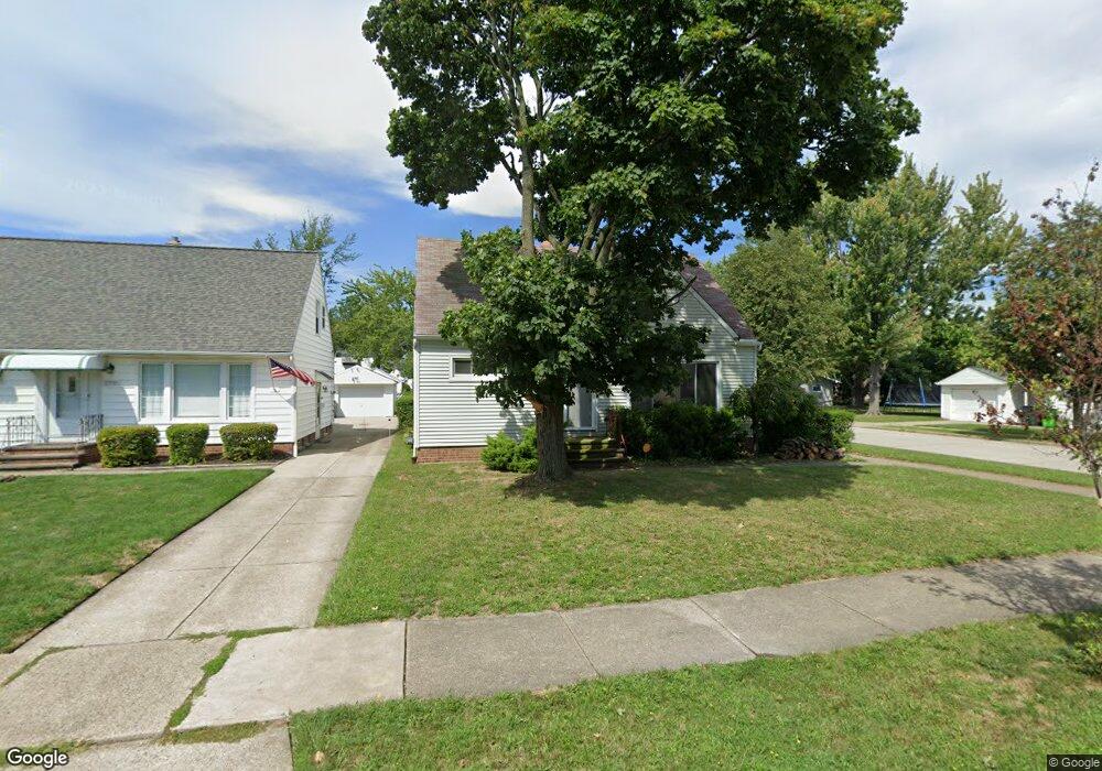
23991 Puritan Rd Euclid, OH 44123
Estimated Value: $141,711 - $157,000
3
Beds
1
Bath
1,326
Sq Ft
$113/Sq Ft
Est. Value
About This Home
This home is located at 23991 Puritan Rd, Euclid, OH 44123 and is currently estimated at $150,178, approximately $113 per square foot. 23991 Puritan Rd is a home located in Cuyahoga County with nearby schools including Bluestone Elementary School, Euclid High School, and Pinnacle Academy.
Ownership History
Date
Name
Owned For
Owner Type
Purchase Details
Closed on
Nov 28, 1997
Sold by
Dodd David L
Bought by
Sustin Michael B
Current Estimated Value
Home Financials for this Owner
Home Financials are based on the most recent Mortgage that was taken out on this home.
Original Mortgage
$79,800
Outstanding Balance
$13,763
Interest Rate
7.45%
Mortgage Type
New Conventional
Estimated Equity
$136,415
Purchase Details
Closed on
Jan 1, 1975
Bought by
Dodd David L and Dodd Catherine
Create a Home Valuation Report for This Property
The Home Valuation Report is an in-depth analysis detailing your home's value as well as a comparison with similar homes in the area
Home Values in the Area
Average Home Value in this Area
Purchase History
| Date | Buyer | Sale Price | Title Company |
|---|---|---|---|
| Sustin Michael B | $84,000 | -- | |
| Dodd David L | -- | -- |
Source: Public Records
Mortgage History
| Date | Status | Borrower | Loan Amount |
|---|---|---|---|
| Open | Sustin Michael B | $79,800 |
Source: Public Records
Tax History Compared to Growth
Tax History
| Year | Tax Paid | Tax Assessment Tax Assessment Total Assessment is a certain percentage of the fair market value that is determined by local assessors to be the total taxable value of land and additions on the property. | Land | Improvement |
|---|---|---|---|---|
| 2024 | $3,234 | $47,005 | $8,785 | $38,220 |
| 2023 | $2,851 | $32,940 | $6,650 | $26,290 |
| 2022 | $2,787 | $32,940 | $6,650 | $26,290 |
| 2021 | $3,104 | $32,940 | $6,650 | $26,290 |
| 2020 | $2,943 | $28,390 | $5,740 | $22,650 |
| 2019 | $2,646 | $81,100 | $16,400 | $64,700 |
| 2018 | $2,672 | $28,390 | $5,740 | $22,650 |
| 2017 | $2,841 | $25,240 | $4,760 | $20,480 |
| 2016 | $2,847 | $25,240 | $4,760 | $20,480 |
| 2015 | $2,592 | $25,240 | $4,760 | $20,480 |
| 2014 | $2,592 | $25,240 | $4,760 | $20,480 |
Source: Public Records
Map
Nearby Homes
- 23896 Devoe Ave
- 24451 Devoe Ave
- 23880 Hartland Dr
- 24330 Glenforest Rd
- 23901 Colbourne Rd
- 23198 Gay St
- 820 E 250th St
- 833 E 250th St
- 23337 Williams Ave
- 720 E 254th St
- 860 E 245th St
- 334 E 238th St
- 490 Kenwood Dr Unit B
- 324 E 235th St
- 754 E 256th St
- 305 E 238th St
- 461 Kenwood Dr Unit T3
- 25390 Briardale Ave
- 825 E 256th St
- 450 Kenwood Dr Unit E12
- 23981 Puritan Rd
- 24001 Puritan Rd
- 23971 Puritan Rd
- 23970 Devoe Ave
- 24041 Puritan Rd
- 23960 Devoe Ave
- 623 E 240th St
- 23961 Puritan Rd
- 24000 Devoe Ave
- 23950 Devoe Ave
- 24081 Puritan Rd
- 23951 Puritan Rd
- 24040 Devoe Ave
- 23900 Devoe Ave
- 625 E 240th St
- 23920 Devoe Ave
- 24030 Puritan Rd
- 23890 Devoe Ave
- 24080 Devoe Ave
- 24101 Puritan Rd