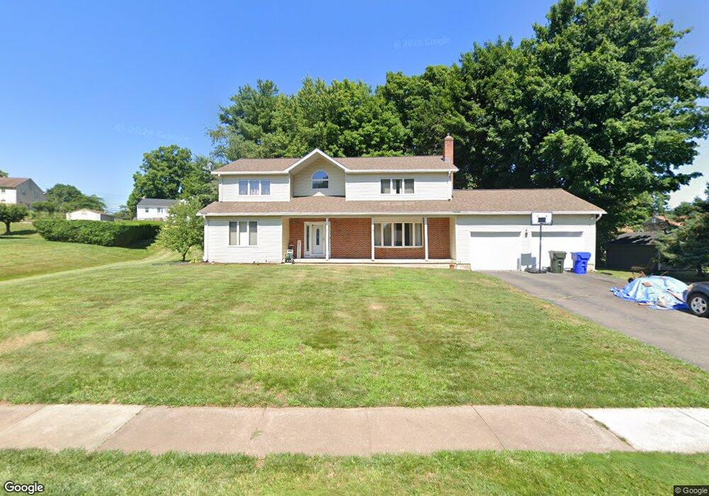
24 Barry Place Rocky Hill, CT 06067
Estimated Value: $495,000 - $636,166
5
Beds
4
Baths
2,924
Sq Ft
$201/Sq Ft
Est. Value
About This Home
This home is located at 24 Barry Place, Rocky Hill, CT 06067 and is currently estimated at $588,792, approximately $201 per square foot. 24 Barry Place is a home located in Hartford County with nearby schools including Albert D. Griswold Middle School, Rocky Hill High School, and Corpus Christi School.
Ownership History
Date
Name
Owned For
Owner Type
Purchase Details
Closed on
Sep 20, 2005
Sold by
Dawson Carol and Dawson Daniel
Bought by
Brouillaro Kathleen D and Brouillaro Michael A
Current Estimated Value
Home Financials for this Owner
Home Financials are based on the most recent Mortgage that was taken out on this home.
Original Mortgage
$125,000
Interest Rate
5.84%
Create a Home Valuation Report for This Property
The Home Valuation Report is an in-depth analysis detailing your home's value as well as a comparison with similar homes in the area
Home Values in the Area
Average Home Value in this Area
Purchase History
| Date | Buyer | Sale Price | Title Company |
|---|---|---|---|
| Brouillaro Kathleen D | $285,000 | -- | |
| Brouillaro Kathleen D | $285,000 | -- |
Source: Public Records
Mortgage History
| Date | Status | Borrower | Loan Amount |
|---|---|---|---|
| Open | Brouillaro Kathleen D | $112,000 | |
| Closed | Brouillaro Kathleen D | $125,000 |
Source: Public Records
Tax History Compared to Growth
Tax History
| Year | Tax Paid | Tax Assessment Tax Assessment Total Assessment is a certain percentage of the fair market value that is determined by local assessors to be the total taxable value of land and additions on the property. | Land | Improvement |
|---|---|---|---|---|
| 2025 | $9,928 | $328,300 | $89,390 | $238,910 |
| 2024 | $9,577 | $328,300 | $89,390 | $238,910 |
| 2023 | $8,660 | $241,080 | $76,160 | $164,920 |
| 2022 | $8,322 | $241,080 | $76,160 | $164,920 |
| 2021 | $8,221 | $241,080 | $76,160 | $164,920 |
| 2020 | $8,100 | $241,080 | $76,160 | $164,920 |
| 2019 | $7,835 | $241,080 | $76,160 | $164,920 |
| 2018 | $7,977 | $246,190 | $68,530 | $177,660 |
| 2017 | $7,780 | $246,190 | $68,530 | $177,660 |
| 2016 | $7,632 | $246,190 | $68,530 | $177,660 |
| 2015 | $7,312 | $246,190 | $68,530 | $177,660 |
| 2014 | $7,312 | $246,190 | $68,530 | $177,660 |
Source: Public Records
Map
Nearby Homes
- 37 Two Stone Dr
- 231 Charter Rd
- 148 Raymond Rd
- 211 Fairlane Dr
- 88 Highland St
- 268 Fox Hill Rd
- 325 Fox Hill Rd
- 1610 Silas Deane Hwy
- 19 Jacob Dr
- 45 Sandy Dr
- 0 Old Post Rd
- 33 Golf Rd
- 18 Colonial Dr Unit A
- 28 Colonial Dr Unit D
- 59 Chapin Ave
- 155 Prospect St
- 373 Prospect St
- 155 Old Common Rd
- 1279 Maple St
- 0 Collier Rd