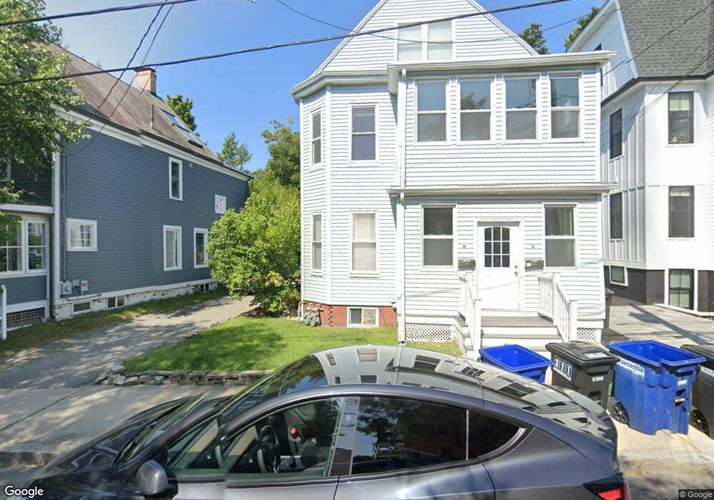
24 Burnside Ave Somerville, MA 02144
Porter Square NeighborhoodEstimated Value: $1,317,000 - $1,853,590
2
Beds
3
Baths
999
Sq Ft
$1,512/Sq Ft
Est. Value
About This Home
Public Transportation Shopping Pool Tennis Court(s) Park Walk/Jog Trails Medical Facility Laundromat Bike Path Conservation Area Highway Access House of Worship Public School T-Station University
357974 657
Ownership History
Date
Name
Owned For
Owner Type
Purchase Details
Closed on
Oct 21, 2013
Sold by
Desimone Robert
Bought by
Desimone Robert and Gong Chen C
Current Estimated Value
Purchase Details
Closed on
Aug 12, 2013
Sold by
Denovellis June and Denovellis Jerry
Bought by
Desimone Robert
Home Financials for this Owner
Home Financials are based on the most recent Mortgage that was taken out on this home.
Original Mortgage
$533,000
Interest Rate
4.45%
Mortgage Type
Purchase Money Mortgage
Create a Home Valuation Report for This Property
The Home Valuation Report is an in-depth analysis detailing your home's value as well as a comparison with similar homes in the area
Home Values in the Area
Average Home Value in this Area
Purchase History
| Date | Buyer | Sale Price | Title Company |
|---|---|---|---|
| Desimone Robert | -- | -- | |
| Desimone Robert | $820,000 | -- | |
| Desimone Robert | $820,000 | -- |
Source: Public Records
Mortgage History
| Date | Status | Borrower | Loan Amount |
|---|---|---|---|
| Previous Owner | Desimone Robert | $533,000 |
Source: Public Records
Property History
| Date | Event | Price | List to Sale | Price per Sq Ft |
|---|---|---|---|---|
| 11/29/2024 11/29/24 | Off Market | $3,795 | -- | -- |
| 09/29/2024 09/29/24 | For Rent | $3,795 | -- | -- |
Tax History
| Year | Tax Paid | Tax Assessment Tax Assessment Total Assessment is a certain percentage of the fair market value that is determined by local assessors to be the total taxable value of land and additions on the property. | Land | Improvement |
|---|---|---|---|---|
| 2025 | $16,510 | $1,513,300 | $853,800 | $659,500 |
| 2024 | $15,797 | $1,501,600 | $853,800 | $647,800 |
| 2023 | $15,071 | $1,457,500 | $853,800 | $603,700 |
| 2022 | $14,184 | $1,393,300 | $813,100 | $580,200 |
| 2021 | $13,809 | $1,355,200 | $807,200 | $548,000 |
| 2020 | $12,810 | $1,269,600 | $753,900 | $515,700 |
| 2019 | $12,671 | $1,177,600 | $735,300 | $442,300 |
| 2018 | $11,784 | $1,041,900 | $668,400 | $373,500 |
| 2017 | $11,550 | $989,700 | $630,700 | $359,000 |
| 2016 | $10,216 | $815,300 | $469,300 | $346,000 |
| 2015 | $9,789 | $776,300 | $433,400 | $342,900 |
Source: Public Records
Map
Nearby Homes
- 32-40 White St
- 49 Cherry St Unit 1
- 10 Beech St Unit 4
- 10 Beech St Unit 1
- 10 Beech St Unit 3
- 79 Willow Ave
- 7 Beech St Unit 319
- 7 Beech St Unit 317
- 20 Mossland St
- 353 Summer St Unit 310
- 18 Upland Rd Unit 1
- 371 Highland Ave
- 3 Arlington St Unit 44
- 156 Albion St Unit 1
- 167 Albion St
- 7 Russell St Unit 1
- 46 Mount Vernon St Unit 1
- 80 Upland Rd Unit B
- 16 Rogers Ave
- 24 Cambridge Terrace Unit 2
- 24 Burnside Ave
- 24 Burnside Ave Unit 4
- 24 Burnside Ave
- 26 Burnside Ave Unit 2
- 24 Burnside Ave Unit 1
- 26 Burnside Ave
- 24 Burnside Ave Unit 24 Burnside
- 28 Burnside Ave
- 22 Burnside Ave
- 22 Burnside Ave Unit 4
- 30 Burnside Ave Unit 30
- 32 Burnside Ave Unit 1
- 18 Burnside Ave
- 17 Banks St
- 17 Banks St Unit 1
- 11 Banks St
- 11 Banks St Unit 2
- 25 Burnside Ave
- 23 Banks St
- 34 Burnside Ave Unit 2
Your Personal Tour Guide
Ask me questions while you tour the home.