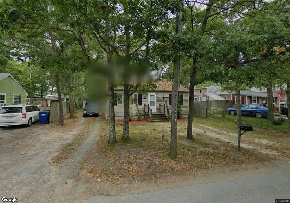
24 Cohasset Rd Buzzards Bay, MA 02532
Estimated Value: $395,719 - $418,000
3
Beds
1
Bath
650
Sq Ft
$626/Sq Ft
Est. Value
About This Home
This home is located at 24 Cohasset Rd, Buzzards Bay, MA 02532 and is currently estimated at $406,930, approximately $626 per square foot. 24 Cohasset Rd is a home with nearby schools including St Margaret Regional School.
Ownership History
Date
Name
Owned For
Owner Type
Purchase Details
Closed on
Sep 8, 2020
Sold by
Snyder Sharon R
Bought by
Huff Stephen D and Foster Crystal
Current Estimated Value
Home Financials for this Owner
Home Financials are based on the most recent Mortgage that was taken out on this home.
Original Mortgage
$201,286
Outstanding Balance
$178,153
Interest Rate
3%
Mortgage Type
FHA
Estimated Equity
$228,777
Purchase Details
Closed on
Nov 29, 1995
Sold by
Martenson Eric O and Martenson Minnie R
Bought by
Snyder Tracy S and Snyder Sharon R
Create a Home Valuation Report for This Property
The Home Valuation Report is an in-depth analysis detailing your home's value as well as a comparison with similar homes in the area
Home Values in the Area
Average Home Value in this Area
Purchase History
| Date | Buyer | Sale Price | Title Company |
|---|---|---|---|
| Huff Stephen D | $205,000 | None Available | |
| Huff Stephen D | $205,000 | None Available | |
| Snyder Tracy S | $70,000 | -- | |
| Snyder Tracy S | $70,000 | -- |
Source: Public Records
Mortgage History
| Date | Status | Borrower | Loan Amount |
|---|---|---|---|
| Open | Huff Stephen D | $201,286 | |
| Closed | Huff Stephen D | $201,286 | |
| Previous Owner | Snyder Tracy S | $135,500 | |
| Previous Owner | Snyder Tracy S | $25,000 |
Source: Public Records
Tax History Compared to Growth
Tax History
| Year | Tax Paid | Tax Assessment Tax Assessment Total Assessment is a certain percentage of the fair market value that is determined by local assessors to be the total taxable value of land and additions on the property. | Land | Improvement |
|---|---|---|---|---|
| 2025 | $3,307 | $301,200 | $115,800 | $185,400 |
| 2024 | $3,173 | $271,700 | $88,900 | $182,800 |
| 2023 | $2,871 | $243,300 | $80,800 | $162,500 |
| 2022 | $2,871 | $210,800 | $80,800 | $130,000 |
| 2021 | $2,866 | $204,700 | $80,800 | $123,900 |
| 2020 | $2,668 | $194,600 | $80,800 | $113,800 |
| 2019 | $2,407 | $177,500 | $73,500 | $104,000 |
| 2018 | $2,461 | $175,300 | $73,500 | $101,800 |
| 2017 | $2,303 | $164,700 | $73,500 | $91,200 |
| 2016 | $2,090 | $148,300 | $69,800 | $78,500 |
| 2015 | $2,032 | $148,300 | $69,800 | $78,500 |
| 2014 | $1,982 | $149,100 | $69,800 | $79,300 |
Source: Public Records
Map
Nearby Homes
- 3132 Cranberry Hwy Unit 59
- 18 Martin St
- 69 Bay Pointe Drive Extension Unit 69
- 13 Bay Pointe Drive Extension Unit 13
- 37 Bay Pointe Drive Extension Unit 37
- 45 Bay Pointe Drive Extension Unit 45
- 3 Fairway Dr Unit F
- 1 Pine Tree Dr
- 22 Long Neck Rd
- 56 Rip Van Winkle Way
- 6 Unit 74
- 14 Buttonwood Ln
- 3 Wolf Rd
- 23 Pine Ridge Rd
- 0 Broad St Off Unit 72362523
- 9 22nd St
- 11 Thompson Rd Unit 11A
- 11 Thompson Rd Unit A
- 34 Washington Ave
- 11 22nd St