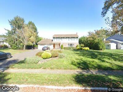
24 Farm Tree Rd Manalapan, NJ 07726
Taylors Mills NeighborhoodEstimated Value: $771,000 - $852,000
4
Beds
3
Baths
2,476
Sq Ft
$327/Sq Ft
Est. Value
About This Home
This home is located at 24 Farm Tree Rd, Manalapan, NJ 07726 and is currently estimated at $810,188, approximately $327 per square foot. 24 Farm Tree Rd is a home located in Monmouth County with nearby schools including Lafayette Mills Elementary School, Manalapan-Englishtown Middle School, and Pine Brook Elementary School.
Ownership History
Date
Name
Owned For
Owner Type
Purchase Details
Closed on
Jul 28, 2003
Sold by
Dauria Raymond
Bought by
Dauria Raymond and Dauria Maria
Current Estimated Value
Purchase Details
Closed on
Feb 22, 2002
Sold by
Christie Thomas
Bought by
Dauria Raymond and Melilli Maria
Home Financials for this Owner
Home Financials are based on the most recent Mortgage that was taken out on this home.
Original Mortgage
$284,000
Interest Rate
6.85%
Purchase Details
Closed on
Nov 19, 1993
Sold by
Leon Wilfred
Bought by
Christie Thomas and Christie Carmela
Home Financials for this Owner
Home Financials are based on the most recent Mortgage that was taken out on this home.
Original Mortgage
$120,000
Interest Rate
6.69%
Create a Home Valuation Report for This Property
The Home Valuation Report is an in-depth analysis detailing your home's value as well as a comparison with similar homes in the area
Home Values in the Area
Average Home Value in this Area
Purchase History
| Date | Buyer | Sale Price | Title Company |
|---|---|---|---|
| Dauria Raymond | -- | -- | |
| Dauria Raymond | $355,000 | -- | |
| Christie Thomas | $225,000 | -- |
Source: Public Records
Mortgage History
| Date | Status | Borrower | Loan Amount |
|---|---|---|---|
| Open | Dauria Raymond | $100,000 | |
| Open | Dauria Raymond | $333,000 | |
| Closed | Dauria Raymond | $290,000 | |
| Closed | Auria Raymond D | $90,000 | |
| Closed | Dauria Raymond | $251,000 | |
| Previous Owner | Dauria Raymond | $284,000 | |
| Previous Owner | Christie Thomas | $120,000 |
Source: Public Records
Tax History Compared to Growth
Tax History
| Year | Tax Paid | Tax Assessment Tax Assessment Total Assessment is a certain percentage of the fair market value that is determined by local assessors to be the total taxable value of land and additions on the property. | Land | Improvement |
|---|---|---|---|---|
| 2024 | $10,530 | $641,800 | $256,500 | $385,300 |
| 2023 | $10,530 | $632,800 | $256,500 | $376,300 |
| 2022 | $10,689 | $564,800 | $206,500 | $358,300 |
| 2021 | $10,689 | $515,100 | $196,500 | $318,600 |
| 2020 | $10,208 | $497,200 | $181,500 | $315,700 |
| 2019 | $10,483 | $510,100 | $201,500 | $308,600 |
| 2018 | $10,048 | $486,100 | $191,500 | $294,600 |
| 2017 | $9,386 | $454,300 | $191,500 | $262,800 |
| 2016 | $10,616 | $463,500 | $228,200 | $235,300 |
| 2015 | $10,819 | $524,200 | $240,000 | $284,200 |
| 2014 | $9,358 | $441,400 | $162,000 | $279,400 |
Source: Public Records
Map
Nearby Homes
- 18 Hearthstone Dr
- 27 Hamilton St
- 10 Harrison Ave
- 28 Whittier Dr
- 21 Harrison Ave
- 2 Dey St
- 68 Main St
- 7 Gordons Corner Rd
- 42 Kipling Way
- 34 Kipling Way
- 0 Private St Unit 22508862
- 105 Harmony Ln
- 10 Heritage Dr
- 17 Conover St
- 13 Lasatta Ave
- 3 Glo Bar Terrace
- 140 Millhurst Rd
- 57 Chestnut Way
- 83 Chestnut Way
- 69 Carriage Ln
- 24 Farm Tree Rd
- 22 Farm Tree Rd
- 26 Farm Tree Rd
- 15 Hearthstone Dr
- 11 Hearthstone Dr
- 20 Farm Tree Rd
- 25 Hearthstone Dr
- 27 Farm Tree Rd
- 29 Farm Tree Rd
- 9 Hearthstone Dr
- 25 Farm Tree Rd
- 18 Farm Tree Rd
- 23 Farm Tree Rd
- 7 Hearthstone Dr
- 22 Hearthstone Dr
- 16 Farm Tree Rd
- 24 Hearthstone Dr
- 20 Hearthstone Dr
- 21 Farm Tree Rd
- 26 Hearthstone Dr